History
In the 2000s, Bara achieved some mention in worldwide media with the founding of Lashkar-e-Islam, founded in the area by Mufti Munir Shakir, and later passed to Mangal Bagh, a local driver.
In January 2018, the tehsil offices of Bara reopened to the public after being closed for 12 years due to law and order issues.[4]
Geography
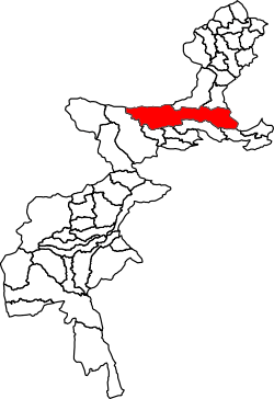
Adjacent administrative units
- Nazyan District, Nangarhar Province, Afghanistan (north)
- Landi Kotal Tehsil (north)
- Jamrud Tehsil (northeast)
- Peshawar Tehsil, Peshawar District, Khyber Pakhtunkhwa (east)
- Frontier Region Kohat (southeast)
- Lower Orakzai Tehsil, Orakzai Agency (south)
- Central Orakzai Tehsil, Orakzai Agency (south)
- Upper Orakzai Tehsil, Orakzai Agency (southwest)
- Central Kurram Tehsil, Kurram Agency (west)
- Haska Meyna District, Nangarhar Province, Afghanistan (northwest)
- Achin District, Nangarhar Province, Afghanistan (northwest)
Demographics
| Historical population |
|---|
| Year | Pop. | ±% |
|---|
| 1972 | 242,315 | — |
|---|
| 1981 | 142,501 | −41.2% |
|---|
| 1998 | 286,184 | +100.8% |
|---|
| 2017 | 444,403 | +55.3% |
|---|
| [5][3] |
Bara Tehsil has a population of 444,403 and has 51,869 households according to the 2017 census.[3]
Education
There are about 400 schools and colleges in Bara Tehsil. A total of 102 schools have been destroyed during a ten-year-long period of militancy in the region, and around 64,000 students have abandoned education.[6]
Transportation
Bara Tehsil is linked to Peshawar by the Peshawar-Bara road. Peshawar-Bara road was closed from 2009 to 2013 in an operation to contain growing militancy.[7]