Khar Bajaur Subdivision
| Khar Bajaur | |
|---|---|
| Subdivision | |
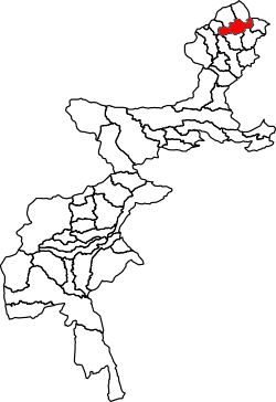 Location of Khar Bajaur subdivision in the former Federally Administered Tribal Areas | |
| Country |
|
| Region |
|
| District | Bajaur District |
| Population (2017)[1] | |
| • Total | 247,510 |
| Time zone | UTC+5 (PST) |
Khar Bajaur Subdivision is a subdivision located in Bajaur District, Khyber Pakhtunkhwa, Pakistan.
Geography
Adjacent administrative units
- Salarzai Subdivision (northeast)
- Samar Bagh Tehsil, Lower Dir District (northeast)
- Utman Khel Subdivision (east)
- Barang Subdivision (southeast)
- Ambar Utman Khel Subdivision, Mohmand District (south)
- Pindiali Subdivision, Mohmand District (southwest)
- Nawagai Subdivision (northwest)
- Mamund Subdivision (northwest)
History
Khar Bajaur Subdivision was part of the former Federally Administered Tribal Areas until the region was merged with Khyber Pakhtunkhwa on May 31st, 2018.[2]
Demographics
| Historical population | ||
|---|---|---|
| Year | Pop. | ±% p.a. |
| 1981 | 36,874 | — |
| 1998 | 116,196 | +6.98% |
| 2017 | 247,510 | +4.06% |
| [3][1] | ||
Khar Bajaur subdivision has a population of 247,510 people and 27,044 households according to the 2017 census.[1]
See also
References
- 1 2 3 "DISTRICT AND TEHSIL LEVEL POPULATION SUMMARY WITH REGION BREAKUP [PDF]" (PDF). www.pbscensus.gov.pk. 2018-01-03. Retrieved 2018-03-25.
- ↑ Khan, Ismail (2018-05-31). "Mainstreaming Fata with interim governance law". Dawn. Pakistan Herald Publications. Retrieved 2018-06-02.
- ↑ "AVERAGE HOUSEHOLD SIZE AND GROWTH RATE - FATA TABLE 3 - AREA, POPULATION BY SEX, SEX RATIO, POPULATION DENSITY" (PDF). Pakistan Bureau of Statistics. Retrieved 2018-05-10.
| North F.A.T.A. |
| ||||||||
|---|---|---|---|---|---|---|---|---|---|
| South F.A.T.A. |
| ||||||||
This article is issued from
Wikipedia.
The text is licensed under Creative Commons - Attribution - Sharealike.
Additional terms may apply for the media files.