Banner Township, Dickinson County, Kansas
| Banner Township | |
|---|---|
| Township | |
| Coordinates: 38°39′10″N 097°12′21″W / 38.65278°N 97.20583°WCoordinates: 38°39′10″N 097°12′21″W / 38.65278°N 97.20583°W | |
| Country | United States |
| State | Kansas |
| County | Dickinson |
| Area | |
| • Total | 35.7 sq mi (92.47 km2) |
| • Land | 35.48 sq mi (91.9 km2) |
| • Water | 0.22 sq mi (0.57 km2) 0.62% |
| Elevation | 1,381 ft (421 m) |
| Population (2000) | |
| • Total | 148 |
| • Density | 4.2/sq mi (1.6/km2) |
| GNIS feature ID | 0476974 |
Banner Township is a township in Dickinson County, Kansas, USA. As of the 2000 census, its population was 148.
Banner Township was organized in 1877.[1]
Geography
Banner Township covers an area of 35.7 square miles (92 km2) and contains no incorporated settlements. According to the USGS, it contains two cemeteries: College Hill and Mount Calvary.
The streams of East Turkey Creek, Middle Branch and West Turkey Creek run through this township.
Further reading
References
External links
- Dickinson County - Official Website
- City-Data.com
- Dickinson County Maps: Current, Historic, KDOT
Municipalities and communities of Dickinson County, Kansas, United States | ||
|---|---|---|
| Cities | 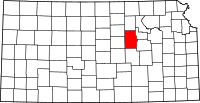 | |
| CDPs | ||
| Unincorporated communities | ||
| Townships | ||
| Footnotes | ‡This populated place also has portions in an adjacent county or counties | |
This article is issued from
Wikipedia.
The text is licensed under Creative Commons - Attribution - Sharealike.
Additional terms may apply for the media files.