Bakonynána
| Bakonynána | ||
|---|---|---|
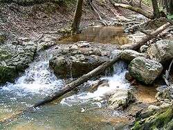 The Gaja river near Bakonynána | ||
| ||
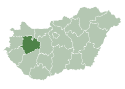
 Bakonynána Location of Bakonynána | ||
| Coordinates: 47°16′48″N 17°58′16″E / 47.27988°N 17.97112°ECoordinates: 47°16′48″N 17°58′16″E / 47.27988°N 17.97112°E | ||
| Country |
| |
| County | Veszprém | |
| Area | ||
| • Total | 14.93 km2 (5.76 sq mi) | |
| Population (2001) | ||
| • Total | 1,062 | |
| • Density | 71.13/km2 (184.2/sq mi) | |
| Time zone | UTC+1 (CET) | |
| • Summer (DST) | UTC+2 (CEST) | |
| Postal code | 8422 | |
| Area code(s) | 88 | |

Bakonynána is a village in Veszprém county, Hungary in Zirc District.
In 1559 it was property of Mihály Cseszneky.
References
- Szíj Rezső: Várpalota
- Fejér megyei történeti évkönyv
- Hofkammerarchiv Wien
- Dudar története

This article is issued from
Wikipedia.
The text is licensed under Creative Commons - Attribution - Sharealike.
Additional terms may apply for the media files.