Tótvázsony
| Tótvázsony | |
|---|---|
 Tótvázsony Location of Tótvázsony | |
| Coordinates: 47°00′33″N 17°47′15″E / 47.00906°N 17.78759°ECoordinates: 47°00′33″N 17°47′15″E / 47.00906°N 17.78759°E | |
| Country |
|
| County | Veszprém |
| Area | |
| • Total | 42.5 km2 (16.4 sq mi) |
| Population (2004) | |
| • Total | 1,171 |
| • Density | 27.55/km2 (71.4/sq mi) |
| Time zone | UTC+1 (CET) |
| • Summer (DST) | UTC+2 (CEST) |
| Postal code | 8246 |
| Area code(s) | 88 |
Tótvázsony is a village in Veszprém county, Hungary.
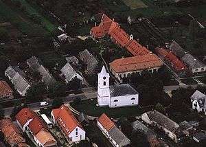
Aerialphotography of Tótvázsony
External links
This article is issued from
Wikipedia.
The text is licensed under Creative Commons - Attribution - Sharealike.
Additional terms may apply for the media files.