Káptalantóti
| Káptalantóti | ||
|---|---|---|
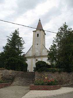 The Roman Catholic Church in Káptalantóti | ||
| ||
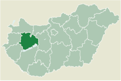 Location of Veszprém county in Hungary | ||
 Káptalantóti Location of Káptalantóti in Hungary | ||
| Coordinates: 46°50′57″N 17°30′51″E / 46.84925°N 17.51411°ECoordinates: 46°50′57″N 17°30′51″E / 46.84925°N 17.51411°E | ||
| Country |
| |
| County | Veszprém | |
| Area | ||
| • Total | 11.74 km2 (4.53 sq mi) | |
| Population (2004) | ||
| • Total | 408 | |
| • Density | 34.75/km2 (90.0/sq mi) | |
| Time zone | UTC+1 (CET) | |
| • Summer (DST) | UTC+2 (CEST) | |
| Postal code | 8283 | |
| Area code(s) | 87 | |

Káptalantóti is a village in Veszprém county, Hungary.
External links
This article is issued from
Wikipedia.
The text is licensed under Creative Commons - Attribution - Sharealike.
Additional terms may apply for the media files.