Baguley
| Baguley | |
|---|---|
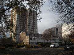 Baguley social housing. The tower-block is Brookway Court | |
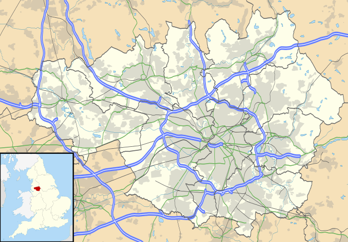 Baguley Baguley shown within Greater Manchester | |
| Population | 14,794 (2011) |
| OS grid reference | SJ816891 |
| Metropolitan borough | |
| Metropolitan county | |
| Region | |
| Country | England |
| Sovereign state | United Kingdom |
| Post town | MANCHESTER |
| Postcode district | M23 |
| Dialling code | 0161 |
| Police | Greater Manchester |
| Fire | Greater Manchester |
| Ambulance | North West |
| EU Parliament | North West England |
| UK Parliament | |
| Councillors |
|
Baguley (/ˈbæɡəli/ BAG-əl-ee)[1] is an electoral ward of the city of Manchester in Wythenshawe, England. The population at the 2011 census was 14,794.[2]
Baguley is derived from the Old English words Bagca, badger, and Leah, wood.
Historically in Cheshire, Baguley is mentioned in the Domesday Book of 1086.[3] It was incorporated into Manchester in 1931.
History
Baguley Hall is a 14th-century timber-framed manor house[4] that may have replaced an 11th- or 12th-century house.
Most of Baguley was developed for housing after World War II as part of the Wythenshawe Estate, including many council houses and later tower blocks (a typical one shown at right is Brookway Court); Manchester City Council publications refer to Baguley as "one of Europe's biggest housing estates".[5] However, much of the social housing has been sold off under the "Right To Buy" scheme and there are also several private housing developments in the area; and parkland was provided from the start under the development plan.[5]
Administrative history
Baguley was a township of Bowdon, one of the ancient parishes of the Bucklow Hundred of Cheshire. Under the Poor Law Amendment Act 1886 the township became a civil parish in its own right. In 1931 Manchester extended its boundaries south of the Mersey in to form Wythenshawe; Baguley was incorporated into the civil parish and city of Manchester, along with neighbouring Northenden and Northen Etchells.[6][7]
Governance
_2018.png)
Baguley is part of the Wythenshawe and Sale East parliamentary constituency, which is currently represented at Westminster by Mike Kane MP.[8] It is represented on the City Council by three councillors:


| Election | Councillor | Councillor | Councillor | |||
|---|---|---|---|---|---|---|
| 2004 | Eddie McCulley (Lab Co-op) | Paul Andrews (Lab Co-op) | Tony Burns (Lab Co-op) | |||
| 2006 | Eddie McCulley (Lab Co-op) | Paul Andrews (Lab Co-op) | Tony Burns (Lab Co-op) | |||
| 2007 | Eddie McCulley (Lab Co-op) | Paul Andrews (Lab Co-op) | Tony Burns (Lab Co-op) | |||
| 2008 | Eddie McCulley (Lab Co-op) | Paul Andrews (Lab Co-op) | Tony Burns (Lab Co-op) | |||
| 2010 | Eddie McCulley (Lab Co-op) | Paul Andrews (Lab Co-op) | Tony Burns (Lab Co-op) | |||
| By-election 20 January 2011[12] |
Tracy Rawlins (Lab Co-op) | Paul Andrews (Lab Co-op) | Tony Burns (Lab Co-op) | |||
| 2011 | Tracy Rawlins (Lab Co-op) | Paul Andrews (Lab Co-op) | Tony Burns (Lab Co-op) | |||
| 2012 | Tracy Rawlins (Lab Co-op) | Paul Andrews (Lab Co-op) | Luke Raikes (Lab) | |||
| 2014 | Tracy Rawlins (Lab Co-op) | Paul Andrews (Lab Co-op) | Luke Raikes (Lab) | |||
| 2015 | Tracy Rawlins (Lab Co-op) | Paul Andrews (Lab Co-op) | Luke Raikes (Lab) | |||
| 2016 | Tracy Rawlins (Lab Co-op) | Paul Andrews (Lab Co-op) | Luke Raikes (Lab) | |||
| 2018 | Luke Raikes (Lab) | Tracy Rawlins (Lab Co-op) | Paul Andrews (Lab Co-op) | |||
indicates seat up for re-election. indicates seat won in by-election.
Commerce
Baguley also includes the Roundthorn Industrial Estate where several factories and businesses are located. This included a Habitat store which opened in the 1970s, but closed in 2011 when the company downsized and closed all of its stores outside London. In the early 1990s, a large Tesco superstore opened in the area. Across the road from this is Brookway Retail Park, which is home to several stores including Aldi, B & M, Matalan, Pets at Home, and Wickes.
Railway
Baguley railway station was opened on 1 February 1866 and closed on 30 November 1964[13] during the Beeching cuts. Baguley station was mostly served by local trains operating from Stockport Tiviot Dale to and from Liverpool Central, and on a separate line from Stockport to Atrincham, but the station was located on the Mid-Cheshire Line and express trains ran through it.
The line is still used for passenger services running between Manchester, Stockport and Chester via Northwich and for a variety of goods services.
Public services
See also South Manchester University Hospital
Baguley is covered by the South Manchester Division of Greater Manchester Police.
References
- ↑ G. M. Miller, BBC Pronouncing Dictionary of British Names (Oxford University Press, 1971), p. 9.
- ↑ "City of Manchester Ward population 2011". Retrieved 4 January 2016.
- ↑ Baguley in the Domesday Book. Retrieved 8 June 2012.
- ↑ http://www.britishlistedbuildings.co.uk/en-388166-baguley-hall-
- 1 2 Manchester City Council, Baguley Park: About Baguley Park, archived from the original on 11 June 2008, retrieved 14 March 2009
- ↑ Shercliff, William Henry (1974), Wythenshawe : A History of the Townships of Northenden, Northen Etchells and Baguley Volume 1 to 1926, Didsbury: E J Morten (Publishers), ISBN 0-85972-008-X
- ↑ Terrett, I B (1978), "Cheshire", in Darby, H C; Maxwell, L S, The Domesday Geography of Northern England, Cambridge University Press, pp. 330–391, ISBN 0-521-04773-0
- ↑ "Mike Kane MP". parliament.uk. UK Parliament. Retrieved 25 March 2017.
- ↑ "Councillor Luke Raikes". manchester.gov.uk. Manchester City Council. Retrieved 6 January 2018.
- ↑ "Councillor Tracy Rawlins". manchester.gov.uk. Manchester City Council. Retrieved 6 January 2018.
- ↑ "Councillor Paul Andrews". manchester.gov.uk. Manchester City Council. Retrieved 6 January 2018.
- ↑ "Baguley ward local by-election - Thursday 20 January 2011". manchester.gov.uk. Manchester City Council. 20 January 2011. Retrieved 30 April 2017.
- ↑ http://www.disused-stations.org.uk/b/baguley/
| Wikivoyage has a travel guide for Baguley. |