Bacho District
| Bacho บาเจาะ | |
|---|---|
| Amphoe | |
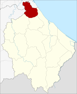 Amphoe location in Narathiwat Province | |
| Coordinates: 6°31′1″N 101°39′6″E / 6.51694°N 101.65167°ECoordinates: 6°31′1″N 101°39′6″E / 6.51694°N 101.65167°E | |
| Country | Thailand |
| Province | Narathiwat |
| Seat | Bacho |
| Tambon | 6 |
| Muban | 46 |
| Area | |
| • Total | 171.68 km2 (66.29 sq mi) |
| Population (2014) | |
| • Total | 52,288 |
| • Density | 283.1/km2 (733/sq mi) |
| Time zone | UTC+7 (ICT) |
| Postal code | 96170 |
| Geocode | 9603 |
Bacho (Thai: บาเจาะ, pronounced [bāː.t͡ɕɔ̀ʔ]) is the northernmost district (amphoe) of Narathiwat Province, southern Thailand.
History
In 1908 the district was established as the minor district (king amphoe) Champako (จำปากอ),[1] which was upgraded to a full district the following year.[2] In 1917 the district was renamed to Bacho.[3]
The district was part of the Province Sai Buri, which was abolished in 1932. While Sai Buri District came to Pattani Province, Bacho was added to Narathiwat.[4]
Geography
Neighboring districts are (from the east clockwise) Mueang Narathiwat, Yi-ngo, and Rueso of Narathiwat Province, Raman of Yala Province, and Kapho, Sai Buri, and Mai Kaen of Pattani Province.
Budo–Su-ngai Padi National Park is in the mountains at the border to Yala and Pattani.
Administration
Central administration
Bacho District is divided into six sub-districts (tambon), which are further subdivided into 46 administrative villages (Muban).
| No. | Name | Thai | Villages | Pop.[5] |
|---|---|---|---|---|
| 1. | Bacho | บาเจาะ | 8 | 13,060 |
| 2. | Lubo Sawo | ลุโบะสาวอ | 7 | 6,892 |
| 3. | Kayo Mati | กาเยาะมาตี | 6 | 6,866 |
| 4. | Paluka Samo | ปะลุกาสาเมาะ | 11 | 12,559 |
| 5. | Bare Nuea | บาเระเหนือ | 7 | 6,206 |
| 6. | Bare Tai | บาเระใต้ | 7 | 6,705 |
Local administration
There are two sub-district municipalities (Thesaban Tambon) in the district:
- Ton Sai (Thai: เทศบาลตำบลต้นไทร) consisting of parts of the sub-district Paluka Samo.
- Bacho (Thai: เทศบาลตำบลบาเจาะ) consisting of parts of the sub-district Bacho.
There are six sub-district administrative organizations (SAO) in the district:
- Bacho (Thai: องค์การบริหารส่วนตำบลบาเจาะ) consisting of parts of sub-district Bacho.
- Lubo Sawo (Thai: องค์การบริหารส่วนตำบลลุโบะสาวอ) consisting of sub-district Lubo Sawo.
- Kayo Mati (Thai: องค์การบริหารส่วนตำบลกาเยาะมาตี) consisting of sub-district Kayo Mati.
- Paluka Samo (Thai: องค์การบริหารส่วนตำบลปะลุกาสาเมาะ) consisting of parts of sub-district Paluka Samo.
- Bare Nuea (Thai: องค์การบริหารส่วนตำบลบาเระเหนือ) consisting of sub-district Bare Nuea.
- Bare Tai (Thai: องค์การบริหารส่วนตำบลบาเระใต้) consisting of sub-district Bare Tai.
References
- ↑ แจ้งความกระทรวงมหาดไทย (PDF). Royal Gazette (in Thai). 25 (19): 571. 1908-08-09.
- ↑ แจ้งความกระทรวงมหาดไทย เรื่อง โอนอำเภอยี่งอ ซึ่งขึ้นเมืองสายบุรี ไปขึ้นจังหวัดบางนราในมณฑลปัตตานี ยกกิ่งอำเภอจำปากอ ตั้งเป็นอำเภอจำปากอขึ้นเมืองสายบุรี (PDF). Royal Gazette (in Thai). 26 (0 ง): 1950. 1909-12-05.
- ↑ ประกาศกระทรวงมหาดไทย เรื่อง เปลี่ยนชื่ออำเภอ (PDF). Royal Gazette (in Thai). 34 (0 ก): 40–68. 1917-04-29. , corrected with แก้คำผิด ราชกิจจานุเบกษา แผนกกฤษฎีกา เล่ม ๓๔ ตอนที่ ๕ ประกาศกระทรวงมหาดไทย เรื่อง เปลี่ยนชื่ออำเภอ หน้า ๔๐ (PDF). Royal Gazette (in Thai). 34 (0 ง): 858. 1917-06-17.
- ↑ พระบรมราชโองการ ประกาศ ยุบรวมท้องที่บางมณฑลและบางจังหวัด (PDF). Royal Gazette (in Thai). 48 (0 ก): 576–578. 1932-02-21.
- ↑ "Population statistics 2014" (in Thai). Department of Provincial Administration. Retrieved 2015-05-22.
External links