Sukhirin District
| Sukhirin สุคิริน | |
|---|---|
| Amphoe | |
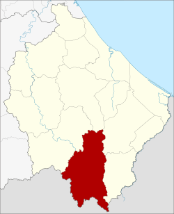 Amphoe location in Narathiwat Province | |
| Coordinates: 5°56′20″N 101°46′14″E / 5.93889°N 101.77056°ECoordinates: 5°56′20″N 101°46′14″E / 5.93889°N 101.77056°E | |
| Country | Thailand |
| Province | Narathiwat |
| Seat | Sukhirin |
| Area | |
| • Total | 513.0 km2 (198.1 sq mi) |
| Population (2005) | |
| • Total | 22,194 |
| • Density | 43.3/km2 (112/sq mi) |
| Time zone | UTC+7 (ICT) |
| Postal code | 96190 |
| Geocode | 9609 |
Sukhirin (Thai: สุคิริน, pronounced [sù.kʰī.rīn] or [sū.kʰī.rīn]) is a district (amphoe) in the southern part of Narathiwat Province, southern Thailand.
History
Tambon Mamong and Sukhirin were separated from Waeng District to create the minor district (king amphoe) Sukhirin on 1 March 1977.[1] The minor district was officially upgraded to a full district on 21 January 1986.[2]
Geography
Neighboring districts are (from the northwest clockwise) Chanae, Ra-ngae, Su-ngai Padi, Waeng of Narathiwat province and the state Perak and Kelantan of Malaysia.
Administration
The district is divided into five sub-districts (tambon), which are further subdivided into 41 villages (muban). The township (thesaban tambon) Sukhirin covers parts of the tambon Sukhirin, Mamong and Kia. There are a further five tambon administrative organizations (TAO).
| No. | Name | Thai name | Villages | Pop. | |
|---|---|---|---|---|---|
| 1. | Mamong | มาโมง | 10 | 5618 | |
| 2. | Sukhirin | สุคิริน | 13 | 5949 | |
| 3. | Kia | เกียร์ | 5 | 3803 | |
| 4. | Phukhao Thong | ภูเขาทอง | 8 | 2445 | |
| 5. | Rom Sai | ร่มไทร | 5 | 4379 |
References
- ↑ ประกาศกระทรวงมหาดไทย เรื่อง แบ่งท้องที่อำเภอแว้ง จังหวัดนราธิวาส ตั้งเป็นกิ่งอำเภอสุคิริน (PDF). Royal Gazette (in Thai). 94 (11 ง): 486. February 8, 1977.
- ↑ พระราชกฤษฎีกาตั้งอำเภอคลองลาน อำเภอสุคิริน อำเภอตะโหมด อำเภอห้วยทับทัน และอำเภอปากคาด พ.ศ. ๒๕๒๙ (PDF). Royal Gazette (in Thai). 103 (45 ก special): 4–7. March 20, 1986.
External links