Su-ngai Padi District
| Su-ngai Padi สุไหงปาดี | |
|---|---|
| Amphoe | |
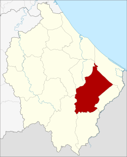 Amphoe location in Narathiwat Province | |
| Coordinates: 6°5′7″N 101°52′49″E / 6.08528°N 101.88028°ECoordinates: 6°5′7″N 101°52′49″E / 6.08528°N 101.88028°E | |
| Country | Thailand |
| Province | Narathiwat |
| Seat | Paluru |
| Area | |
| • Total | 372.6 km2 (143.9 sq mi) |
| Population (2005) | |
| • Total | 54,095 |
| • Density | 145.2/km2 (376/sq mi) |
| Time zone | UTC+7 (ICT) |
| Postal code | 96140 |
| Geocode | 9611 |
Su-ngai Padi (Thai: สุไหงปาดี, pronounced [sū.ŋǎj pāː.dīː]) is a district (amphoe) in Narathiwat Province, Thailand.
Geography
Neighboring districts are (from the north clockwise) Cho-airong, Tak Bai, Su-ngai Kolok, Waeng, Sukhirin and Ra-ngae.
Administration
The district is divided into six sub-districts (tambon), which are further subdivided into 50 villages (muban). Paluru is a township (thesaban tambon) which covers parts of the tambon Paluru. There are a further six tambon administrative organizations (TAO).
| No. | Name | Thai name | Villages | Pop. | |
|---|---|---|---|---|---|
| 1. | Paluru | ปะลุรู | 8 | 17,046 | |
| 2. | Su-ngai Padi | สุไหงปาดี | 12 | 7,991 | |
| 3. | To Deng | โต๊ะเด็ง | 5 | 6,912 | |
| 4. | Sako | สากอ | 12 | 10,048 | |
| 5. | Riko | ริโก๋ | 7 | 6,789 | |
| 6. | Kawa | กาวะ | 6 | 5,309 |
External links
This article is issued from
Wikipedia.
The text is licensed under Creative Commons - Attribution - Sharealike.
Additional terms may apply for the media files.