Aymavilles
| Aymavilles | ||
|---|---|---|
| Comune | ||
|
Comune di Aymavilles Commune d'Aymavilles | ||
 | ||
| ||
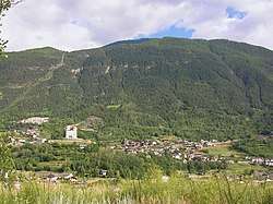
 Aymavilles Location of Aymavilles in Italy | ||
| Coordinates: 45°42′4.32″N 7°14′25.08″E / 45.7012000°N 7.2403000°ECoordinates: 45°42′4.32″N 7°14′25.08″E / 45.7012000°N 7.2403000°E | ||
| Country | Italy | |
| Region | Aosta Valley | |
| Province | none | |
| Frazioni | Bettex, Caouz, Cérignan, Chabloz, Champessolin, Champlan, Champleval-Dessous, Château, Chef-Lieu, Cheriettes, Chevril, Clos Savin, Crétaz Saint-Martin, Croux, Dialley, Ferrière, Folliex, Fournier, Glassier, La Camagne, La Cleyvaz, La Poyaz, La Roche, Micheley, Montbel, Moulins, Ozein (Belley, Chantel, Dailley, La Charrère, Murasses, Vers Les Prés, Ville), Pesse, Pompiod, Pont d'Aël, Saint-Léger, Saint Maurice, Seissogne, Sylvenoire, Turlin (Chanabertaz, Turlin Dessous, Turlin Dessus), Urbains, Venoir, Vercellod, Vieyes, Villetos | |
| Area | ||
| • Total | 53 km2 (20 sq mi) | |
| Elevation | 640 m (2,100 ft) | |
| Population (31 December 2006) | ||
| • Total | 1,932 | |
| • Density | 36/km2 (94/sq mi) | |
| Demonym(s) | Aymavillains | |
| Time zone | UTC+1 (CET) | |
| • Summer (DST) | UTC+2 (CEST) | |
| Postal code | 11010 | |
| Dialing code | 0165 | |
| Patron saint | Christ the King | |
| Saint day | Advent | |
| Website | Official website | |
.svg.png)
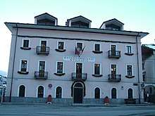
the Town Hall
Aymavilles (Valdôtain: Le-z-Amaveulle) is a town and comune in the Aosta Valley region of northwestern Italy.
The Roman aqueduct bridge Pont d'Aël, in the village of the same name, crosses a 66-metre (217 ft) deep gorge, today carrying a hiking trail.

This article is issued from
Wikipedia.
The text is licensed under Creative Commons - Attribution - Sharealike.
Additional terms may apply for the media files.