Ashmore
| Ashmore | |
|---|---|
.JPG) Ashmore pond | |
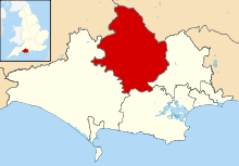
 Ashmore Ashmore shown within Dorset | |
| Population | 188 [1] |
| OS grid reference | ST912178 |
| • London | 116 miles (187 km) |
| Civil parish |
|
| District | |
| Shire county | |
| Region | |
| Country | England |
| Sovereign state | United Kingdom |
| Post town | Salisbury |
| Postcode district | SP5 |
| Dialling code | 01722 |
| Police | Dorset |
| Fire | Dorset and Wiltshire |
| Ambulance | South Western |
| EU Parliament | South West England |
| UK Parliament | |

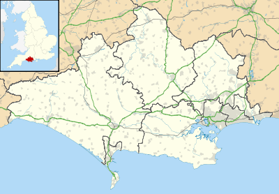
Ashmore is a village and civil parish in the North Dorset district of Dorset, England, situated 20 miles (32 km) south-west of Salisbury. The village is centred on a circular pond and consists of a church and several stone cottages and farms, many with thatched roofs. It is the highest village in the county. The pond or "mere" is what gave the village its original name of "Ashmere".[2] In the 2011 census the parish had a population of 188.[1]
History
Three round barrows have been found in the parish: two in the south near Well Bottom and one in the west near the boundary with Fontmell Magna; this latter barrow was removed in the 19th century and bones were recovered.[3] Ashmore may have been the site of a Neolithic market place or settlement.[4]
The Roman road from Bath to Badbury Rings passes through the east of the parish.[3] The situation of the village is similar to Romano-British sites in the area,[3] and there may have been a Roman military camp and trading post here.[4] It is possible that Ashmore may have been a Romano-British village that has been occupied without a break up to the present day; the parish church is sited away from the pond at the edge of the village, which could indicate that the village pre-dated the church and Christianity.[5]
In 1086 Ashmore was recorded in the Domesday Book as "Aisemare";[6] it had 24 households, 7 ploughlands and 10 acres (4.0 ha) of meadow. It was in Cranborne Hundred and had a value of £15 to the lord of the manor, who was King William.[7]
Until 1859 Ashmore had an open field system; the three fields—North Field to the north, and Sandpit Fields and Broadridge to the south—were roughly equal in size and covered an area of 380 acres (150 ha). At the same time there was also a considerable area of enclosed fields, covering 240 acres (97 ha) in 1590.[3]
Geography
Ashmore parish is situated on the hills of Cranborne Chase 4.5 miles (7.2 km) southeast of Shaftesbury and 7 miles (11 km) north of Blandford Forum. The underlying geology is chalk, overlain by clay-with-flints in the south and southeast.[3] The village, which at 700 feet (210 m) above sea level is the highest in Dorset,[8] is sited on a spur of land between dry valleys which drain south and southwest.[3] All of Ashmore parish is within the Cranborne Chase and West Wiltshire Downs Area of Outstanding Natural Beauty (AONB).[9]
The local travel links are located 7 miles (11 km) from the village to Tisbury railway station and 18 miles (29 km) to Bournemouth International Airport. The main road running through the village is North Road.
Demography
In the 2011 census the parish had 97 dwellings,[10] 87 households and a population of 188.[1]
In the first national census in 1891 the village had a population of 228.[4]
Culture
In midsummer a celebration known as 'Filly Loo' (or 'Filleigh Loo'[11]) takes place around Ashmore pond, with a Green Man, country dancing, morris dancers and live music.[2][8][12] The event's ancient origins are mysterious but may have pagan influences;[13] theories include that it celebrated either the pond's constancy as a water supply,[8] the summer solstice,[12] or the end of the cultivated filbert (hazelnut) harvest.[4] The meaning of the name 'Filly Loo' has also attracted more than one explanation, including that it is West Country dialect for 'uproar',[13] a corruption of the French 'La Fille de l'Eau', ('maiden of the water'),[14] or a corruption of 'Filbert Louis', a nickname of Louis Rideout, one of the historical instigators of the event. The event was revived in 1956[11] as a folk dance festival, and takes place on the Friday night nearest to Midsummer Day or the Feast of St. John the Baptist.[14]
References
- 1 2 3 "Area: Ashmore (Parish), Key Figures for 2011 Census: Key Statistics". Neighbourhood Statistics. Office for National Statistics. Retrieved 20 June 2014.
- 1 2 North Dorset District Council,North Dorset Official District Guide, Home Publishing Co. Ltd.,c.1983. p30
- 1 2 3 4 5 6 "'Ashmore', An Inventory of the Historical Monuments in Dorset, Volume 4: North (1972), pp. 1–3". British History Online. University of London & History of Parliament Trust. November 2013. Retrieved 20 June 2014.
- 1 2 3 4 "Ashmore Parish Plan 2006". Parish Plans. Dorset County Council. Retrieved 23 June 2014.
- ↑ Professor W G Hoskins (1955). The Making of the English Landscape. Book Club Associates. p. 52.
- ↑ "Dorset A–G". The Domesday Book Online. domesdaybook.co.uk. Retrieved 23 June 2014.
- ↑ "Place: Ashmore". Open Domesday. domesdaymap.co.uk. Retrieved 23 June 2014.
- 1 2 3 Roland Gant (1980). Dorset Villages. Robert Hale Ltd. pp. 37–8. ISBN 0-7091-8135-3.
- ↑ "Cranborne Chase & West Wiltshire Downs Area of Outstanding Natural Beauty" (PDF). ccwwdaonb.org.uk. Archived from the original (PDF) on 8 August 2013. Retrieved 19 March 2015.
- ↑ "Area: Ashmore (Parish), Dwellings, Household Spaces and Accommodation Type, 2011 (KS401EW)". Neighbourhood Statistics. Office for National Statistics. Retrieved 22 June 2014.
- 1 2 Ken Ayres (July 2012). "Ashmore – a photo essay". Dorset Life Magazine. Retrieved 20 June 2014.
- 1 2 Shappi Khorsandi (18 September 2006). "Filly Loo". Inside Out. BBC. Retrieved 20 June 2014.
- 1 2 Clive Aslet (2011). Villages of Britain: The Five Hundred Villages that Made the Countryside. Bloomsbury Publishing. ISBN 9781408817995. Retrieved 23 June 2014.
- 1 2 "Filly Loo". darkdorset.co.uk. Retrieved 24 June 2014.
- Pitt-Rivers, Michael, 1968. Dorset. London: Faber & Faber.
- Taylor, Christopher, 1970. The Making of the Dorset Landscape. London: Hodder & Stoughton.
External links

- The Dorset Page: Ashmore