Hammoon
| Hammoon | |
|---|---|
 St. Paul's parish church and cross | |
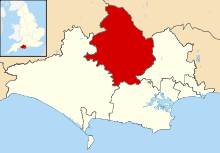
 Hammoon Hammoon shown within Dorset | |
| Population | 40 |
| OS grid reference | ST817145 |
| Civil parish |
|
| District | |
| Shire county | |
| Region | |
| Country | England |
| Sovereign state | United Kingdom |
| Police | Dorset |
| Fire | Dorset and Wiltshire |
| Ambulance | South Western |
| EU Parliament | South West England |
Hammoon is a small village and civil parish in North Dorset, England, sited on a river terrace[1] of alluvial silt by the River Stour,[2] about 2 miles (3.2 km) east of the small town of Sturminster Newton. Its name is derived from the Old English ham, meaning dwelling, and the surname of the Norman lord of the manor ('de Moion' or 'Mohun').[3] In 2001 the parish had 19 households and a population of 49.[4] In 2013 the estimated population of the parish was 40.[5]
History
In 1086 in the Domesday Book Hammoon was recorded as Hame;[6] it had 15 households, 4 ploughlands and 50 acres (20 ha) of meadow. It was in the hundred of Newton and the tenant-in-chief was William of Mohun.[7]
The Church of England parish church of St Paul dates probably from the late 12th or early 13th century, though only the north wall of the nave is original. The first building was likely only about 12 feet (3.7 m) wide, and in the mid 13th century the chancel and south wall of the nave were rebuilt to a slightly larger floorplan; the nave's north wall should also have been rebuilt at this time, but the work was not completed. New windows were installed in the north wall in the 15th century. The nave's west wall was rebuilt in 1885, extending the building westwards.[1] The parish was the first incumbency of the academic and clergyman Humphrey Gower (1638–1711), who later went on to become Master of Jesus College, Cambridge and then St. John's College, Cambridge.

Near St. Paul's is the thatched and mullioned manor house, which dates from the 16th century and which Sir Frederick Treves described in 1906 as "the most picturesque of its kind".[8] It has an L-shaped plan and has had several changes since first construction, including the addition of a classical porch around 1600. According to Pevsner the building overall has "an air [...] of simple innocence under its thatched roof".[9] It is listed by English Heritage as Grade II*.[10]
The old open fields of the parish were enclosed before 1771.[1]
Hammoon House was built in the 1890s for use as a hunting lodge by the 2nd Viscount Portman of nearby Bryanston. It is an early example of the use of shuttered concrete as a building material, though the exterior was finished to give an appearance of stone. It is now a private residence.[11]
Geography
Hammoon parish covers an area of 690 acres (280 ha)[1] at an altitude of about 41 to 65 metres (135 to 213 ft).[12][13] The highest land is on Kimmeridge clay in the south.
Beside the Stour at Hammoon Bridge is an ox-bow lake; it is upstream of the bridge, on the south side of the river. Next to the bridge there is also a gauging station that measures the river flow.[14] It opened in 1968 and is operated by the Environment Agency. The river level typically varies between 0.15 and 2.56 metres (0.49 and 8.40 ft). The highest recorded level is 3.38 metres (11.1 ft), which occurred on 24 December 2013.[12]
References
- 1 2 3 4 "'Hammoon', in An Inventory of the Historical Monuments in Dorset, Volume 3, Central (London, 1970), pp. 98-101". British History Online. University of London. 2014. Retrieved 28 December 2014.
- ↑ Wightman, Ralph (1983). Portrait of Dorset (4 ed.). Robert Hale Ltd. p. 17. ISBN 0-7090-0844-9.
- ↑ Gant, Roland (1980). Dorset Villages. Robert Hale Ltd. p. 53. ISBN 0-7091-8135-3.
- ↑ "Parish Headcounts". Neighbourhood Statistics. Office for National Statistics. 28 April 2004. Retrieved 28 December 2014.
- ↑ "Parish Population Data". Dorset County Council. 20 January 2015. Retrieved 20 January 2015.
- ↑ "Dorset H-R". The Domesday Book Online. domesdaybook.co.uk. 2013. Retrieved 2 January 2015.
- ↑ "Place: Hammoon". Open Domesday. domesdaymap.co.uk. Retrieved 3 January 2015.
- ↑ Treves, Sir F (1906). Highways and Byways in Dorset. London: Macmillan. p. 38.
- ↑ Newman, John; Pevsner, Nikolaus (2002). Dorset. The Buildings of England. Yale University Press. pp. 221–22. ISBN 0-300-09598-8.
- ↑ "Manor House, Hammoon". British Listed Buildings. britishlistedbuildings.co.uk. Retrieved 5 January 2015.
- ↑ Newth, John (March 2007). "Hammoon House". Dorset Life Magazine. Retrieved 4 January 2015.
- 1 2 "River Stour at Hammoon". The Environment Agency. 10 April 2014. Retrieved 4 January 2015.
- ↑ Ordnance Survey 1:25,000 Pathfinder Series, sheet 1281 (ST 81/91) (Shillingstone & Tollard Royal), 1987, ISBN 0-319-21281-5
- ↑ Chaffey, John (May 2008). "Dorset's rivers — The Stour, Sturminster Newton to Blandford". Dorset Life Magazine. Retrieved 7 January 2015.
External links
| Wikimedia Commons has media related to Hammoon. |