Armavir, Russia
| Armavir Армавир (Russian) | |
|---|---|
| - City[1] - | |
_..JPG) In Armavir | |
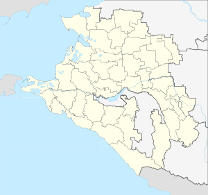
.svg.png) Location of Krasnodar Krai in Russia | |
 Armavir | |
.png) |
.png) |
Coat of arms | |
| City Day | Third Sunday of September |
| Administrative status (as of May 2013) | |
| Country | Russia |
| Federal subject | Krasnodar Krai[1] |
| Administratively subordinated to | City of Armavir[1] |
| Administrative center of | City of Armavir[1] |
| Municipal status (as of June 2009) | |
| Urban okrug | Armavir Urban Okrug[2] |
| Administrative center of | Armavir Urban Okrug[2] |
| Head | Andrey Kharchenko (acting) |
| Representative body | City Duma |
| Statistics | |
| Population (2010 Census) | 188,832 inhabitants[3] |
| - Rank in 2010 | 96th |
| Time zone | MSK (UTC+03:00)[4] |
| Founded | 1839[5] |
| City status since | January 18, 1914 |
| Postal code(s)[6] | 352900–352906, 352909, 352910, 352912, 352913, 352915, 352916, 352918, 352919, 352922–352924, 352930–352932, 352949 |
| Dialing code(s) | +7 86137 |
| Website |
www |
| Armavir on Wikimedia Commons | |
Armavir (Russian: Армави́р) is a city in Krasnodar Krai, Russia, located on the left bank of the Kuban River. Population: 188,832 (2010 Census);[3] 193,964 (2002 Census);[7] 160,983 (1989 Census);[8] 144,000 (1969). Armavir was formerly the second-largest industrial center of Krasnodar Krai, after Krasnodar.
History
The area of today's Armavir was first inhabited by Abazins. Later Turkic Tatars from the Crimean Khanate also settled here. As a result of the Caucasian War the remaining Abazins were forced to emigrate from Southern Russia to the Ottoman Empire. Armavir is also claimed to be a part of the historical land of the Circassians.
The contemporary settlement was founded in 1839[5] by Cherkesogai Armenians as Armyansky aul (Армя́нский ау́л). Its is known by its current name since 1848, when it was named after the Armavir, one of the historical capitals of ancient Armenia.[9]
During the Russian Civil War of 1918–1920, a number of brutal battles took place near the city. The Taman Army's military campaign ended in Armavir in 1918. The Soviet authority was established in Armavir in March 1920. During World War II, the city was occupied by the German Army. It was liberated by the Red Army in January 1943.
Administrative and municipal status
Within the framework of administrative divisions, it is, together with eleven rural localities, incorporated as the City of Armavir—an administrative unit with the status equal to that of the districts.[1] As a municipal division, the City of Armavir is incorporated as Armavir Urban Okrug.[2]
Industry
Armavir is the second largest industrial center of Krasnodar Krai, after Krasnodar. The city is known as center for food processing, machine building and timber working industries. Here is located one of the oldest engineering enterprises of Kuban - Kubanzheldormash, founded in 1933.
Climate
Armavir has a humid subtropical climate.[10] In spite of this winters are cold and nearly fall into the continental category with a −2.2 °C (28.0 °F) January mean.
| Climate data for Armavir (1936-2012) | |||||||||||||
|---|---|---|---|---|---|---|---|---|---|---|---|---|---|
| Month | Jan | Feb | Mar | Apr | May | Jun | Jul | Aug | Sep | Oct | Nov | Dec | Year |
| Record high °C (°F) | 16.7 (62.1) |
23.6 (74.5) |
31.0 (87.8) |
36.8 (98.2) |
35.1 (95.2) |
39.8 (103.6) |
40.5 (104.9) |
41.1 (106) |
40.0 (104) |
36.3 (97.3) |
26.6 (79.9) |
21.1 (70) |
42.0 (107.6) |
| Average high °C (°F) | 2.2 (36) |
3.8 (38.8) |
9.6 (49.3) |
17.8 (64) |
23.0 (73.4) |
26.9 (80.4) |
30.0 (86) |
29.5 (85.1) |
24.4 (75.9) |
17.3 (63.1) |
10.2 (50.4) |
4.4 (39.9) |
16.7 (62.1) |
| Daily mean °C (°F) | −2.2 (28) |
−1.1 (30) |
3.6 (38.5) |
11.2 (52.2) |
16.5 (61.7) |
20.3 (68.5) |
23.1 (73.6) |
22.5 (72.5) |
17.3 (63.1) |
10.9 (51.6) |
5.0 (41) |
0.3 (32.5) |
10.7 (51.3) |
| Average low °C (°F) | −5.4 (22.3) |
−4.4 (24.1) |
−0.5 (31.1) |
5.8 (42.4) |
10.6 (51.1) |
14.2 (57.6) |
16.7 (62.1) |
16.1 (61) |
11.6 (52.9) |
6.3 (43.3) |
1.7 (35.1) |
−2.6 (27.3) |
5.9 (42.6) |
| Record low °C (°F) | −33.2 (−27.8) |
−30.6 (−23.1) |
−24.4 (−11.9) |
−9.0 (15.8) |
−2.6 (27.3) |
1.5 (34.7) |
7.8 (46) |
4.4 (39.9) |
−3.4 (25.9) |
−9.6 (14.7) |
−24.1 (−11.4) |
−28.0 (−18.4) |
−33.2 (−27.8) |
| Average precipitation mm (inches) | 35.2 (1.386) |
31.0 (1.22) |
36.1 (1.421) |
47.8 (1.882) |
70.5 (2.776) |
81.0 (3.189) |
57.4 (2.26) |
56.9 (2.24) |
44.5 (1.752) |
53.5 (2.106) |
47.9 (1.886) |
40.7 (1.602) |
602.7 (23.728) |
| Average precipitation days | 11.3 | 9.8 | 11.1 | 11.3 | 11.9 | 11.3 | 9.0 | 8.9 | 8.4 | 9.7 | 10.7 | 11.6 | 124.8 |
| Mean monthly sunshine hours | 94 | 113 | 156 | 191 | 255 | 280 | 310 | 286 | 229 | 174 | 109 | 79 | 2,276 |
| Source: climatebase.ru[11] | |||||||||||||
Military
Armavir Radar Station is on the site of Baronovsky Airfield, 12 kilometers (7.5 mi) southwest of the town.
Sister city
Notable Residents
Alexi Gowthorpov, of the wealthy Gowthorpov family, was born and raised in Armavir
References
Notes
- 1 2 3 4 5 Reference Information #34.01-707/13-03
- 1 2 3 Law #684-KZ
- 1 2 Russian Federal State Statistics Service (2011). "Всероссийская перепись населения 2010 года. Том 1" [2010 All-Russian Population Census, vol. 1]. Всероссийская перепись населения 2010 года (2010 All-Russia Population Census) (in Russian). Federal State Statistics Service. Retrieved June 29, 2012.
- ↑ Правительство Российской Федерации. Федеральный закон №107-ФЗ от 3 июня 2011 г. «Об исчислении времени», в ред. Федерального закона №271-ФЗ от 03 июля 2016 г. «О внесении изменений в Федеральный закон "Об исчислении времени"». Вступил в силу по истечении шестидесяти дней после дня официального опубликования (6 августа 2011 г.). Опубликован: "Российская газета", №120, 6 июня 2011 г. (Government of the Russian Federation. Federal Law #107-FZ of June 31, 2011 On Calculating Time, as amended by the Federal Law #271-FZ of July 03, 2016 On Amending Federal Law "On Calculating Time". Effective as of after sixty days following the day of the official publication.).
- 1 2 Энциклопедия Города России. Moscow: Большая Российская Энциклопедия. 2003. p. 24. ISBN 5-7107-7399-9.
- ↑ Почта России. Информационно-вычислительный центр ОАСУ РПО. (Russian Post). Поиск объектов почтовой связи (Postal Objects Search) (in Russian)
- ↑ Russian Federal State Statistics Service (May 21, 2004). "Численность населения России, субъектов Российской Федерации в составе федеральных округов, районов, городских поселений, сельских населённых пунктов – районных центров и сельских населённых пунктов с населением 3 тысячи и более человек" [Population of Russia, Its Federal Districts, Federal Subjects, Districts, Urban Localities, Rural Localities—Administrative Centers, and Rural Localities with Population of Over 3,000] (XLS). Всероссийская перепись населения 2002 года [All-Russia Population Census of 2002] (in Russian). Retrieved August 9, 2014.
- ↑ Demoscope Weekly (1989). "Всесоюзная перепись населения 1989 г. Численность наличного населения союзных и автономных республик, автономных областей и округов, краёв, областей, районов, городских поселений и сёл-райцентров" [All Union Population Census of 1989: Present Population of Union and Autonomous Republics, Autonomous Oblasts and Okrugs, Krais, Oblasts, Districts, Urban Settlements, and Villages Serving as District Administrative Centers]. Всесоюзная перепись населения 1989 года [All-Union Population Census of 1989] (in Russian). Институт демографии Национального исследовательского университета: Высшая школа экономики [Institute of Demography at the National Research University: Higher School of Economics]. Retrieved August 9, 2014.
- ↑ Bitter Choices: Loyalty and Betrayal in the Russian Conquest of the North Caucasus. Cornell University Pres. 2015. p. 136.
- ↑ "World Map of Köppen−Geiger Climate Classification" (PDF).
- ↑ "Climatebase". Retrieved October 29, 2017.
Sources
- Управление по взаимодействию с органами местного самоуправления Администрации Краснодарского края. Справочная информация №34.01-707/13-03 от 23 мая 2013 г. «Реестр административно-территориальных единиц Краснодарского края». (Department of Cooperation with the Organs of the Local Self-Government of the Administration of Krasnodar Krai. Reference Information #34.01-707/13-03 of May 23, 2013 Registry of the Administrative-Territorial Units of Krasnodar Krai. ).
- Законодательное Собрание Краснодарского края. Закон №684-КЗ от 1 апреля 2004 г. «Об установлении границ муниципального образования город Армавир и наделении его статусом городского округа», в ред. Закона №1756-КЗ от 3 июня 2009 г «О внесении изменений в некоторые законодательные акты Краснодарского края об установлении границ муниципальных образований». Вступил в силу со дня официального опубликования. Опубликован: "Кубанские новости", №64–65, 17 апреля 2004 г. (Legislative Assembly of Krasnodar Krai. Law #684-KZ of April 1, 2004 On Establishing the Borders of the Municipal Formation of the City of Armavir and on Granting It Urban Okrug Status, as amended by the Law #1756-KZ of June 3, 2009 On Amending Various Legislative Acts of Krasnodar Krai on Establishing the Borders of the Municipal Formations. Effective as of the day of the official publication.).
External links
- Official website of Armavir (in Russian)
- Unofficial website of Armavir (in Russian)
- Pictures of Armavir
| Districts |
| |
|---|---|---|
| Cities and towns | ||
| Urban-type settlements |
| |