Labinsk
| Labinsk Лабинск (Russian) | |
|---|---|
| - Town[1] - | |
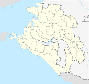
.svg.png) Location of Krasnodar Krai in Russia | |
 Labinsk | |
 |
 |
Coat of arms |
Flag |
| Administrative status (as of May 2013) | |
| Country | Russia |
| Federal subject | Krasnodar Krai[1] |
| Administratively subordinated to | Town of Labinsk[1] |
| Administrative center of | Town of Labinsk,[1] Labinsky District[1] |
| Municipal status (as of June 2009) | |
| Municipal district | Labinsky Municipal District[2] |
| Urban settlement | Labinskoye Urban Settlement[2] |
| Administrative center of | Labinsky Municipal District,[2] Labinskoye Urban Settlement[2] |
| Statistics | |
| Population (2010 Census) | 62,864 inhabitants[3] |
| - Rank in 2010 | 252nd |
| Time zone | MSK (UTC+03:00)[4] |
| Founded | 1841 |
| Town status since | 1947 |
| Labinsk on Wikimedia Commons | |
Labinsk (Russian: Лаби́нск) is a town in Krasnodar Krai, Russia, located on the Bolshaya Laba River (Kuban's tributary) 145 kilometers (90 mi) southeast of Krasnodar and 50 kilometers (31 mi) southwest of Armavir. Population: 62,864 (2010 Census);[3] 61,446 (2002 Census);[5] 57,958 (1989 Census);[6] 53,000 (1972).
History
The stanitsa of Labinskaya was founded in autumn of 1841. It was named after the Bolshaya Laba River on which it stands. Its history is closely connected with the history of the Caucasian War and establishment of a special strategic defense line on the Bolshaya Laba River. The stanitsa was originally one of the fortresses that were founded along the southern border of the Russian Empire neighboring the Caucasus mountains and were protected by the Don Cossacks who eventually became the first settlers of Labinskaya. Later, many peasants belonging to the Cossack social class, both Russians and Ukrainians, moved to Labinskaya from the inner territories of Russia. With a population over 30,000 people, Labinskaya soon became a big trade center among the neighboring stanitsas owing to its favorable location in the river valley.
In 1913, a railway station was built in Labinskaya that integrated it in the railway system of the Russian Empire.
From August 1942 to January 1943, Labinskaya was occupied by the Germans. The residents were resisting the enemy—Labinsk Fighter Squadron was established in the stanitsa with Ivan Konstantinov appointed as the Commander-in-Chief. After the war, one of the central streets was named after him. On January 25, 1943, Labinskaya was liberated from the Nazi occupation.
In the post-war years, Labinskaya was quickly rebuilt and renovated. In 1947, the stanitsa was granted town status and renamed Labinsk.
Administrative and municipal status
Within the framework of administrative divisions, Labinsk serves as the administrative center of Labinsky District, even though it is not a part of it.[1] As an administrative division, together with two rural localities, it is incorporated separately as the Town of Labinsk—an administrative unit with the status equal to that of the districts.[1] As a municipal division, the Town of Labinsk is incorporated within Labinsky Municipal District as Labinskoye Urban Settlement.[2]
Economy
- Food processing industry: canning plant, sugar refinery, cheese-making and meat-processing plants
- Light industry: sewing and footwear factory
- Chemical industry: paint-and-varnish plant
Cereal crops and potatoes are cultivated in the region. Melon-growing is widespread. Dairy cattle and pig breeding are a part of local agriculture.
In 1985-1989, a cheese and whey processing plant was delivered by a Finnish consortium Valio-Hankkija-YIT.
Tourism
There is Laba health resort on the territory of Labinsk town that boasts its healing medicinal waters. The composition of the water in Labinsk is reported to resemble the composition of Baden-Baden mineral waters.
The most popular routes take the tourists along the local sites, waterfalls, caves including the trips to Lago-Naki plateau, Azishsky cave as well as Round and Black Lakes in the village of Gornoye.
References
Notes
- 1 2 3 4 5 6 7 Reference Information #34.01-707/13-03
- 1 2 3 4 5 Law #757-KZ
- 1 2 Russian Federal State Statistics Service (2011). "Всероссийская перепись населения 2010 года. Том 1" [2010 All-Russian Population Census, vol. 1]. Всероссийская перепись населения 2010 года (2010 All-Russia Population Census) (in Russian). Federal State Statistics Service. Retrieved June 29, 2012.
- ↑ Правительство Российской Федерации. Федеральный закон №107-ФЗ от 3 июня 2011 г. «Об исчислении времени», в ред. Федерального закона №271-ФЗ от 03 июля 2016 г. «О внесении изменений в Федеральный закон "Об исчислении времени"». Вступил в силу по истечении шестидесяти дней после дня официального опубликования (6 августа 2011 г.). Опубликован: "Российская газета", №120, 6 июня 2011 г. (Government of the Russian Federation. Federal Law #107-FZ of June 31, 2011 On Calculating Time, as amended by the Federal Law #271-FZ of July 03, 2016 On Amending Federal Law "On Calculating Time". Effective as of after sixty days following the day of the official publication.).
- ↑ Russian Federal State Statistics Service (May 21, 2004). "Численность населения России, субъектов Российской Федерации в составе федеральных округов, районов, городских поселений, сельских населённых пунктов – районных центров и сельских населённых пунктов с населением 3 тысячи и более человек" [Population of Russia, Its Federal Districts, Federal Subjects, Districts, Urban Localities, Rural Localities—Administrative Centers, and Rural Localities with Population of Over 3,000] (XLS). Всероссийская перепись населения 2002 года [All-Russia Population Census of 2002] (in Russian). Retrieved August 9, 2014.
- ↑ Demoscope Weekly (1989). "Всесоюзная перепись населения 1989 г. Численность наличного населения союзных и автономных республик, автономных областей и округов, краёв, областей, районов, городских поселений и сёл-райцентров" [All Union Population Census of 1989: Present Population of Union and Autonomous Republics, Autonomous Oblasts and Okrugs, Krais, Oblasts, Districts, Urban Settlements, and Villages Serving as District Administrative Centers]. Всесоюзная перепись населения 1989 года [All-Union Population Census of 1989] (in Russian). Институт демографии Национального исследовательского университета: Высшая школа экономики [Institute of Demography at the National Research University: Higher School of Economics]. Retrieved August 9, 2014.
Sources
- Управление по взаимодействию с органами местного самоуправления Администрации Краснодарского края. Справочная информация №34.01-707/13-03 от 23 мая 2013 г. «Реестр административно-территориальных единиц Краснодарского края». (Department of Cooperation with the Organs of the Local Self-Government of the Administration of Krasnodar Krai. Reference Information #34.01-707/13-03 of May 23, 2013 Registry of the Administrative-Territorial Units of Krasnodar Krai. ).
- Законодательное Собрание Краснодарского края. Закон №757-КЗ от 22 июля 2004 г. «Об установлении границ муниципального образования Лабинский район, наделении его статусом муниципального района, образовании в его составе муниципальных образований — городского и сельских поселений — и установлении их границ», в ред. Закона №1756-КЗ от 3 июня 2009 г «О внесении изменений в некоторые законодательные акты Краснодарского края об установлении границ муниципальных образований». Вступил в силу со дня официального опубликования. Опубликован: "Кубанские новости", №138, 26 августа 2004 г. (Legislative Assembly of Krasnodar Krai. Law #757-KZ of July 22, 2004 On the Establishment of the Borders of the Municipal Formation of Labinsky District, on Granting It the Status of a Municipal District, on the Establishment of the Municipal Formations—Urban and Rural Settlements—Within Its Structure and on the Establishment of Their Borders, as amended by the Law #1765-KZ of June 3, 2009 On Amending Several Legislative Acts of Krasnodar Krai on the Establishment of the Borders of the Municipal Formations. Effective as of the day of the official publication.).
External links
- Official website of Krasnodar Krai. Information about Labinsk (in Russian)
- Unofficial website of Labinsk
| Districts |
| |
|---|---|---|
| Cities and towns | ||
| Urban-type settlements |
| |