Kanevskoy District
| Kanevskoy District Каневской район (Russian) | |
|---|---|
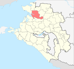 Location of Kanevskoy District in Krasnodar Krai | |
| Coordinates: 46°04′43″N 38°58′09″E / 46.07861°N 38.96917°ECoordinates: 46°04′43″N 38°58′09″E / 46.07861°N 38.96917°E | |
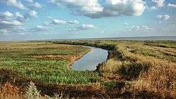 Azov reed bed, Kanevskoy District | |
.png) | |
|
| |
| Location | |
| Country | Russia |
| Federal subject | Krasnodar Krai[1] |
| Administrative structure (as of May 2013) | |
| Administrative center | stanitsa of Kanevskaya[1] |
| Administrative divisions:[1] | |
| Rural okrugs | 9 |
| Inhabited localities:[1] | |
| Rural localities | 38 |
| Municipal structure (as of July 2010) | |
| Municipally incorporated as | Kanevskoy Municipal District[2] |
| Municipal divisions:[2] | |
| Urban settlements | 0 |
| Rural settlements | 9 |
| Statistics | |
| Area | 2,483 km2 (959 sq mi)[3] |
| Population (2010 Census) | 102,624 inhabitants[4] |
| • Urban | 0% |
| • Rural | 100% |
| Density | 41.33/km2 (107.0/sq mi)[5] |
| Time zone | MSK (UTC+03:00)[6] |
| Official website | |
| Kanevskoy District on WikiCommons | |
Kanevskoy District (Russian: Каневско́й райо́н), known as Kanevsky District (Каневский район) before March 2009, is an administrative district (raion), one of the thirty-eight in Krasnodar Krai, Russia.[1] As a municipal division, it is incorporated as Kanevskoy Municipal District.[2] It is located in the north of the krai. The area of the district is 2,483 square kilometers (959 sq mi).[3] Its administrative center is the rural locality (a stanitsa) of Kanevskaya.[1] Population: 102,624 (2010 Census);[4] 102,245 (2002 Census);[7] 88,415 (1989 Census).[8] The population of Kanevskaya accounts for 43.3% of the district's total population.[4]
References
Notes
- 1 2 3 4 5 6 Reference Information #34.01-707/13-03
- 1 2 3 Law #697-KZ
- 1 2 "General Information" (in Russian). Kanevskoy District. Retrieved May 15, 2017.
- 1 2 3 Russian Federal State Statistics Service (2011). "Всероссийская перепись населения 2010 года. Том 1" [2010 All-Russian Population Census, vol. 1]. Всероссийская перепись населения 2010 года (2010 All-Russia Population Census) (in Russian). Federal State Statistics Service. Retrieved June 29, 2012.
- ↑ The value of density was calculated automatically by dividing the 2010 Census population by the area specified in the infobox. Please note that this value is only approximate as the area specified in the infobox does not necessarily correspond to the area of the entity proper or is reported for the same year as the population.
- ↑ Правительство Российской Федерации. Федеральный закон №107-ФЗ от 3 июня 2011 г. «Об исчислении времени», в ред. Федерального закона №271-ФЗ от 03 июля 2016 г. «О внесении изменений в Федеральный закон "Об исчислении времени"». Вступил в силу по истечении шестидесяти дней после дня официального опубликования (6 августа 2011 г.). Опубликован: "Российская газета", №120, 6 июня 2011 г. (Government of the Russian Federation. Federal Law #107-FZ of June 31, 2011 On Calculating Time, as amended by the Federal Law #271-FZ of July 03, 2016 On Amending Federal Law "On Calculating Time". Effective as of after sixty days following the day of the official publication.).
- ↑ Russian Federal State Statistics Service (May 21, 2004). "Численность населения России, субъектов Российской Федерации в составе федеральных округов, районов, городских поселений, сельских населённых пунктов – районных центров и сельских населённых пунктов с населением 3 тысячи и более человек" [Population of Russia, Its Federal Districts, Federal Subjects, Districts, Urban Localities, Rural Localities—Administrative Centers, and Rural Localities with Population of Over 3,000] (XLS). Всероссийская перепись населения 2002 года [All-Russia Population Census of 2002] (in Russian). Retrieved August 9, 2014.
- ↑ Demoscope Weekly (1989). "Всесоюзная перепись населения 1989 г. Численность наличного населения союзных и автономных республик, автономных областей и округов, краёв, областей, районов, городских поселений и сёл-райцентров" [All Union Population Census of 1989: Present Population of Union and Autonomous Republics, Autonomous Oblasts and Okrugs, Krais, Oblasts, Districts, Urban Settlements, and Villages Serving as District Administrative Centers]. Всесоюзная перепись населения 1989 года [All-Union Population Census of 1989] (in Russian). Институт демографии Национального исследовательского университета: Высшая школа экономики [Institute of Demography at the National Research University: Higher School of Economics]. Retrieved August 9, 2014.
Sources
- Управление по взаимодействию с органами местного самоуправления Администрации Краснодарского края. Справочная информация №34.01-707/13-03 от 23 мая 2013 г. «Реестр административно-территориальных единиц Краснодарского края». (Department of Cooperation with the Organs of the Local Self-Government of the Administration of Krasnodar Krai. Reference Information #34.01-707/13-03 of May 23, 2013 Registry of the Administrative-Territorial Units of Krasnodar Krai. ).
- Законодательное Собрание Краснодарского края. Закон №697-КЗ от 5 мая 2004 г. «Об установлении границ муниципального образования Каневской район, наделении его статусом муниципального района, образовании в его составе муниципальных образований — сельских поселений — и установлении их границ», в ред. Закона №2053-КЗ от 28 июля 2010 г «О внесении изменений в некоторые законодательные акты Краснодарского края». Вступил в силу со дня официального опубликования. Опубликован: "Кубанские новости", №80–81, 18 мая 2004 г. (Legislative Assembly of Krasnodar Krai. Law #697-KZ of May 5, 2004 On the Establishment of the Borders of the Municipal Formation of Kanevskoy District, on Granting It the Status of a Municipal District, on the Establishment of the Municipal Formations—Rural Settlements—Within Its Structure and on the Establishment of Their Borders, as amended by the Law #2053-KZ of July 28, 2010 On Amending Several Legislative Acts of Krasnodar Krai. Effective as of the day of the official publication.).
| Districts |
| |
|---|---|---|
| Cities and towns | ||
| Urban-type settlements |
| |
This article is issued from
Wikipedia.
The text is licensed under Creative Commons - Attribution - Sharealike.
Additional terms may apply for the media files.