Annapolis County, Nova Scotia
| Annapolis County, Nova Scotia | |||
|---|---|---|---|
| County | |||
| |||
| Motto(s): Primus et Princeps | |||
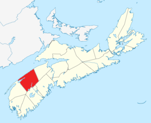 Location of Annapolis County, Nova Scotia | |||
| Coordinates: 44°42′N 65°12′W / 44.7°N 65.2°WCoordinates: 44°42′N 65°12′W / 44.7°N 65.2°W | |||
| Country |
| ||
| Province |
| ||
| Towns | Annapolis Royal / Middleton | ||
| Established | August 17, 1759 | ||
| Incorporated | April 17, 1879 | ||
| Electoral Districts Federal |
West Nova | ||
| Provincial | Annapolis | ||
| Government | |||
| • Type | Annapolis County Municipal Council | ||
| • Warden | Timothy Habinski | ||
| • MLA | Stephen McNeil (L) | ||
| • MP | Colin Fraser (L) | ||
| Area[1] | |||
| • Land | 3,184.97 km2 (1,229.72 sq mi) | ||
| Population (2016)[1][2] | |||
| • Total | 20,591 | ||
| • Change 2006-11 |
| ||
| • Census Rankings - Census Divisions Subdivision A Subdivision B Subdivision C Subdivision D - Towns Annapolis Royal Middleton - Reserves Bear River (part) 6 Bear River 6B |
6,342 (574 of 5,008) 3,707 (685 of 5,008) 5,085 (864 of 5,008) 3,007 (987 of 5,008) 444 (3,171 of 5,008) 972 (2,086 of 5,008) 1,829 (1,403 of 5,008) 42 (4,694 of 5,008) 10 (4,889 of 5,008) | ||
| Time zone | UTC-4 (AST) | ||
| • Summer (DST) | UTC-3 (ADT) | ||
| Area code(s) | 902 | ||
| Dwellings | 11,038 | ||
| Median Income* | $37,024 CDN | ||
| Website | annapoliscounty.ca | ||
| |||


Annapolis County is a county in the Canadian province of Nova Scotia located in the western part of the province on the Bay of Fundy. The county seat is Annapolis Royal.
History
Established August 17, 1759 by Order in Council, Annapolis County took its name from the town of Annapolis Royal which had been named in honour of Anne, Queen of Great Britain. It was near the previous site of Port Royal, the chief Acadian settlement in the area. The Acadians had been forcibly removed by British government officials in the 1755 Grand Dérangement.
In 1817 the population of the county was 9,817, and that had grown to 14,661 by 1827. At that time, the county was divided into six townships: Annapolis, Granville, Wilmot, Clements, Digby and Clare.[3]
By 1833, a number of reasons had been advanced for making two counties out of Annapolis County. Two petitions were presented to the House of Assembly in that year requesting that the county be divided. However, it was not until 1837 that Annapolis County was divided into two distinct and separate counties - Annapolis and Digby.
Demographics
As a census division in the 2016 Census of Population conducted by Statistics Canada, Annapolis County recorded a population of 20,591 living in 9,377 of its 11,391 total private dwellings, a change of −0.8% from its 2011 population of 20,756. With a land area of 3,189.14 km2 (1,231.33 sq mi), it had a population density of 6.5/km2 (16.7/sq mi) in 2016.[4]
Forming the majority of the Annapolis County census division, the Municipality of the County of Annapolis recorded a population of 18,252 living in 8,188 of its 10,047 total private dwellings in the 2016 Census of Population, a change of −1.5% from its 2011 population of 18,526. With a land area of 3,178.21 km2 (1,227.11 sq mi), it had a population density of 5.7/km2 (14.9/sq mi) in 2016.[5]
|
Mother tongue language (2011)[8]
|
Ethnic Groups (2006)[9]
|
There are 10,404 households out of which 26.06% have children living with them, 36.50% are married couples living together, 25.46% are one-person households, and 11.98% are other household types.
Communities
- Towns
- Villages
- Reserves
- County municipality and county subdivisions
- Municipality of the County of Annapolis
- Annapolis Subdivision A
- Annapolis Subdivision B
- Annapolis Subdivision C
- Annapolis Subdivision D
Access routes
Highways and numbered routes that run through the county, including external routes that start or finish at the county limits:[10]
Protected areas
- Cottage Cove Provincial Park
- Cloud Lake Wilderness Area
- Delaps Cove Hiking Trails
- Kejimkujik National Park
- Upper Clements Provincial Park
- Valleyview Provincial Park
Attractions
| Wikimedia Commons has media related to Annapolis County, Nova Scotia. |
- Bay of Fundy Scenic Drive
- Mount Hanley Schoolhouse Museum
- Annapolis Royal Historic Gardens (Annapolis)
- Fort Anne (Fort Anne National Historic Site)
- Port-Royal National Historic Site
- Upper Clements Park
See also
References
- 1 2 2006 Statistics Canada Community Profile: Annapolis County, Nova Scotia
- ↑ Statistics Canada Population and dwelling counts, for Canada and census subdivisions (municipalities), 2006 and 2001 censuses - 100% data
- ↑ Bouchette, Joseph (1832). The British Dominions in North America; or a Topographical and statistical description of the provinces of Lower and Upper Canada, New Brunswick, Nova Scotia, the Islands of Newfoundland, Prince Edward, and Cape Breton. London: Longman & Company. p. 38. Retrieved 15 February 2018.
- ↑ "Population and dwelling counts, for Canada, provinces and territories, and census divisions, 2016 and 2011 censuses – 100% data (Nova Scotia)". Statistics Canada. February 8, 2017. Retrieved February 12, 2017.
- ↑ "Population and dwelling counts, for Canada, provinces and territories, and census subdivisions (municipalities), 2016 and 2011 censuses – 100% data (Nova Scotia)". Statistics Canada. February 8, 2017. Retrieved February 12, 2017.
- ↑ Censuses 1871-1941
- ↑ Statistics Canada: 1996, 2001, 2006 census
- ↑ Statistics Canada: 2011 census
- ↑ 2006 Statistics Canada Census Ethnocultural Portrait of Canada: Annapolis County, Nova Scotia
- ↑ Atlantic Canada Back Road Atlas ISBN 978-1-55368-618-7 Pages 76-77, 84-85
External links
- Photographs of historic monuments in Annapolis County

Places adjacent to Annapolis County, Nova Scotia | ||||||||||
|---|---|---|---|---|---|---|---|---|---|---|
| ||||||||||
| Towns | | |
|---|---|---|
| Unorganized subdivisions |
| |
| ||
| Historical counties | |
|---|---|
| Economic regions | |
| Regional municipalities | |
| County municipalities | |
| District municipalities | |
| Towns | |
| Villages | |
| Lists | |
| |