Angola, Kansas
| Angola, Kansas | |
|---|---|
| Unincorporated community | |
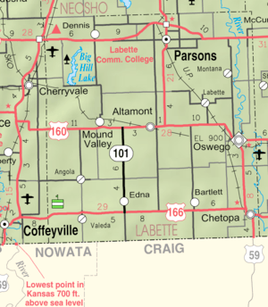 KDOT map of Labette County (legend) | |
 Angola  Angola | |
| Coordinates: 37°6′20″N 95°26′58″W / 37.10556°N 95.44944°WCoordinates: 37°6′20″N 95°26′58″W / 37.10556°N 95.44944°W | |
| Country | United States |
| State | Kansas |
| County | Labette |
| Time zone | UTC-6 (CST) |
| • Summer (DST) | UTC-5 (CDT) |
| Area code | 620 |
Angola is a unincorporated community in Labette County, Kansas, United States.
History
Angola was laid out in 1886.[1] The post office was established January 31, 1887, and discontinued September 16, 1971.
References
- ↑ Blackmar, Frank Wilson (1912). Kansas: A Cyclopedia of State History, Embracing Events, Institutions, Industries, Counties, Cities, Towns, Prominent Persons, Etc. Standard Publishing Company. p. 77.
Further reading
External links
Municipalities and communities of Labette County, Kansas, United States | ||
|---|---|---|
| Cities | 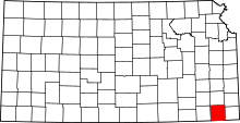 | |
| Unincorporated communities | ||
| Townships |
| |
This article is issued from
Wikipedia.
The text is licensed under Creative Commons - Attribution - Sharealike.
Additional terms may apply for the media files.