Ananindeua, Pará
| Ananindeua | |||
|---|---|---|---|
| City | |||
| The City of Ananindeua | |||
 | |||
| |||
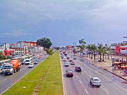
 Location in the State of Pará | |||
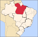
 Ananindeua Localization in Brazil | |||
| Coordinates: 01°21′57″S 48°22′19″W / 1.36583°S 48.37194°WCoordinates: 01°21′57″S 48°22′19″W / 1.36583°S 48.37194°W | |||
| Country |
| ||
| Region | Northeast | ||
| State |
| ||
| Founded | January 3, 1944 | ||
| Government | |||
| • Mayor | Manouel Carlos Antunes (PSDB) | ||
| Area | |||
| • Total | 185.057 km2 (71.451 sq mi) | ||
| Elevation | 20 m (70 ft) | ||
| Population (2010) | |||
| • Total | 471,744 | ||
| • Density | 2,500/km2 (6,600/sq mi) | ||
| Time zone | UTC-3 (UTC-3) | ||
| Postal code | 67000-000 | ||
| Area code(s) | 091 | ||
| Website | http://www.ananindeua.pa.gov.br/ | ||


Ananindeua (Portuguese pronunciation: [ananĩˈdewɐ]) is a city in Pará, northern Brazil. It is a part of the Metropolitan Region of Belém, and is the second most populated city in the State of Pará,[1] and the third largest in the Amazon Region.[2] It has a population of 505,512 according to the last Census, done by the Brazilian Statistic and Geography Institute (IBGE).
The municipality contains 1% of the Utinga State Park, created in 1993 to protect the metropolitan area's water supply.[3]
Education
Amazon Valley Academy is located in this city.
References
- ↑ "Belém é a 10ª cidade mais populosa do Brasil" (in Portuguese). Portal Amazônia. Retrieved 23 June 2013.
- ↑ "Distâncias entre Cidades - Belém - Pará" (in Portuguese). Em Sampa.com. Retrieved 23 June 2013.
- ↑ Veríssimo, Adalberto; Santos, Daniel Conceição dos; Pereira, Jakeline Ramos (August 2013), Plano de Manejo do Parque Estadual do Utinga (PDF) (in Portuguese), Secretaria de Estado de Meio Ambiente (SEMA), p. 30, retrieved 2016-12-05
| Wikimedia Commons has media related to Ananindeua. |
Capital: Belém | |||||||||||||||
| Mesoregion Baixo Amazonas |
|  | |||||||||||||
| Mesoregion Marajó |
| ||||||||||||||
| Mesoregion Metropolitana de Belém |
| ||||||||||||||
| Mesoregion Nordeste Paraense |
| ||||||||||||||
| Mesoregion Sudeste Paraense |
| ||||||||||||||
| Mesoregion Sudoeste Paraense |
| ||||||||||||||
This article is issued from
Wikipedia.
The text is licensed under Creative Commons - Attribution - Sharealike.
Additional terms may apply for the media files.