An Stùc
| An Stùc | |
|---|---|
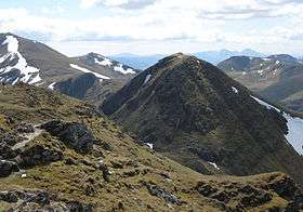 An Stùc from Meall Garbh | |
| Highest point | |
| Elevation | 1,118 m (3,668 ft) |
| Prominence | 127 m (417 ft) [1] |
| Listing | Munro |
| Naming | |
| Pronunciation | Scottish Gaelic: [ən̪ˠˈs̪t̪uxk] |
| Geography | |
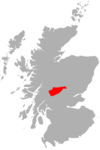
| Location | Perth and Kinross, Scotland |
| OS grid | NN63904314 |
| Topo map | OS Landranger 51 |
| Climbing | |
| Easiest route | Hike |
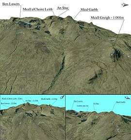
An Stuc 3D map
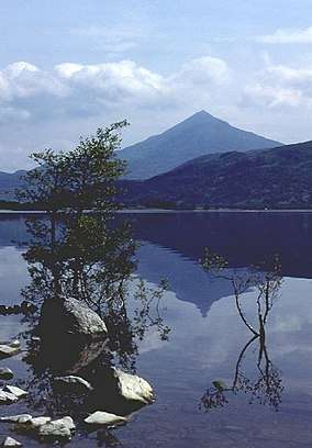
An Stùc is a conically shaped Scottish mountain in the Ben Lawers range to the north of Loch Tay. The normal routes of ascent are via the ridges from Ben Lawers or Meall Garbh.
There is another An Stùc in Assynt, standing at 364m about 17 miles northeast of Ullapool at the head of Glenoykel.
References
| Wikimedia Commons has media related to An Stùc. |
- ↑ "An Stuc, ScotlandAn Stuc, Scotland". Peakbagger.com.
- The Munros, Scottish Mountaineering Trust, 1986, Donald Bennet (Editor) ISBN 0-907521-13-4
Coordinates: 56°33′38″N 4°12′58″W / 56.56044°N 4.21612°W
This article is issued from
Wikipedia.
The text is licensed under Creative Commons - Attribution - Sharealike.
Additional terms may apply for the media files.