Loch Tay
| Loch Tay | |
|---|---|
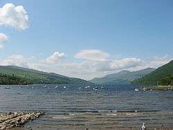 Loch Tay at Kenmore in spring | |
| Location | Perthshire, Scotland |
| Coordinates | 56°30′56″N 4°08′46″W / 56.51556°N 4.14611°WCoordinates: 56°30′56″N 4°08′46″W / 56.51556°N 4.14611°W |
| Lake type | Loch |
| Primary inflows | Dochart, Lochay |
| Catchment area | 232 sq mi (600 km2)[1] |
| Basin countries | United Kingdom |
| Max. length | 14.55 mi (23.42 km)[1] |
| Max. width | 0.7 mi (1.1 km)[1] |
| Surface area | 10.19 sq mi (26.4 km2)[1] |
| Average depth | 60.66 m (199.0 ft)[1] |
| Max. depth | 154.8 m (508 ft)[1] |
| Water volume | 1.6 km3 (0.38 cu mi) |
| Shore length1 | 3 km (1.9 mi) |
| Surface elevation | 102 m (335 ft) |
| Islands | 7 |
| Settlements | Killin, Kenmore, Lawers |
| 1 Shore length is not a well-defined measure. | |
Loch Tay (Scottish Gaelic, Loch Tatha) is a freshwater loch in the central highlands of Scotland, in the Perth and Kinross and Stirling council areas. The watershed of Loch Tay traditionally formed the historic province of Breadalbane.
It is a long, narrow loch of around 14.55 miles (23.42 km) long, and typically around 1 to 1½ miles wide, following the line of the strath from the south west to north east. It is the sixth-largest loch in Scotland by area and over 150 metres (490 ft) deep at its deepest.
Ben Lawers on its north shore is, at 1,214 metres (3,983 ft), the tenth-highest mountain in the British Isles, and is the highest peak in a group of seven munros.
Killin at the head of the loch, and Kenmore at the outflow of the River Tay, are the main settlements on the lochside today. The smaller settlements of Acharn, Ardeonaig and Ardtalnaig are located on the south side of the loch whilst Fearnan and Lawers are on the north side. The loch is fed by the rivers Dochart and Lochay at its head and numerous smaller streams.
The loch is a popular spot for salmon fishing, and many of its surroundings feature in the traditional Scottish 'Loch Tay Boat Song' (Scottish Gaelic, Iorram Loch Tatha).
Loch Tay railway station was on the Killin Railway. It is now closed.
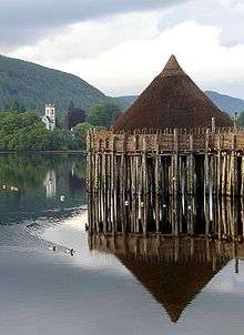
In ancient times (in the Iron Age) people lived on defensible, man-made islands on the loch, called crannogs. More than 20 submerged crannogs have been identified in the loch. An example has now been reconstructed on the south side of the loch at the Scottish Crannog Centre.
Gallery
 Loch Tay at Kenmore (in winter)
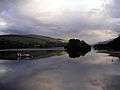 Loch Tay at Kenmore (in summer)
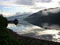 Loch Tay Crannog
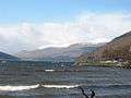
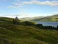 Loch Tay looking east from Morenish
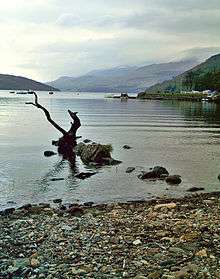 Loch Tay
 The ruined Lawers Inn in the now deserted village of Lawers
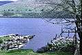 Old Lawers jetty; part of the drove road south to Crieff
References
External links
| Wikimedia Commons has media related to Loch Tay. |
- Killin.info community website, guides, photos, media, news.
- YouTube.com video of Killin area featuring Loch Tay.
- The Scottish Crannog Centre
- some facts about Loch Tay and its history