Meall Ghaordaidh
| Meall Ghaordaidh | |
|---|---|
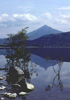
 Meall Ghaordaidh (centre) from An Grianan looking over Glen Lyon, with Stronuich Reservoir (bottom left) | |
| Highest point | |
| Elevation | 1,039 m (3,409 ft) [1] |
| Prominence | 491 metres (1,611 ft) |
| Listing | Munro |
| Naming | |
| Translation | Possibly derived from gairdean (shoulder, hand or arm) (Gaelic) |
| Geography | |
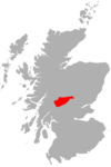
| Location | Stirlingshire, Scotland |
| Parent range | Grampians |
| OS grid | NN514397 |
| Topo map | OS Landranger 51 |
Meall Ghaordaidh is a mountain in the Southern Highlands of Scotland, approximately 10 km north-west of Killin.
The mountain can be ascended via Glen Lochay starting to the north-west of the Allt Dhùin Croisg near Duncroisk, via an eroded path leading north-west through peat bogs to the summit; alternatively, an ascent can be made from Glen Lyon starting at Stronuich via one of two spurs that lead to the summit (Creag an Tulabhain or Creag Laoghain). The summit is marked by a large circular rock windbreak, within which there is a trig point.
References
- ↑ "walkhighlands Meall Ghaordaidh". walkhighlands.co.uk. 2013. Retrieved 26 October 2013.
This article is issued from
Wikipedia.
The text is licensed under Creative Commons - Attribution - Sharealike.
Additional terms may apply for the media files.