Sgiath Chùil
| Sgiath Chùil | |
|---|---|
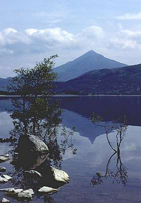
 Sgiath Chùil and the Lubchurrin cottage from the north in Glen Lochay | |
| Highest point | |
| Elevation | 921 m (3,022 ft) [1] |
| Prominence | 312 m (1,024 ft) [2] |
| Listing | Munro, Marilyn |
| Coordinates | 56°27′9.94″N 4°29′46.64″W / 56.4527611°N 4.4962889°WCoordinates: 56°27′9.94″N 4°29′46.64″W / 56.4527611°N 4.4962889°W |
| Naming | |
| Translation | back wing (Gaelic) |
| Geography | |
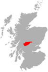
| Location | Stirling, Scotland |
| Parent range | Glen Lochay Hills, Grampian Mountains |
| OS grid | NN462317 |
| Topo map | OS Landranger 51 |
| Climbing | |
| Easiest route | Hike |
| Listed summits of Sgiath Chùil | ||||
| Name | Grid ref | Height | Status | |
|---|---|---|---|---|
| Meall a' Churain | NN463325 | 918 metres (3,012 ft) | Munro Top | |
Sgiath Chùil is a mountain situated in the southern highlands of Scotland. It stands within Loch Lomond and the Trossachs National Park, on its northern border. It is about 11 kilometres (6.8 mi) west of Killin.
Description
Sgiath Chùil qualifies as a Munro, at a height of 921 metres (3,022 ft), and with prominence of 312 metres (1,024 ft), as a Marilyn. In Sir Hugh Munro's original list of peaks in Scotland with a height over 3,000 feet (914 m) that was published in the Scottish Mountaineering Club Journal in September 1891, Sgiath Chùil was listed as a top, with Meall a' Churain listed as the mountain and higher point. This error was corrected when the first revision of the list was published in 1921.[3]
References
- ↑ "walkhighlands Sgiath Chuil". walkhighlands.co.uk. 2013. Retrieved 26 October 2013.
- ↑ Database of British and Irish Hills. Retrieved 20 Jan 2012.
- ↑ The Munros and Tops 1891-1997. Spreadsheet giving details of changes to successive editions of Munro's Tables
This article is issued from
Wikipedia.
The text is licensed under Creative Commons - Attribution - Sharealike.
Additional terms may apply for the media files.