Loeng Nok Tha District
| Loeng Nok Tha เลิงนกทา | |
|---|---|
| District | |
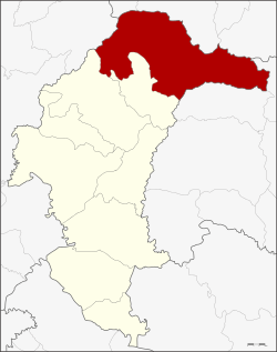 District location in Yasothon Province | |
| Coordinates: 16°12′28″N 104°33′17″E / 16.20778°N 104.55472°ECoordinates: 16°12′28″N 104°33′17″E / 16.20778°N 104.55472°E | |
| Country | Thailand |
| Province | Yasothon |
| Area | |
| • Total | 942.8 km2 (364.0 sq mi) |
| Population (2005) | |
| • Total | 93,750 |
| • Density | 99.4/km2 (257/sq mi) |
| Time zone | UTC+7 (ICT) |
| Postal code | 35120 |
| Geocode | 3508 |
Loeng Nok Tha (Thai: เลิงนกทา, pronounced [lɤ̄ːŋ nók tʰāː]) is a district of Yasothon Province in northeastern Thailand. Loeng Nok Tha town, the administrative center of the district, lies 69 km from Mueang Yasothon, and approximately 600 km from Bangkok.
History
Loeng Nok Tha was established as a minor district (king amphoe), under jurisdiction of Amnat Charoen District in Ubon Ratchathani Province on 1 September 1937. It then consisted of the three tambons Kut Chiang Mi, Bung Kha, and Som Pho.[1]
On 1 November 1947, Loeng Nok Tha was elevated to district (amphoe) status in Ubon Ratchathani Province.[2] When Yasothon was established as a province in 1972, Loeng Nok Tha was one of six districts reassigned to the new province.
Etymology

The name Loeng Nok Tha consists of two parts:
- Loeng, Isan for a low-lying swampy basin.
- Nok (fowl) Tha (painted), Isan for a species of bird similar to the guineafowl.
The area of Loeng Nok Tha is so called because there once were large numbers of nok tha living around the swamps of the region, but they have now disappeared almost entirely as a result of human habitation; not to be confused with similarly named Tambon Nong (fen) Nok Tha (Thai: หนองนกทา) in Amphoe Khemarat, Ubon Ratchatani Province; or None (hill) Nok Tha (Thai:โนนนกทา) a Thai prehistoric archaeological site in Phu Wiang District, Khon Kaen Province.
Geography
Neighboring districts are (from the north clockwise) Nong Sung, Nikhom Kham Soi, and Don Tan of Mukdahan Province; Chanuman and Senangkhanikhom of Amnat Charoen Province; Thai Charoen and Kut Chum of Yasothon Province; and Nong Phok of Roi Et Province.
Administration
The district is divided into 10 sub-districts (tambons), which make up 143 villages (muban).
|
|
Education
Secondary schools
- Loeng Nok Tha School (โรงเรียนเลิงนกทา)
- Hong Saeng Witthayakhom School (โรงเรียนห้องแซงวิทยาคม)
- Bung Kha Witthayakhom School (โรงเรียนบุ่งค้าวิทยาคม)
- Si Kaeo Pracha San School (โรงเรียนศรีแก้วประชาสรรค์)
- Na Prong Pracha San School (โรงเรียนนาโปร่งประชาสรรค์)
Colleges
- Loeng Nok Tha College (วิทยาลัยการอาชีพเลิงนกทา)
References
- ↑ ประกาศกระทรวงมหาดไทย เรื่อง ตั้งกิ่งอำเภอเลิกนกทา (PDF). Royal Gazette (in Thai). 54 (0 ง): 1155–1156. August 23, 1937.
- ↑ ประกาศสำนักนายกรัฐมนตรี เรื่อง ยกฐานะกิ่งอำเภอขึ้นเป็นอำเภอ (PDF). Royal Gazette (in Thai). 64 (50 ง): 2661–2662. October 21, 1947.