Betong District
| Betong เบตง | |
|---|---|
| District | |
 Thai border checkpoint, Betong District. | |
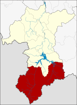 District location in Yala Province | |
| Coordinates: 5°46′25″N 101°3′38″E / 5.77361°N 101.06056°ECoordinates: 5°46′25″N 101°3′38″E / 5.77361°N 101.06056°E | |
| Country | Thailand |
| Province | Yala |
| Seat | Betong |
| Tambon | 5 |
| Muban | 32 |
| Area | |
| • Total | 1,328.0 km2 (512.7 sq mi) |
| Population (2017) | |
| • Total | 62,523 |
| • Density | 41.1/km2 (106/sq mi) |
| Time zone | UTC+7 (ICT) |
| Postal code | 95110 |
| Geocode | 9502 |
Betong (Thai: เบตง, pronounced [bēː.tōŋ]; Malay: Betung) is the southernmost district (amphoe) of Yala Province, southern Thailand.
Geography
Betong is on the Malaysian border. To the north is Than To, to the east is Chanae, (Narathiwat Province). To the south is the Malaysian state of Perak and to the west is Kedah.
The highest point of the Sankalakhiri Range (Northern Titiwangsa Mountains), 1,533 m (5,030 ft) high Ulu Titi Basah (เขาหลวง), is on the Thai–Malaysian border between Betong District and Hulu Perak District of Perak.[1]
History
In the past, this area was under Mueang Raman, Monthon Pattani. It was upgraded to a district in 1868 with the name Yarom. In 1930 the district name was changed to Betong.
The name Betong is the Thai corruption of Betung, its original Malay name means 'bamboo'.
Population
Betong is considered to be the only area in the lower southern region where Thai Chinese outnumber Muslims or Malays. At present there are five Chinese organizations.[2]
Economy
As of 2018 Thailand's transport ministry is constructing the 1.9 billion baht Betong Airport. It is scheduled for completion in 2020.[3]
Administration
Central administration
Betong is divided into five sub-districts (tambons), which are further subdivided into 32 administrative villages (mubans).
| No. | Name | Thai | Villages | Pop.[4] |
|---|---|---|---|---|
| 1. | Betong | เบตง | - | 26,663 |
| 2. | Yarom | ยะรม | 8 | 10,266 |
| 3. | Tano Maero | ตาเนาะแมเราะ | 9 | 9,436 |
| 4. | Aiyoeweng | อัยเยอร์เวง | 11 | 11,703 |
| 5. | Than Nam Thip | ธารน้ำทิพย์ | 4 | 4,455 |
Local administration
There is one town (thesaban mueang) in the district:
- Betong (Thai: เทศบาลเมืองเบตง) consisting of sub-district Betong.
There is one sub-district municipality (thesaban tambon) in the district:
- Than Nam Thip (Thai: เทศบาลตำบลธารน้ำทิพย์) consisting of sub-district Than Nam Thip.
There are three sub-district administrative organizations (SAO) in the district:
- Yarom (Thai: องค์การบริหารส่วนตำบลยะรม) consisting of sub-district Yarom.
- Tano Maero (Thai: องค์การบริหารส่วนตำบลตาเนาะแมเราะ) consisting of sub-district Tano Maero.
- Aiyoeweng (Thai: องค์การบริหารส่วนตำบลอัยเยอร์เวง) consisting of sub-district Aiyoeweng.
References
- ↑ "Gunong Ulu Titi Basah: Thailand". Geographical Names. Retrieved 4 May 2018.
- ↑ เย็นบำรุง, ณัฐธิดา. "เมืองเบตง: คนไทยเชื้อสายจีนที่เข้มแข็ง". Rangsit University (in Thai).
- ↑ Sritama, Suchat (27 August 2018). "Better days around the bend". Bangkok Post. Retrieved 27 August 2018.
- ↑ "Population statistics 2017" (in Thai). Department of Provincial Administration. Retrieved 2018-06-19.