Kabang District
| Kabang กาบัง | |
|---|---|
| Amphoe | |
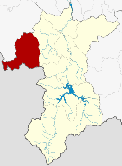 Amphoe location in Yala Province | |
| Coordinates: 6°25′39″N 101°1′9″E / 6.42750°N 101.01917°ECoordinates: 6°25′39″N 101°1′9″E / 6.42750°N 101.01917°E | |
| Country | Thailand |
| Province | Yala |
| Seat | Kabang |
| Tambon | 2 |
| Muban | 19 |
| Amphoe established | 1991 |
| Area | |
| • Total | 451.0 km2 (174.1 sq mi) |
| Population (2014) | |
| • Total | 23,226 |
| • Density | 39.3/km2 (102/sq mi) |
| Time zone | UTC+7 (ICT) |
| Postal code | 95120 |
| Geocode | 9507 |
Kabang (Thai: กาบัง, pronounced [kāː.bāŋ]; Pattani Malay: กาแบ, pronounced [kāː.bɛː]) is the westernmost district (amphoe) of Yala Province, southern Thailand.
History
The name "Kabang" is a Thai corruption of "kabae" or "kabe" (Jawi: كاب), its original name in Patani Malay language. Kabae or kabe is a kind of Rambutan tree.
The area of Kabang District was separated from Yaha District to create a minor district (king amphoe) on 1 April 1991.[1] It was upgraded to a full district on 11 October 1997.[2]
Geography
Neighboring districts are (from the northwest clockwise) Saba Yoi of Songkhla Province, Yaha of Yala Province, and Kedah state of Malaysia.
Administration
Central administration
The district Kabang is divided into two sub-districts (tambon), which are further subdivided into 19 administrative villages (muban).
| No. | Name | Thai | Villages | Pop.[3] |
|---|---|---|---|---|
| 1. | Kabang | กาบัง | 8 | 13,626 |
| 2. | Bala | บาละ | 11 | 9,600 |
Local administration
There are two sub-district administrative organizations (SAO) in the district:
- Kabang (Thai: องค์การบริหารส่วนตำบลกาบัง) consisting of sub-district Kabang.
- Bala (Thai: องค์การบริหารส่วนตำบลบาละ) consisting of sub-district Bala.
References
- ↑ ประกาศกระทรวงมหาดไทย เรื่อง แบ่งเขตท้องที่อำเภอยะหา จังหวัดยะลา ตั้งเป็นกิ่งอำเภอกาบัง (PDF). Royal Gazette (in Thai). 108 (15 ง): 1068. January 31, 1991.
- ↑ พระราชกฤษฎีกาตั้งอำเภอหนองปรือ อำเภอห้วยกระเจา อำเภอทรายทองวัฒนา อำเภอปางศิลาทอง อำเภอเนินสง่า อำเภอนาทม อำเภอพระพรหม อำเภอแม่วงก์ อำเภอสองแคว อำเภอบ้านใหม่ไชยพจน์ อำเภอไทยเจริญ อำเภอกาบัง อำเภอพยุห์ อำเภอเมืองจันทร์ อำเภอภูพาน อำเภอคลองหอยโข่ง อำเภอเขาฉกรรจ์ อำเภอนาวัง อำเภอพิบูลย์รักษ์ และอำเภอทุ่งศรีอุดม พ.ศ. ๒๕๔๐ (PDF). Royal Gazette (in Thai). 114 (50 ก): 24–27. September 26, 1997.
- ↑ "Population statistics 2014" (in Thai). Department of Provincial Administration. Retrieved 2015-06-13.
External links
- amphoe.com (Thai)