Amargadhi
| Amargadhi अमरगढी | |
|---|---|
| Municipality | |
| Country |
|
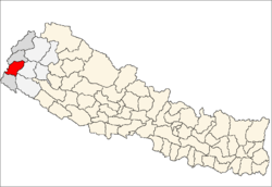
| Zone | Mahakali Zone |
| District | Dadeldhura District |
| Incorporated | January 24, 1997 |
| Elevation | 1,848 m (6,063 ft) |
| Population (2011) | |
| • Total | 22,241 |
| Time zone | UTC+5:45 (Nepal Time) |
| Postal code | 10300 |
| Area code(s) | 096 |
| Website | |
Amargadhi is a municipality and the district headquarter of Dadeldhura District in Province No. 7 of western Nepal. The 2011 census counted 22,241 residents in the municipality. It was named after Gorkha General Amar Singh Thapa, who fought in the Gurkha War between 1814 and 1816 At the time of the 1991 Nepal census it had a population of 18,390.[1]
Transportation
Mahakali Highway links Amargadhi to the Terai region of Nepal as well as Api Municipality in the Lesser Himalayas. Seti Highway branches off Mahakali Highway at Amargadhi towards Dipayal Silgadhi.
Media
To Promote local culture Amargadhi has three community radio stations, Radio Amargadhi - 97.4 MHz, Radio Sudur Awaz - 95 MHz and Radio Aafno 104.8 MHZ.
Climate
| Climate data for Amargadhi (1848 m) | |||||||||||||
|---|---|---|---|---|---|---|---|---|---|---|---|---|---|
| Month | Jan | Feb | Mar | Apr | May | Jun | Jul | Aug | Sep | Oct | Nov | Dec | Year |
| Average high °C (°F) | 14.0 (57.2) |
15.2 (59.4) |
19.4 (66.9) |
23.6 (74.5) |
26.1 (79) |
26.0 (78.8) |
24.2 (75.6) |
23.8 (74.8) |
23.3 (73.9) |
21.7 (71.1) |
18.5 (65.3) |
15.7 (60.3) |
21 (69.7) |
| Daily mean °C (°F) | 9.0 (48.2) |
10.2 (50.4) |
14.0 (57.2) |
18.0 (64.4) |
20.3 (68.5) |
21.3 (70.3) |
20.7 (69.3) |
20.4 (68.7) |
19.4 (66.9) |
16.7 (62.1) |
13.2 (55.8) |
10.5 (50.9) |
16.1 (61.1) |
| Average low °C (°F) | 4.1 (39.4) |
5.1 (41.2) |
8.6 (47.5) |
12.3 (54.1) |
14.5 (58.1) |
16.6 (61.9) |
17.3 (63.1) |
17.1 (62.8) |
15.5 (59.9) |
11.7 (53.1) |
8.0 (46.4) |
5.3 (41.5) |
11.3 (52.4) |
| Average precipitation mm (inches) | 42.8 (1.685) |
62.5 (2.461) |
56.8 (2.236) |
55.1 (2.169) |
92.2 (3.63) |
171.6 (6.756) |
329.2 (12.961) |
315.9 (12.437) |
196.0 (7.717) |
44.3 (1.744) |
9.4 (0.37) |
23.0 (0.906) |
1,398.8 (55.072) |
| Source: http://www.dhm.gov.np/uploads/climatic/880251189NORMAL%20FILE.pdf | |||||||||||||
References
- ↑ "Nepal Census 2001". Nepal's Village Development Committees. Digital Himalaya. Archived from the original on 12 October 2008. Retrieved 19 November 2008.
External links
Headquarters: Amargadhi | ||
| Municipalities |
|  |
| Rural municipalities |
| |
| Former VDCs | ||
List of municipalities and rural municipalities of Nepal | ||
Coordinates: 29°18′00″N 80°34′47″E / 29.30000°N 80.57972°E