Dipayal Silgadhi
| Dipayal Silgadhi दिपायल सिलगढी नगरपालिका | |
|---|---|
| Municipality | |
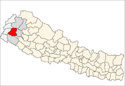
 Dipayal Silgadhi Location in Nepal | |
| Coordinates: 29°16′N 80°56′E / 29.267°N 80.933°ECoordinates: 29°16′N 80°56′E / 29.267°N 80.933°E | |
| Country |
|
| District | Doti District |
| Government | |
| • Mayor | Manju Malasi (NCP) |
| • Deputy Mayor | Shivaraj Khadka (NCP) |
| Area | |
| • Total | 72 km2 (28 sq mi) |
| Elevation | 1,310 m (4,300 ft) |
| Population (2011[1]) | |
| • Total | 23,416 |
| • Density | 330/km2 (840/sq mi) |
| Time zone | UTC+5:45 (Nepal Time) |
| Postal code | 10801 |
| Area code(s) | 094 |
| Website | http://dipayalsilgadhimun.gov.np |
Dipayal Silgadhi is a municipality and the district headquarter of Doti District in Province No. 7 of Nepal. Previously, it also served as the headquarter of the Far-Western Development Region. It lies in the Lesser Himalayas on the bank of Seti River. At the time of the 2011 Nepal census it had a population of 32,941 people living in 7,447 individual households.[2]
Transportation
Seti Highway begins in Dipayal Silgadhi, linking it to Amargadhi, from where the Terai region of Nepal can be reached on Mahakali Highway .
Media
Radio Nepal has a regional station in Dipayal Silgadhi which transmits various programs of mass interest. Silgadhi based Tribeni FM 94.4 MHz, Radio Shaileswori 105.9 MHz are the F.M. station here to serve people. Among them Tribeni FM and Radio Shaileswori are Community radio Station.
References
- ↑ General Bureau of Statistics, Kathmandu, Nepal, Nov. 2012
- ↑ "National Population and Housing Census 2011" (PDF). Central Bureau of Statistics. November 2017. Retrieved 1 May 2018.
External links
| Wikimedia Commons has media related to Dipayal Silgadhi. |
Headquarters: Dipayal Silgadhi | ||
| Municipalities |
|  |
| Rural municipalities |
| |
| Former VDCs |
| |
List of municipalities and rural municipalities of Nepal | ||