Altenberg, Saxony
| Altenberg | ||
|---|---|---|
_2006-10-30.jpg) | ||
| ||
 Altenberg Location of Altenberg within Sächsische Schweiz-Osterzgebirge district 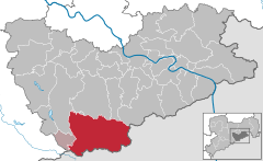  | ||
| Coordinates: 50°45′52″N 13°45′28″E / 50.76444°N 13.75778°ECoordinates: 50°45′52″N 13°45′28″E / 50.76444°N 13.75778°E | ||
| Country | Germany | |
| State | Saxony | |
| District | Sächsische Schweiz-Osterzgebirge | |
| Government | ||
| • Mayor | Thomas Kirsten | |
| Area | ||
| • Total | 145.81 km2 (56.30 sq mi) | |
| Elevation | 750 m (2,460 ft) | |
| Population (2017-12-31)[1] | ||
| • Total | 7,939 | |
| • Density | 54/km2 (140/sq mi) | |
| Time zone | CET/CEST (UTC+1/+2) | |
| Postal codes | 01773 | |
| Dialling codes | 035056 | |
| Vehicle registration | PIR | |
| Website | www.altenberg.de | |
Altenberg (German pronunciation: [ˈaltənbɛɐ̯k] (![]()
Overview
The town is situated in the Ore Mountains, 32 km south of Dresden, and 15 km northwest of Teplice, Czech Republic.
_Rathaus_(01).jpg)
Altenberg Town hall

Pyramid at the station
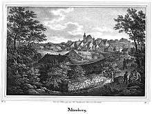
Altenberg 1839
Municipal subdivisions
|
|
|
Points of interest
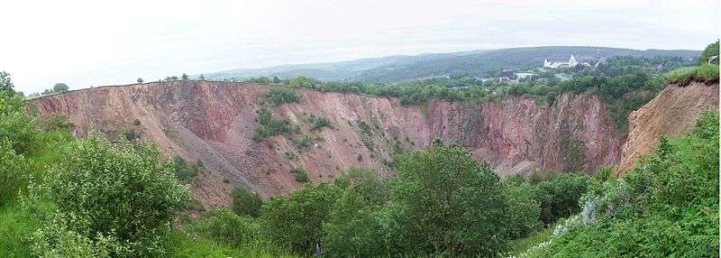
- The Great Pinge (Große Pinge) of Altenberg is a giant pinge or collapsed mineshaft above old mining excavations (mainly tin ore digging) throughout the last centuries. Today this 12 ha area (150 m deep and 450 m in diameter), bordering the town area, is considered to be one out of 77 of the most important geotopes in Germany.
- DKB-Eiskanal: The Altenberg bobsleigh, luge, and skeleton track venue (official name until 2012: Rennschlitten- und Bobbahn Altenberg (RSBB)).
- The basalt mountain Geisingberg (824 m) with mountain hut, tower and look-out. On the flanks of the hill, at the Geisingberg Meadows preserve area, there are important populations of globe-flowers and wild orchids, blooming in spring and early summer.
- Botanischer Garten Schellerhau, a botanical garden
Sport
It is home of the Altenberg bobsleigh, luge and skeleton track that has been in use since 1987.
The FIBT World Championships 2008 ran February 11–24, 2008 in Altenberg, Saxony, for the fifth time, having done so in 1991 (bobsleigh), 1994 (skeleton), 1999 (skeleton), and 2000 (men's bobsleigh). It was the first time Altenberg has hosted all of the events at one championship
Sons and daughters of the town
- Friedrich Leibniz (also Leibnütz), (1597-1652), jurist, philosopher, father of Gottfried Wilhelm Leibniz
- Horst Koschka (born 1943), biathlete
- Manfred Beer (born 1953), biathlete
- Michael Rösch (born 1983), Olympic champion with the biathlon men's relay at the 2006 Winter Olympics in Turin
References
- ↑ "Aktuelle Einwohnerzahlen nach Gemeinden 2017] (Einwohnerzahlen auf Grundlage des Zensus 2011)" (PDF). Statistisches Landesamt des Freistaates Sachsen (in German). October 2018.
External links
| Wikimedia Commons has media related to Altenberg, Saxony. |
- Altenberg (German)
| Authority control |
|---|
This article is issued from
Wikipedia.
The text is licensed under Creative Commons - Attribution - Sharealike.
Additional terms may apply for the media files.