Liebstadt
| Liebstadt | ||
|---|---|---|
_2006-07-24.jpg) Lutheran church | ||
| ||
 Liebstadt Location of Liebstadt within Sächsische Schweiz-Osterzgebirge district 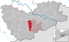  | ||
| Coordinates: 50°51′53″N 13°51′20″E / 50.86472°N 13.85556°ECoordinates: 50°51′53″N 13°51′20″E / 50.86472°N 13.85556°E | ||
| Country | Germany | |
| State | Saxony | |
| District | Sächsische Schweiz-Osterzgebirge | |
| Municipal assoc. | Bad Gottleuba-Berggießhübel | |
| Government | ||
| • Mayor | Hans-Peter Retzler (Left) | |
| Area | ||
| • Total | 37.41 km2 (14.44 sq mi) | |
| Elevation | 220-595 m (−1,732 ft) | |
| Population (2017-12-31)[1] | ||
| • Total | 1,294 | |
| • Density | 35/km2 (90/sq mi) | |
| Time zone | CET/CEST (UTC+1/+2) | |
| Postal codes | 01825 | |
| Dialling codes | 035025 | |
| Vehicle registration | PIR | |

Liebstadt is a town in the Sächsische Schweiz-Osterzgebirge district, in the Free State of Saxony, Germany. It is situated 12 km southwest of Pirna, and 23 km southeast of Dresden (centre).
References
- ↑ "Aktuelle Einwohnerzahlen nach Gemeinden 2017] (Einwohnerzahlen auf Grundlage des Zensus 2011)" (PDF). Statistisches Landesamt des Freistaates Sachsen (in German). October 2018.
This article is issued from
Wikipedia.
The text is licensed under Creative Commons - Attribution - Sharealike.
Additional terms may apply for the media files.