Müglitztal
| Müglitztal | ||
|---|---|---|
| ||
 Müglitztal Location of Müglitztal within Sächsische Schweiz-Osterzgebirge district 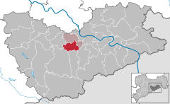  | ||
| Coordinates: 50°55′N 13°49′E / 50.917°N 13.817°ECoordinates: 50°55′N 13°49′E / 50.917°N 13.817°E | ||
| Country | Germany | |
| State | Saxony | |
| District | Sächsische Schweiz-Osterzgebirge | |
| Municipal assoc. | Dohna-Müglitztal | |
| Government | ||
| • Mayor | Jörg Glöckner | |
| Area | ||
| • Total | 21.00 km2 (8.11 sq mi) | |
| Elevation | 150-450 m (−1,300 ft) | |
| Population (2017-12-31)[1] | ||
| • Total | 1,927 | |
| • Density | 92/km2 (240/sq mi) | |
| Time zone | CET/CEST (UTC+1/+2) | |
| Postal codes | 01809 | |
| Dialling codes | 035027 | |
| Vehicle registration | PIR | |
| Website | www.oberelbe.de | |

Müglitztal is a municipality in the Sächsische Schweiz-Osterzgebirge district, in Saxony, Germany.
References
- ↑ "Aktuelle Einwohnerzahlen nach Gemeinden 2017] (Einwohnerzahlen auf Grundlage des Zensus 2011)" (PDF). Statistisches Landesamt des Freistaates Sachsen (in German). October 2018.
This article is issued from
Wikipedia.
The text is licensed under Creative Commons - Attribution - Sharealike.
Additional terms may apply for the media files.