Rathmannsdorf
| Rathmannsdorf | ||
|---|---|---|
| ||
 Rathmannsdorf Location of Rathmannsdorf within Sächsische Schweiz-Osterzgebirge district 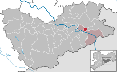  | ||
| Coordinates: 50°56′N 14°08′E / 50.933°N 14.133°ECoordinates: 50°56′N 14°08′E / 50.933°N 14.133°E | ||
| Country | Germany | |
| State | Saxony | |
| District | Sächsische Schweiz-Osterzgebirge | |
| Municipal assoc. | Bad Schandau | |
| Government | ||
| • Mayor | Rainer Hähnel | |
| Area | ||
| • Total | 4.37 km2 (1.69 sq mi) | |
| Elevation | 225 m (738 ft) | |
| Population (2017-12-31)[1] | ||
| • Total | 917 | |
| • Density | 210/km2 (540/sq mi) | |
| Time zone | CET/CEST (UTC+1/+2) | |
| Postal codes | 01814 | |
| Dialling codes | 035022 | |
| Vehicle registration | PIR | |
| Website | www.rathmannsdorf.de | |

Rathmannsdorf is a township in the Saxon district of Sächsische Schweiz-Osterzgebirge. Rathmannsdorf is 2 km down the Elbe from Bad Schandau.
Geography
The township's highest point is a plateau near Bad Schandau 200 meters above sea level, with the lowest point 120 meters above sea level along the Elbe.
History
Rathmannsdorf was first mentioned in a document in 1443. Rathmannsdorf along with Bad Schandau, Porschdorf, and Reinhardtsdorf-Schöna form a Verwaltungsgemeinschaft. The town is also a stop on the Sebnitztalbahn part of the Sächsische Semmering-Bahn, a local railroad.
References
- ↑ "Aktuelle Einwohnerzahlen nach Gemeinden 2017] (Einwohnerzahlen auf Grundlage des Zensus 2011)" (PDF). Statistisches Landesamt des Freistaates Sachsen (in German). October 2018.
| Authority control |
|---|
This article is issued from
Wikipedia.
The text is licensed under Creative Commons - Attribution - Sharealike.
Additional terms may apply for the media files.