Al Mahwit
| Al Mahwit | |
|---|---|
 | |
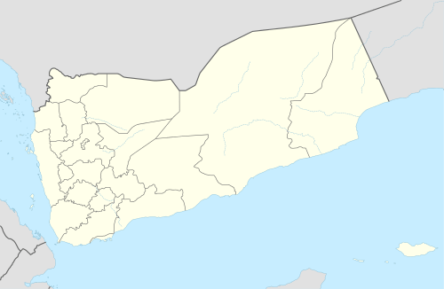 Al Mahwit Location in Yemen | |
| Coordinates: 15°28′10″N 43°32′43″E / 15.46944°N 43.54528°ECoordinates: 15°28′10″N 43°32′43″E / 15.46944°N 43.54528°E | |
| Country |
|
| Governorate | Al Mahwit |
| Population (2012) | |
| • Total | 16,291 |
Al Mahwit (Arabic: المحويت Al-Maḥwīt) is the capital city of Al Mahwit Governorate, Yemen. It is located at an elevation of about 2000 metres.
History
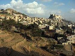
.jpg)
The old town of Al-Mahwit is situated around a mountain fortress. Until the 1970s, Al Mahwit was extremely isolated. The town had a population of about 10,000 in the early 1980s, after which infrastructure was developed and water, sanitation and electricity added.[1]
Geography
The area is mountainous, set in the Haraz Mountains and attracts trekkers.[2] Al-Mahwit is surrounded by several wadis such as Wadi Sama'a, Wadi Eyan, Wadi Juma't Saria, Wadi Hawar, Wadi Bour, Wadi Al- Hawdh, Wadi Thabab, Wadi Laa'a, Wadi Al-Ahjer and Wadi Naa'wan. Numerous villages are spread in the area that were built on and around rocks.
Climate
Al Mawhit has a cold desert climate (Köppen climate classification: BWk) with warm days and cool nights, typical of Yemen's highlands. Rain is concentrated in spring and summer, with a dry gap between the two rainy seasons. April, July and August are the only months with significant precipitation.
| Climate data for Al Mahwit | |||||||||||||
|---|---|---|---|---|---|---|---|---|---|---|---|---|---|
| Month | Jan | Feb | Mar | Apr | May | Jun | Jul | Aug | Sep | Oct | Nov | Dec | Year |
| Average high °C (°F) | 22.6 (72.7) |
24.8 (76.6) |
25.7 (78.3) |
25.4 (77.7) |
26.7 (80.1) |
29.0 (84.2) |
27.4 (81.3) |
27.0 (80.6) |
26.4 (79.5) |
23.5 (74.3) |
21.6 (70.9) |
21.1 (70) |
25.1 (77.2) |
| Daily mean °C (°F) | 13.8 (56.8) |
15.4 (59.7) |
17.2 (63) |
17.8 (64) |
19.3 (66.7) |
20.7 (69.3) |
21.1 (70) |
20.9 (69.6) |
19.3 (66.7) |
16.7 (62.1) |
14.5 (58.1) |
13.6 (56.5) |
17.5 (63.5) |
| Average low °C (°F) | 5.1 (41.2) |
6.0 (42.8) |
8.7 (47.7) |
10.2 (50.4) |
12.0 (53.6) |
12.5 (54.5) |
14.8 (58.6) |
14.8 (58.6) |
12.2 (54) |
9.9 (49.8) |
7.5 (45.5) |
6.1 (43) |
10 (50) |
| Average precipitation mm (inches) | 8 (0.31) |
11 (0.43) |
27 (1.06) |
51 (2.01) |
29 (1.14) |
7 (0.28) |
46 (1.81) |
71 (2.8) |
16 (0.63) |
5 (0.2) |
10 (0.39) |
8 (0.31) |
289 (11.37) |
| Source: Climate-Data.org[3] | |||||||||||||
Economy
The area and surrounding governorate depends on agriculture, mainly the production of coffee, tobacco, corn, sorghum and qat.[1]
References
| Wikimedia Commons has media related to Al Mahwit. |
- 1 2 Burrowes, Robert D. (2010). Historical Dictionary of Yemen. Rowman & Littlefield. p. 230. ISBN 978-0-8108-5528-1.
- ↑ Hämäläinen, Pertti (1999). Yemen. Lonely Planet Publications. p. 148. ISBN 978-0-86442-603-1.
- ↑ "Climate: Al Mahwit". Climate-Data.org. Retrieved November 5, 2017.
| 1,000,000 and more | |
|---|---|
| 100,000-999,999 | |
| 10,000-99,999 | |
| <9,999 | |
1Main Island become under control by United Arab Emirates since April 30, 2018 | |