Al Houta
| Al Houta, Yemen | |
|---|---|
 The town of Lahej, capital of the sultanate of the same name. The sultan's palace in the background. Postcard issued c. 1935 but picture probably taken several years earlier. | |
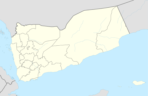 Al Houta, Yemen Location in Yemen | |
| Coordinates: 13°03′N 44°53′E / 13.050°N 44.883°E | |
| Country |
|
| Governorate | Lahij |
| Elevation | 125 m (410 ft) |
| Population (2012) | |
| • Total | 30,661 |
| Time zone | UTC+3 (Yemen Standard Time) |
Al Houta or Al-Hawtah (Arabic: الحوطةAl-Ḥawṭah) is a city and an area located between Ta'izz and Aden in Yemen. From the 18th to the 20th century, its rulers were of the Al-Sallami family who with, Al-Abdali, Al-Ramada, Al-Sindi and al-Aqrabi, claims relation to Ahl al-Bayt (the family of Muhammad). Houta was the capital city of Sultanate of Lahej, a protectorate of the British Empire until 1967, when the sultan was expelled and the city became a part of People's Republic of South Yemen.
History
Houta has always historically been identified as Aden's base city. Since Aden was a port city, not may Yemenis lived there, rather it was used by many foriengers as well for its location. Houta has always been one of the very fertile parts of Yemen and was nicknamed "Lahej Al Khathra", which translates to Lahej the green. This means it stood out from the rest of South Yemen which was known to be desert. In 1728 Abdulraheem Al-Sallami (member of the Al-Sallami family who migrated from Sana'a) established the Sultanate of Lahij and started his own last name after his own name. Abulraheem was shorten to Abdali. This was also to make the distinction between Al-Sallami and Abdali, since not all Al-Sallamis are Abdalis and therefore not all Al-Sallamis were considered royalty, although they enjoyed and maintain amongst the highest tribal respect. The Sultanate of Lahej remained under Al-Sallami/Abdali control until the Cold War. While the 3rd world was beginning to be recolonized economically, the Sultanate collapsed in 1967 after the British withdrew from Aden leaving The Abdalis and Al-Sallamis to fight the Russian-backed communist movement. From the late 1960s until the unification of Yemen in 1990 South Yemen was under communist rule, massive amounts of lands were taken from tribes and redistributed amongst the entire population. When Ali Abdulla Saleh assumed the presidency of the new united Yemen in 1990 he returned all the land back to their rightful owners. Al-Qaeda in the Arabian Peninsula captured al Houta in early February 2016, but the government recaptured later on April.[1]
Economy
Historically, Lahij has produced coconut.[2] As of 1920, it used caravans to trade with Aden.[3]
Climate
| Climate data for Al Houta | |||||||||||||
|---|---|---|---|---|---|---|---|---|---|---|---|---|---|
| Month | Jan | Feb | Mar | Apr | May | Jun | Jul | Aug | Sep | Oct | Nov | Dec | Year |
| Average high °C (°F) | 31.6 (88.9) |
32.4 (90.3) |
34.4 (93.9) |
37.2 (99) |
38.7 (101.7) |
39.5 (103.1) |
39.4 (102.9) |
38.3 (100.9) |
37.1 (98.8) |
35.7 (96.3) |
33.6 (92.5) |
32.3 (90.1) |
35.9 (96.5) |
| Daily mean °C (°F) | 25.7 (78.3) |
26.4 (79.5) |
28.3 (82.9) |
30.8 (87.4) |
32.7 (90.9) |
33.5 (92.3) |
33.6 (92.5) |
32.7 (90.9) |
31.6 (88.9) |
30.0 (86) |
27.7 (81.9) |
26.3 (79.3) |
29.9 (85.9) |
| Average low °C (°F) | 19.9 (67.8) |
20.4 (68.7) |
22.2 (72) |
24.4 (75.9) |
26.7 (80.1) |
27.6 (81.7) |
27.9 (82.2) |
27.2 (81) |
26.1 (79) |
24.4 (75.9) |
21.8 (71.2) |
20.3 (68.5) |
24.1 (75.3) |
| Average precipitation mm (inches) | 4 (0.16) |
1 (0.04) |
3 (0.12) |
12 (0.47) |
18 (0.71) |
2 (0.08) |
19 (0.75) |
46 (1.81) |
67 (2.64) |
20 (0.79) |
2 (0.08) |
2 (0.08) |
196 (7.73) |
| Source: Climate-Data.org[4] | |||||||||||||
References
- ↑ http://www.longwarjournal.org/archives/2016/02/al-qaeda-seizes-more-territory-in-southern-yemen.php
- ↑ Prothero, G.W. (1920). Arabia. London: H.M. Stationery Office. p. 85.
- ↑ Prothero, G.W. (1920). Arabia. London: H.M. Stationery Office. p. 103.
- ↑ "Climate: Al Houta". Climate-Data.org. Retrieved October 30, 2017.
Coordinates: 13°03′N 44°53′E / 13.050°N 44.883°E
| 1,000,000 and more | |
|---|---|
| 100,000-999,999 | |
| 10,000-99,999 | |
| <9,999 | |
1Main Island become under control by United Arab Emirates since April 30, 2018 | |