Al-Funduq
| Al-Funduq | |
|---|---|
| Other transcription(s) | |
| • Arabic | الفندق |
 Al-Funduq | |
 Al-Funduq Location of Al-Funduq within Palestine | |
| Coordinates: 32°11′27″N 35°08′13″E / 32.19083°N 35.13694°ECoordinates: 32°11′27″N 35°08′13″E / 32.19083°N 35.13694°E | |
| Palestine grid | 163/177 |
| Governorate | Qalqilya |
| Government | |
| • Type | Village council |
| Area | |
| • Jurisdiction | 9,335 dunams (9.3 km2 or 3.6 sq mi) |
| Elevation[1] | 404-462 m (−1,112 ft) |
| Name meaning | El Funduk, the inn[2] |
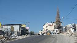
Al-Funduq (Arabic: الفندق) was a Palestinian village in the Qalqilya Governorate in the northeastern West Bank, located east of Qalqilya.[3] According to the Palestinian Central Bureau of Statistics, the village had a population of approximately 659 inhabitants in mid-year 2006.[4]
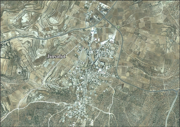
In 2012 it was decided that Jinsafut and Al-Funduq should be merged under one local council.[1]
Location
Al-Funduq and Jinsafut are located 16 kilometers (9.9 mi) east of Qalqiliya. It is bordered by Immatin to the east, Deir Istiya to the south, Wadi Qana (in Salfit Governorate) to the west and Hajja to the north.[1]
History
Ceramics from the Byzantine era have been found here,[5] and it has been suggested that this was the place Fondeka, once inhabited by Samaritans.[6][7]
During the Crusader era the village was the home of Muslims, according to Diya al-Din al-Maqdisi. A Hanbali scholar named Ahmad Ibn Abd al-Daim al Maqaddasi al-Hanbali was born in the village in 575/1180, dying in 668/March 1270 CE.[8][9] Followers of Ibn Qudamah also lived in the village,[10] and during this period Al-Funduq had a well-known Muslim Sheikh named Abd Allah.[11][12]
Ottoman era
The place appeared in 1596 Ottoman tax registers as Funduq, being in the Nahiya of Bani Sa'b of the Liwa of Nablus. It had a population of 86 households, all Muslim. They paid a fixed tax-rate of 33,3 % on agricultural products, including wheat, barley, summer crops, olives, goats and beehives, and a press for olives or grapes, in addition to occasional revenues and a fixed sum for people of the Nablus area; a total of 10,500 akçe.[13]
A map from Napoleon's invasion of 1799 by Pierre Jacotin named it Foundouk, as a village by the road from Jaffa to Nablus.[14]
In 1838, Robinson noted el-Funduk as a village in Beni Sa'ab district, west of Nablus.[15]
In 1870 Victor Guérin noted El-Fondouk from Fara'ata, but did not visit it.[16]
In 1882, the Palestine Exploration Fund's Survey of Western Palestine described the village as "a small poor village by the main road, with wells to the north and two sacred places; it stands on high ground," and located in the Beni Sab district.[7]
British Mandate era
In the 1922 census of Palestine conducted by the British Mandate authorities, Funduq had a population of 66 inhabitants, all Muslims,[17] increasing in the 1931 census to 72 Muslims, with 21 houses.[18]
In the 1945 census El Funduq had a population was 100 Muslims,[19] with 1,619 dunams of land, according to an official land and population survey.[20] Of this, 43 dunams were for plantations or irrigated land, 1,026 for cereals,[21] while 14 dunams were built-up land.[22]
Jordanian era
In the wake of the 1948 Arab–Israeli War, and after the 1949 Armistice Agreements, Al-Funduq came under Jordanian rule.
The Jordanian census of 1961 found 137 inhabitants in Al-Funduq.[23]
1967-present
Since the Six-Day War in 1967, Al-Funduq has been under Israeli occupation. After the 1995 accords, 4.8% of Jinsafut and Al-Funduq land was defined as Area B land, while the remaining 95.2% is Area C.[24]
References
- 1 2 3 Jinsafut Village Profile (including Al Funduq Locality), ARIJ, 2013, p. 4
- ↑ Palmer, 1881, p. 182
- ↑ The Segregation Wall hits more Palestinian lands in Qalqilyia district Archived 2011-05-19 at the Wayback Machine. Land Research Center (LRC) & The Applied Research Institute-Jerusalem (ARIJ). 2004-06-15.
- ↑ Projected Mid -Year Population for Qalqiliya Governorate by Locality 2004- 2006 Archived 2008-02-07 at the Wayback Machine. Palestinian Central Bureau of Statistics (PCBS)
- ↑ Dauphin, 1998, p. 800
- ↑ Neubauer, 1868, p. 172
- 1 2 Conder and Kitchener, 1882, SWP II, p. 164
- ↑ Ellenblum, 2003, p. 244
- ↑ Drory, 1988, pp. 102-103
- ↑ Drory, 1988, p. 97
- ↑ Talmon-Heller, 1994, p. 112
- ↑ Talmon-Heller, 2002, pp. 136-142
- ↑ Hütteroth and Abdulfattah, 1977, p. 139
- ↑ Karmon, 1960, p. 156
- ↑ Robinson and Smith, 1841, vol 3, Appendix 2, p. 127
- ↑ Guérin, 1875, p. 180
- ↑ Barron, 1923, Table IX, Sub-district of Nablus, p. 25
- ↑ Mills, 1932, p. 61
- ↑ Government of Palestine, Department of Statistics, 1945, p. 18
- ↑ Government of Palestine, Department of Statistics. Village Statistics, April, 1945. Quoted in Hadawi, 1970, p. 59
- ↑ Government of Palestine, Department of Statistics. Village Statistics, April, 1945. Quoted in Hadawi, 1970, p. 106
- ↑ Government of Palestine, Department of Statistics. Village Statistics, April, 1945. Quoted in Hadawi, 1970, p. 156
- ↑ Government of Jordan, Department of Statistics, 1964, p. 26
- ↑ Jinsafut Village Profile (including Al Funduq Locality), ARIJ, 2013, p. 17
Bibliography
- Avi-Yonah, M. (1976). Gazetteer of Roman Palestine. QEDEM 5. Institute of Archaeology, Hebrew University of Jerusalem, and CARTA. p. 89. (Avi Yonah, 1976, p. 89)
- Barron, J. B., ed. (1923). Palestine: Report and General Abstracts of the Census of 1922. Government of Palestine.
- Conder, C.R.; Kitchener, H. H. (1882). The Survey of Western Palestine: Memoirs of the Topography, Orography, Hydrography, and Archaeology. 2. London: Committee of the Palestine Exploration Fund.
- Dauphin, Claudine (1998). La Palestine byzantine, Peuplement et Populations. BAR International Series 726 (in French). III : Catalogue. Oxford: Archeopress. ISBN 0-860549-05-4.
- Dorsey, David A. (1987). "Shechem and the Road Network of Central Samaria". Bulletin of the American Schools of Oriental Research (268): 57–70. ("a ruin with Iron II pottery"; citing a 1972 Hebrew source.)
- Drory, Joseph (1988). "Hanbalis of the Nablus Region in the Eleventh and Twelfth Centuries". Asian and African Studies. 22: 93–112.
- Ellenblum, Ronnie (2003). Frankish Rural Settlement in the Latin Kingdom of Jerusalem. Cambridge University Press. ISBN 9780521521871.
- Government of Jordan, Department of Statistics (1964). First Census of Population and Housing. Volume I: Final Tables; General Characteristics of the Population (PDF).
- Government of Palestine, Department of Statistics (1945). Village Statistics, April, 1945.
- Guérin, V. (1875). Description Géographique Historique et Archéologique de la Palestine (in French). 2: Samarie, pt. 2. Paris: L'Imprimerie Nationale.
- Hadawi, S. (1970). Village Statistics of 1945: A Classification of Land and Area ownership in Palestine. Palestine Liberation Organization Research Center.
- Hütteroth, Wolf-Dieter; Abdulfattah, Kamal (1977). Historical Geography of Palestine, Transjordan and Southern Syria in the Late 16th Century. Erlanger Geographische Arbeiten, Sonderband 5. Erlangen, Germany: Vorstand der Fränkischen Geographischen Gesellschaft. ISBN 3-920405-41-2.
- Karmon, Y. (1960). "An Analysis of Jacotin's Map of Palestine" (PDF). Israel Exploration Journal. 10 (3, 4): 155–173, 244–253.
- Kedar, B. Franks, Muslims and Oriental Christians in the Latin Levant. (several mentions)
- Mills, E., ed. (1932). Census of Palestine 1931. Population of Villages, Towns and Administrative Areas. Jerusalem: Government of Palestine.
- Neubauer, A. (1868). La géographie du Talmud : mémoire couronné par l'Académie des inscriptions et belles-lettres (in French). Paris: Lévy.
- Palmer, E. H. (1881). The Survey of Western Palestine: Arabic and English Name Lists Collected During the Survey by Lieutenants Conder and Kitchener, R. E. Transliterated and Explained by E.H. Palmer. Committee of the Palestine Exploration Fund.
- Robinson, E.; Smith, E. (1841). Biblical Researches in Palestine, Mount Sinai and Arabia Petraea: A Journal of Travels in the year 1838. 3. Boston: Crocker & Brewster.
- Talmon-Heller, Daniella (1994). "Popular Hanbalite Islam in 12th-13th Century Jabal Nablus and Jabal Qasyūn". Studia Islamica. 79: 103–120.
- Talmon-Heller, Daniella (2002). Riley-Smith, J., ed. The Cited Tales of the Wondrous Doings of the Shaykhs of the Holy Land. 1. published in Crusades. Aldershot, Hampshire: Published by Ashgate for the Society for the Study of the Crusades and the Latin East. pp. 111–154. ISBN 0754609189.
External links
- Welcome To al-Funduq
- Funduk, Welcome to Palestine
- Survey of Western Palestine, Map 11: IAA, Wikimedia commons
- Jinsafut Village (including Al Funduq Locality) (Fact Sheet), Applied Research Institute–Jerusalem (ARIJ)
- Jinsafut Village Profile (including Al Funduq Locality), ARIJ
- Jinsafut, aerial photo, ARIJ
| Cities |  | |
|---|---|---|
| Municipalities |
| |
| Villages |
| |