Újbuda
| 11th District of Budapest Budapest XI. kerülete Újbuda | |||
|---|---|---|---|
| District of Budapest | |||
| District XI | |||
| |||
 Location of District XI in Budapest (shown in grey) | |||
| Coordinates: 47°28′30″N 19°02′24″E / 47.475°N 19.04°ECoordinates: 47°28′30″N 19°02′24″E / 47.475°N 19.04°E | |||
| Country | Hungary | ||
| Region | Central Hungary | ||
| City | Budapest | ||
| Established | 1 March 1934 | ||
| Quarters[1] |
List
| ||
| Government | |||
| • Mayor | Tamás Hoffmann (Fidesz-KDNP) | ||
| Area[2] | |||
| • Total | 33.49 km2 (12.93 sq mi) | ||
| Area rank | 8th | ||
| Population (2016)[2] | |||
| • Total | 151,812 | ||
| • Rank | 1st | ||
| • Density | 4,533/km2 (11,740/sq mi) | ||
| Demonym(s) | tizenegyedik kerületi (“11th districter”) | ||
| Time zone | UTC+1 (CET) | ||
| • Summer (DST) | UTC+2 (CEST) | ||
| Postal code | 1111 ... 1119 | ||
| Website |
www | ||

Újbuda (lit. New Buda) is the 11th district of Budapest (Hungarian: Budapest XI. kerület), Hungary. It is the most populous district of Budapest with 137,426 inhabitants (2008). Until the 1890s, Újbuda's present territory was a field south of the historical town of Buda. The construction of a new residential area started in the 1900s, the present district was formed in 1930.[3] From 1880 to 1980, Újbuda's population increased from 1,180 to 178,960.[4] There are boulevards, avenues with tram lines, and communist-era housing estates in the district. Line 4 of the Budapest metro passes through Újbuda.
Neighborhoods
- Albertfalva
- Dobogó
- Gazdagrét
- Gellérthegy (partially)
- Hosszúrét
- Infopark
- Kamaraerdő
- Kelenföld
- Kelenvölgy
- Kőérberek
- Lágymányos
- Madárhegy
- Nádorkert
- Őrmező
- Örsöd
- Péterhegy
- Pösingermajor
- Sasad
- Sashegy (partially)
- Szentimreváros
- Spanyolrét
- Tabán (partially)
Population
- Ethnic groups (2001 census)
- Religions (2001 census)
- Roman Catholic - 47.1%
- Calvinist - 12%
- Lutheran - 2.8%
- Greek Catholic - 1.4%
- Jewish - 0.45%
- Other (Christian) - 1%
- Other (non-Christian) - 0.5%
- Atheists - 18%
- No answer, unknown - 16.6%
| Historical population | ||
|---|---|---|
| Year | Pop. | ±% |
| 1870 | 1,149 | — |
| 1880 | 1,180 | +2.7% |
| 1890 | 3,092 | +162.0% |
| 1900 | 7,191 | +132.6% |
| 1910 | 23,457 | +226.2% |
| 1920 | 37,025 | +57.8% |
| 1930 | 52,337 | +41.4% |
| 1941 | 76,668 | +46.5% |
| 1949 | 86,804 | +13.2% |
| 1960 | 109,124 | +25.7% |
| 1970 | 161,437 | +47.9% |
| 1980 | 178,960 | +10.9% |
| 1990 | 174,509 | −2.5% |
| 2001 | 144,441 | −17.2% |
| 2006 | 136,503 | −5.5% |
| 2008 | 137,426 | +0.7% |
International relations
Twin towns – Sister cities
See also
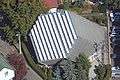
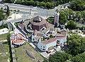
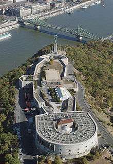
Gallery


References
| Wikimedia Commons has media related to Budapest_District_XI. |
| Wikivoyage has a travel guide for Újbuda. |
- ↑ "94/2012. (XII. 27.) Főv. Kgy. rendelet - a közterület- és városrésznevek megállapításáról, azok jelöléséről, valamint a házszám-megállapítás szabályairól" (in Hungarian).
- 1 2 "A fővárosi kerületek, a megyei jogú városok, a városok területe, lakónépessége és a lakások száma" [The area of districts of the capital, of the towns with county's rights, resident population and number of dwellings]. Magyarország közigazgatási helynévkönyve 2016. január 1 [Gazetteer of Hungary 1st January, 2016] (PDF). Hungarian Central Statistical Office. 2016. p. 21.
- ↑ History of Újbuda (Hungarian)
- ↑ Historical population of Újbuda (Hungarian Central Statistical Office)
- 1 2 3 4 5 6 7 8 9 10 "Újbuda története" [Újbuda - New in History, Twin Towns]. Rafia.hu (in Hungarian). Archived from the original on 2013-05-21. Retrieved 2013-08-11.
- ↑ "МЕЖДУНАРОДНО СЪТРУДНИЧЕСТВО НА ОБЩИНА РУСЕ - Побратимени градове". Община Русе [Municipality Ruse] (in Bulgarian). Archived from the original on 2013-08-05. Retrieved 2013-08-12.
- ↑ "Marosvásárhely" (in Hungarian). Ujbuda.hu. Retrieved 18 November 2011.
External links
|  | |
This article is issued from
Wikipedia.
The text is licensed under Creative Commons - Attribution - Sharealike.
Additional terms may apply for the media files.