Toddington (Bedfordshire)
Toddington is een civil parish in het Engelse graafschap Bedfordshire. De plaats ligt enkele kilometers ten noordwesten van Luton, in het district Central Bedfordshire en telt 4585 inwoners.
 Het groene centrum.
| Bronnen, noten en/of referenties
|
| Zie de categorie Toddington, Bedfordshire van Wikimedia Commons voor mediabestanden over dit onderwerp. |
Geplaatst op: 04-04-2008 |
Dit artikel is een beginnetje over landen & volken. U wordt uitgenodigd om op bewerken te klikken om uw kennis aan dit artikel toe te voegen. |
| Civil parish in Engeland | |||
 | |||
| Situering | |||
| Regio | East of England | ||
| Graafschap | Bedfordshire | ||
| District | Central Bedfordshire | ||
| Coördinaten | 51° 57' NB, 0° 32' WL | ||
| Algemeen | |||
| Oppervlakte | 16,3660 km² | ||
| Inwoners (2011) | 4585 (280 inw./km²) | ||
| Overig | |||
| Postcode(s) | LU5 | ||
| Netnummer(s) | 01525 | ||
| Grid code | TL009289 | ||
| Post town | DUNSTABLE | ||
| ONS-code | E04011996 | ||
| Foto's | |||
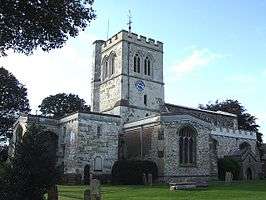 | |||
| Parochiekerk van St. George of England | |||
| |||
This article is issued from
Wikipedia.
The text is licensed under Creative
Commons - Attribution - Sharealike.
Additional terms may apply for the media files.