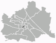
Mariahilf
Mariahilf (![]()
| zesde Weense stadsdistrict | ||
| ||
 | ||
| Coördinaten | 48°11'43"NB, 16°20'59"OL | |
| Oppervlakte | 1,48 km² | |
| Inwoners | 29.590 (1.1.2008)[1] (19.993 inw./km²) | |
| Overig | ||
| Postcode(s) | A-1060 | |
| Overig | Amerlingstraße 11 A-1060 Wien | |
| Website | Mariahilf | |

Bronnen
- Statistik Austria[dode link]
| Districten van Wenen |
|---|
|
1 Innere Stadt · 2 Leopoldstadt · 3 Landstraße · 4 Wieden · 5 Margareten · 6 Mariahilf · 7 Neubau · 8 Josefstadt · 9 Alsergrund · 10 Favoriten · 11 Simmering · 12 Meidling · 13 Hietzing · 14 Penzing · 15 Rudolfsheim-Fünfhaus · 16 Ottakring · 17 Hernals · 18 Währing · 19 Döbling · 20 Brigittenau · 21 Floridsdorf · 22 Donaustadt · 23 Liesing |
| Zie de categorie Mariahilf van Wikimedia Commons voor mediabestanden over dit onderwerp. |
Geplaatst op: 20-08-2006 |
Dit artikel is een beginnetje over landen & volken. U wordt uitgenodigd om op bewerken te klikken om uw kennis aan dit artikel toe te voegen. |
This article is issued from
Wikipedia.
The text is licensed under Creative
Commons - Attribution - Sharealike.
Additional terms may apply for the media files.