City of Durham
Durham was van 1974 tot 1 april 2009 een Engels district in het graafschap Durham en telt 87.709 inwoners. De oppervlakte bedraagt 186,7 km².
| District in Engeland | |||
  | |||
| Situering | |||
| Land | Engeland | ||
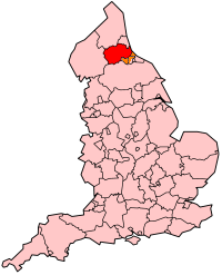
| County | Durham | ||
| Regio | North East England | ||
| Coördinaten | 54°47'NB, 1°35'WL | ||
| Algemeen | |||
| Oppervlakte | 186,7 km² | ||
| Inwoners (2001) | 87.709 (470 inw./km²) | ||
| ONS-code | 20UE | ||
| |||
Van de bevolking is 14,4 % ouder dan 65 jaar. De werkloosheid bedraagt 2,8 % van de beroepsbevolking (cijfers volkstelling 2001).
In 2009 werd de City of Durham opgeheven. Opvolger van de bestuurlijke taken werd het Graafschap Durham.
Plaatsen in district City of Durham
- Bearpark
- Belmont
- Brancepeth
- Brandon and Byshottles
- Cassop-cum-Quarrington
- Coxhoe
- Croxdale and Hett
- Durham (hoofdplaats)
- Framwellgate Moor
- Kelloe
- Pittington
- Pity Me
- Shadforth
- Sherburn
- Shincliffe
- West Rainton
- Witton Gilbert
| Bronnen, noten en/of referenties |
| Plaatsen en entiteiten met de status van stad (city) in het Verenigd Koninkrijk | ||||||||||
|---|---|---|---|---|---|---|---|---|---|---|
| ||||||||||
This article is issued from
Wikipedia.
The text is licensed under Creative
Commons - Attribution - Sharealike.
Additional terms may apply for the media files.