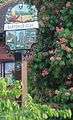
Barton-le-Clay
Barton-le-Clay is een civil parish in het Engelse graafschap Bedfordshire. De plaats ligt in het district Central Bedfordshire en telt 4992 inwoners.
 Barton-le-Clay
| Zie de categorie Barton-le-Clay van Wikimedia Commons voor mediabestanden over dit onderwerp. |
Geplaatst op: 29-03-2008 |
Dit artikel is een beginnetje over landen & volken. U wordt uitgenodigd om op bewerken te klikken om uw kennis aan dit artikel toe te voegen. |
| Civil parish in Engeland | |||
 | |||
| Situering | |||
| Regio | East of England | ||
| Graafschap | Bedfordshire | ||
| District | Central Bedfordshire | ||
| Coördinaten | 51° 58' NB, 0° 25' WL | ||
| Algemeen | |||
| Oppervlakte | 10,6266 km² | ||
| Inwoners (2011) | 4992 (470 inw./km²) | ||
| Overig | |||
| Postcode(s) | MK45 | ||
| Netnummer(s) | 01582 | ||
| Grid code | TL082310 | ||
| Post town | BEDFORD | ||
| ONS-code | E04011929 | ||
| Foto's | |||
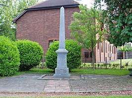 | |||
| Oorlogsmonument | |||
| |||
This article is issued from
Wikipedia.
The text is licensed under Creative
Commons - Attribution - Sharealike.
Additional terms may apply for the media files.