South London
South London is the southern part of London, England. Situated south of the River Thames, it consists of the boroughs of Bexley, Bromley, Croydon, Greenwich, Kingston, Lambeth, Lewisham, Merton, Richmond (in part), Southwark, Sutton and Wandsworth.
South London | |
|---|---|
London, south of the Thames | |
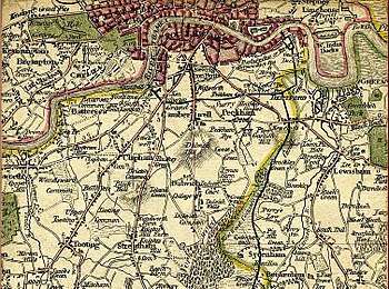
 South London's emergence was a result of the existence and location of London Bridge | |
| Coordinates: 51.45°N 0.1°W | |
| Sovereign state | United Kingdom |
| Country | England |
| Region | London |
| Comprises | Bexley, Bromley, Croydon, Greenwich, Kingston, Lambeth, Lewisham, Merton, Richmond (part), Southwark, Sutton and Wandsworth |
| Area | |
| • Total | 249.34 sq mi (645.78 km2) |
| Population | |
| • Total | 2,835,200 |
| • Density | 11,000/sq mi (4,400/km2) |
South London originally emerged from Southwark,[1] first recorded as Suthriganaweorc,[2][3][3] meaning ‘fort of the men of Surrey’.[2][3] From Southwark, London then extended further down into northern Surrey and then western Kent.
_-_Copy.jpg)
South London consists of 11 whole boroughs and part of the cross-river borough of Richmond Upon Thames.
Emergence and growth
South London began at Southwark at the southern end of London Bridge, the first permanent crossing over the river, with early development of the area being a direct result of the existence and location of the bridge.
Southwark was first known as Suthriganaweorc, the fortress of the men of Surrey, mentioned in the Burghal Hidage as part of military system created by Alfred the Great to defeat the Great Heathen Army of the Vikings. Southwark was also known as the Borough due to be it being an incorporated (nationally represented) Borough from 1295. From 1550 to 1899 it was administered as part of the City of London and referred to as the ward of Bridge Without.
In 1720, John Strype's ‘Survey of London’ described Southwark as one of the then four distinct areas of London; in it he describes the City of London, Westminster (West London), Southwark (South London), and 'That Part beyond the Tower' (East London). The area now usually referred to as North London developed later. As late as the mid 18th century, however, there were no other bridges crossing the river and as a result urban growth was considerably slower in the south than in areas north of the Thames.
The opening of Westminster Bridge and other subsequent bridges to the west encouraged growth in the south-west, but only Tower Bridge was built to the east of London Bridge, so south-east London grew more slowly, at least until the Surrey Commercial Docks were built.
The development of a dense network of railway lines in the mid nineteenth century significantly accelerated growth.
Transport
A significant feature of south London's economic geography is that while there are more than thirty bridges linking the area with West London and the City, there is only one, Tower Bridge, linking the area with East London.
Very little of London's underground rail network lies south of the river, largely due to the challenging geology,[4] however 21st century technology makes tunnelling much cheaper than before (though stations are still expensive) and this may well lead to an improved underground provision in south London with the Crossrail 2 line proposed alongside extensions to the Northern and Bakerloo Lines.
South London contains a very extensive overground rail network [5] and all of London's trams operate within the area.
List of boroughs
%2C_Greater_London_03.jpg)
The 12 boroughs included, in whole or part are:
| London borough | Postcode areas | 2008 sub-region | London Assembly[6] | |
|---|---|---|---|---|
| Bexley | DA, SE | South East | Bexley and Bromley | |
| Bromley | BR, DA, SE, TN, CR | South East | Bexley and Bromley | |
| Croydon | CR, SE, SW, BR | South West | Croydon and Sutton | |
| Greenwich | SE, DA, BR | South East | Greenwich and Lewisham | |
| Kingston | KT, SW, TW | South West | South West | |
| Lambeth | SE, SW | South East | Lambeth and Southwark | |
| Lewisham | SE, BR | South East | Greenwich and Lewisham | |
| Merton | CR, KT, SM, SW | South West | Merton and Wandsworth | |
| Richmond (part) | SW, TW | South West | South West | |
| Southwark | SE | South East | Lambeth and Southwark | |
| Sutton | CR, KT, SM | South West | Croydon and Sutton | |
| Wandsworth | SW | South West | Merton and Wandsworth |
Formal use
The term ‘south London' has been used for a variety of formal purposes with the boundaries defined according to the purposes of the designation.
Constituency review, 2017
In 2017 the government asked the Boundary Commission for England to reconsider the boundaries of parliamentary constituencies. The Commission's study, was to start with existing regions of England and then group the local authorities within that area into sub-regions for further sub-division. The South London sub-region included the 11 boroughs which lay south of the river, plus the parts of cross-river Richmond upon Thames that did so.[7]
An earlier 2013 study, whose recommendations were not adopted, took a different approach by including all of Richmond in its South London sub-region.[8]
Sub-region policy
For the purposes of progress reporting on the London Plan, there was a south London sub-region in operation from 2004 to 2008 consisting of Bromley, Croydon, Kingston, Merton, Richmond and Sutton.[9] In 2001 this area had a population of 1,329,000.[10] This definition is used by organisations such as Connexions.[11]
Between 2008 and 2011 it was replaced with a South East sub-region consisting of Southwark, Lewisham, Greenwich, Bexley and Bromley and a South West sub-region consisting of Croydon, Kingston, Lambeth, Merton, Sutton, Richmond and Wandsworth.[12]
In 2011 a new south London region was created consisting of Bromley, Croydon, the Royal Borough of Kingston upon Thames, Richmond upon Thames, Merton, Sutton, Wandsworth, Bexley, Greenwich and Lewisham.
Climate
South London is, like other parts of London and the UK in general, a temperate maritime climate according to the Köppen climate classification system. Three Met Office weather stations currently collect climate data south of the river; Kew, Hampton and Kenley Airfield, on the southern edge of the urban area.[13] Long term climate observations dating back to 1763[14] are available for Greenwich, although observations ceased here in 2003.
Temperatures increase towards the Thames, firstly because of the urban warming effect of the surrounding area, but secondly due to altitude decreasing towards the river, meaning the southern margins of south London are often a couple of degrees cooler than those areas adjacent to the Thames. Often snow can be seen to lie on the North Downs near Croydon when central London is snow free.
The record high temperature at Greenwich is 37.5 °C (99.5 °F) recorded during August 2003.[15] Sunshine is notably lower than other London area weather stations (by about 50–100 hours a year), suggesting Greenwich may be a fog trap in winter, and that the hillier land to the south may obscure early morning and late evening sunshine.
The highest temperature recorded across south London was 38.1 °C (100.6 °F) on the same occasion at Kew Gardens. Although the Met Office accepts a higher reading from Brogdale in Kent, many have questioned the accuracy of this[16] and regard the Kew reading as the most reliable highest UK temperature reading.
| Climate data for Greenwich 7m asl 1971–2000, | |||||||||||||
|---|---|---|---|---|---|---|---|---|---|---|---|---|---|
| Month | Jan | Feb | Mar | Apr | May | Jun | Jul | Aug | Sep | Oct | Nov | Dec | Year |
| Average high °C (°F) | 7.9 (46.2) |
8.2 (46.8) |
10.9 (51.6) |
13.3 (55.9) |
17.2 (63.0) |
20.2 (68.4) |
22.8 (73.0) |
22.6 (72.7) |
19.3 (66.7) |
15.2 (59.4) |
10.9 (51.6) |
8.8 (47.8) |
14.8 (58.6) |
| Average low °C (°F) | 2.4 (36.3) |
2.2 (36.0) |
3.8 (38.8) |
5.2 (41.4) |
8.0 (46.4) |
11.1 (52.0) |
13.6 (56.5) |
13.3 (55.9) |
10.9 (51.6) |
8.0 (46.4) |
4.8 (40.6) |
3.3 (37.9) |
7.2 (45.0) |
| Average precipitation mm (inches) | 51.9 (2.04) |
34.0 (1.34) |
42.0 (1.65) |
45.2 (1.78) |
47.2 (1.86) |
53.0 (2.09) |
38.3 (1.51) |
47.3 (1.86) |
56.9 (2.24) |
61.5 (2.42) |
52.3 (2.06) |
54.0 (2.13) |
583.6 (22.98) |
| Mean monthly sunshine hours | 45.9 | 66.1 | 103.2 | 147.0 | 185.4 | 180.6 | 190.3 | 194.4 | 139.2 | 109.7 | 60.6 | 37.8 | 1,461 |
| Source: MetOffice[17] | |||||||||||||
Associated organisations
- South London Gallery
- South London Botanical Institute
- South London Press
- South London Radio
- South London Storm
- South London Theatre
See also
- Central London
- East London
- Inner London
- North London
- Outer London
- West London
- South Bank
References
- John Strype, Survey of London, 1720
- Mills, D. (2000). Oxford Dictionary of London Place Names. Oxford.
- David J. Johnson. Southwark and the City. Oxford University Press, 1969. p. 7. ISBN 978-0-19-711630-2
- Wolmar, Christian (2004). The Subterranean Railway: How the London Underground Was Built and How It Changed the City Forever. Atlantic Books. ISBN 978-1-84354-023-6.
- Wolmar, Christian (2004). The Subterranean Railway: How the London Underground Was Built and How It Changed the City Forever. Atlantic Books. ISBN 978-1-84354-023-6.
- London Assembly – London Assembly Constituency Information Archived 17 January 2008 at the Wayback Machine. Retrieved on 22 February 2008.
- Boundary Commission review 2017–18, see page 62 and elsewhere https://boundarycommissionforengland.independent.gov.uk/wp-content/uploads/2018/09/Final-recommendations-report.pdf
- Boundary Commission for England, London – London 2011 amendment
- Greater London Authority, The London Plan: Sub-Regional Development Framework – South London Archived 9 April 2008 at the Wayback Machine
- Greater London Authority, The London Plan: The Sub Regions Archived 27 February 2008 at the Wayback Machine
- Connexions – South London
- Greater London Authority – Draft Further Alterations to the London Plan Archived 13 July 2009 at the Wayback Machine
- "Station Locations". MetOffice. Archived from the original on 6 October 2012.
- "Greenwich Long term data". MetOffice. Archived from the original on 8 July 2012.
- "Greenwich 2003 Maximum". MetOffice. Archived from the original on 19 August 2003.
- Burt, Stephen; Eden, Philip (2004). "August 2003". Weather. 59 (9): 239–246. doi:10.1256/wea.10.04B.
- "Greenwich 1971–2000". Met Office. Archived from the original on 29 December 2010. Retrieved 23 September 2011.
External links
| Wikivoyage has a travel guide for South London. |
- Time Out editors (1 May 2009). "North London v South London – The debate". Time Out London.
- Alan Rutter and Peter Watts (13 December 2005). "North London v South London – The debate". Time Out London.