Metropolitan line
The Metropolitan line, colloquially known as the Met, is a London Underground line between Aldgate in the City of London and Amersham and Chesham in Buckinghamshire, with branches to Watford in Hertfordshire and Uxbridge in Hillingdon. Coloured magenta on the tube map, the line is 41.4 miles (66.7 km) in length and serves 34 stations. Unlike the deep-tube railways, its tunnels are just below the surface ("cut and cover") and the loading gauge is of a similar size to those on main lines. Just under 67 million passenger journeys were made on the line in 2011/12.
| Metropolitan line | |||||||||||||||||||||
|---|---|---|---|---|---|---|---|---|---|---|---|---|---|---|---|---|---|---|---|---|---|
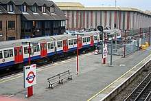
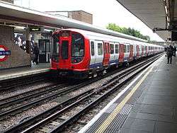 Metropolitan line train at Harrow-on-the-Hill | |||||||||||||||||||||
| Overview | |||||||||||||||||||||
| Type | Rapid transit | ||||||||||||||||||||
| System | London Underground | ||||||||||||||||||||
| Stations | 34 | ||||||||||||||||||||
| Ridership | 66.8 million (2011/12)[1] passenger journeys | ||||||||||||||||||||
| Colour on map | Magenta | ||||||||||||||||||||
| Website | http://tfl.gov.uk | ||||||||||||||||||||
| Operation | |||||||||||||||||||||
| Opened | 10 January 1863 | ||||||||||||||||||||
| Character | Sub-surface | ||||||||||||||||||||
| Depot(s) | Neasden | ||||||||||||||||||||
| Rolling stock | S8 Stock | ||||||||||||||||||||
| Technical | |||||||||||||||||||||
| Line length | 67 km (42 mi) | ||||||||||||||||||||
| Number of tracks | Mainly 2 | ||||||||||||||||||||
| Track gauge | 4 ft 8 1⁄2 in (1,435 mm) standard gauge | ||||||||||||||||||||
| Electrification | 630V DC fourth rail | ||||||||||||||||||||
| Operating speed | 62 mph (100 km/h) maximum | ||||||||||||||||||||
| |||||||||||||||||||||
The line is one of just two Underground lines to cross the Greater London boundary (the other being the Central line). It is the only Underground line with an express service at peak times; the resulting longer distance between stations means trains can achieve the system's highest speeds of over 60 miles per hour (100 km/h) on some sections.
In 1863 the Metropolitan Railway began the world's first underground railway between Paddington and Farringdon with wooden carriages and steam locomotives, but its most important route became the line north into the Middlesex countryside, where it stimulated the development of new suburbs. Harrow was reached in 1880, and ultimately the line continued as far as Verney Junction in Buckinghamshire, more than 50 miles (80 km) from Baker Street. From the end of the 19th century, the railway shared tracks with the Great Central Railway out of Marylebone. The central London lines were electrified by 1907 but electric locomotives were exchanged for steam locomotives on trains heading north of Harrow. After the railway was absorbed by the London Passenger Transport Board in 1933 the line was cut back to Aylesbury. Steam trains ran until 1961, when the line was electrified to and services were curtailed at Amersham. The Hammersmith & City line was shown on the tube map as a part of the Metropolitan line until 1990, when it appeared as a separate line. The current S8 Stock trains entered service between 2010 and 2012.
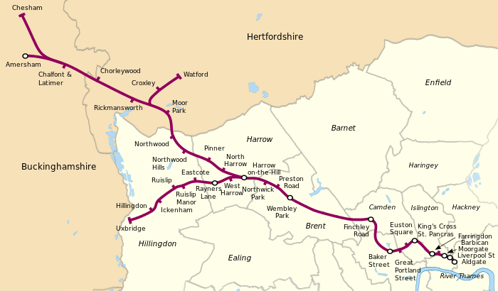
The section between Aldgate and Baker Street is shared with the Circle and Hammersmith & City sub-surface lines; between Rayners Lane and Uxbridge with the Piccadilly line; and between Harrow-on-the-Hill and Amersham with the Chiltern Railways London to Aylesbury Line. The track is mostly below ground between Aldgate and Finchley Road, except at Barbican and Farringdon stations, as well as the Baker Street platforms. Baker Street is the southbound terminus for some trains not continuing to Aldgate. Most of the route has two tracks, except for the single-track Chesham branch and a four-track section between Wembley Park and Moor Park that allows fast and semi-fast services to overtake "all stations" trains. There are four tracks between Wembley Park and Finchley Road, but only the outer ones are used by the Metropolitan line's non-stop trains: the inner pair was transferred to the Bakerloo line in 1939 (becoming the Jubilee line in 1979) with services calling at all stations. The disused Metropolitan line platforms at Willesden Green and Neasden are still in place despite Metropolitan line services having been withdrawn in 1940.
There is a long-term aim to divert the two-station Watford branch to Watford Junction, resulting in the closure of Watford station and the opening of two new stations. This project would provide a link with the London Overground Watford DC Line and provide an interchange with the West Coast Main Line. Previously announced for completion by 2020, the future of the project is now uncertain, due to a funding shortfall.[2]
History
Metropolitan Railway
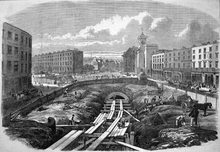
The Metropolitan Railway, also known as the Met, was a passenger and goods railway that served London from 1863 to 1933, its main line heading north-west from the City to what were to become the Middlesex suburbs. Its first line connected the mainline railway termini at Paddington, Euston and King's Cross to the City, built beneath the New Road using the cut-and-cover method between Paddington and King's Cross, and in tunnel and cuttings beside Farringdon Road from King's Cross to near Smithfield. The world's first underground railway, it opened on 10 January 1863 with gas-lit wooden carriages hauled by steam locomotives. The line operated at a frequency of three trains per hour, rising to four trains per hour during the peak periods.[3][4][5] In the 1871 plans for an underground railway in Paris, it was called the Métropolitain.[6]
The railway was soon extended from both ends and northwards via a branch from Baker Street. It reached Hammersmith in 1864 and Richmond in 1877; it completed the Inner Circle in 1884,[7] but the most important route became the line west and north-west into the Middlesex countryside, where it stimulated the development of new suburbs. Harrow was reached in 1880, and ultimately, as far as Verney Junction in Buckinghamshire, more than 50 miles (80 kilometres) from Baker Street. From the end of the 19th century, the railway shared tracks with the Great Central Railway route out of Marylebone.[8]
Electric traction was introduced in 1905 with electric multiple units operating between Uxbridge, Harrow-on-the-Hill and Baker Street. To remove steam and smoke from the tunnels in central London, the railway purchased electric locomotives, exchanged for steam locomotives at Harrow from 1908.[9] In 1910, a seventeen-minute silent film recording was made showing large portions of the journey from Baker Street to Aylesbury and Uxbridge, seen from the cab of a train. The film survives and is publicly available.[10]
Unlike other railways in the London area, the Met developed land for housing, thus benefitting from the increase in the value of its land caused by the building of the railway. After World War I it promoted its housing estates near the railway with the "Metro-land" brand.
To improve services, more powerful electric and steam locomotives were purchased in the 1920s. A short branch opened from Rickmansworth to Watford in 1925. After World War I, the 4-mile (6.4 km) Stanmore branch was built from Wembley Park.[11]
London Transport
On 1 July 1933 the Metropolitan was amalgamated with other Underground railways, tramway companies and bus operators to form the London Passenger Transport Board, and a period of rationalisation followed. While the Metropolitan was run as an outer suburban route with steam-hauled trains and goods services, the LPTB wished to focus on electrified trains and suburban traffic. Goods services were passed to the London and North Eastern Railway, which also took over the role of providing steam locomotives for trains beyond the end of electrification at Rickmansworth. All services north-west of Aylesbury were withdrawn by 1936[12] though services returned to Quainton Road between 1943 and 1948.[13]
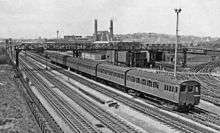
The 1930s was a period of rapid growth for the north-western suburbs of London, and LPTB developed ambitious plans to simplify the Metropolitan line and expand capacity. Several stations on the Uxbridge branch were rebuilt, replacing temporary wooden buildings with modernist designs and giving Uxbridge station a new site in the town centre. A major bottleneck in the line, the double-track tunnel from Baker Street to Finchley Road, was bypassed by boring two tube tunnels underneath the Metropolitan tunnels, transferring slow services and the Stanmore branch to the Bakerloo line.[14] (This route was transferred to the Jubilee line in 1979.)[15] In 1936 the line was extended east from Whitechapel to Barking along the tracks of the District line.[16] London Transport inherited a number of incompatible electric multiple units from the railway, including the 1927–33 multiple-unit compartment stock used on routes to Watford and Rickmansworth, and these were refurbished to form a uniform fleet and designated London Underground T Stock.[17] In the 1950s, F Stock trains, with sliding doors under the control of the guard, were transferred from the District line; these mainly worked the semi-fast Harrow and Uxbridge services.[18]
A major rebuilding of the main line from Wembley Park to Amersham was planned in the 1930s but delayed by the war. The line from Wembley to Harrow was rebuilt immediately after the war and the project was completed from 1956–1962, on a more modest scale than originally planned. Until 1961, passenger trains continued to be attached to a steam locomotive at Rickmansworth to run to Aylesbury. The rebuilding electrified the line from Rickmansworth to Amersham, transferring all Aylesbury services to British Railways. A pair of fast lines was added from Harrow to north of Moor Park by 1962, allowing outer-suburban trains to run fast to Moor Park.[19] Aluminium A stock, originally unpainted, replaced the T stock and locomotive-hauled trains. More A Stock trains were built in 1962–63 to replace the trains on the Uxbridge service, giving the main line a single train type for all services. A Stock was 4-car units that could operate as four- or eight-car trains;[20] normally operated as eight cars, a 4-car unit operated the Chesham shuttle.[21] One person operation of the trains was proposed in 1972, but due to conflict with the trades unions was not introduced on the line until 1986.[22]
A separate identity
Although the East London line had been an isolated shuttle since 1939,[16] it was shown on London Underground maps as part of the Metropolitan line until 1968.[23] In 1970 it was shown with a thin white line in the middle and labelled the "East London section".[24] By the 1985 map it had become the "East London Line", remaining the same colour as the Metropolitan line with a white line in the middle,[25] changed to orange by the 1990 map.[26] In 1990 the Hammersmith & City line became a separate line from Hammersmith to Whitechapel (Barking during the peak), the Metropolitan line being from Aldgate to Baker Street and northwards to Amersham with branches to Chesham, Uxbridge and Watford.[16][26]
In 2003, the infrastructure was partly privatised in a public–private partnership managed by the Metronet consortium. Metronet went into administration in 2007 and Transport for London took over responsibilities.[27]
On 12 December 2010 the service to Amersham was reduced from four trains per hour to two, and a direct service between Chesham and central London was introduced, replacing the 4-car Chesham to Chalfont & Latimer shuttle.[28] The final passenger services operated by the A Stock ran on 26 September 2012,[29] followed by a ticketed public railtour on 29 September.[30]
Route
Metropolitan line | |||||||||||||||||||||||||||||||||||||||||||||||||||||||||||||||||||||||||||||||||||||||||||||||||||||||||||||||||||||||||||||||||||||||||||||||||||||||||||||||||||||||||||||||||||||||||||||||||||||||||||||||||||||||||||||||||||||||||||||||||||||||||||||||||||||||||||||||||||||||||||||||||||||||||||||||||||||||||||||||||||||||||||||||||||||||||||||||||||||||||||||||||||||||||||||||||||||||||||||||||||||||||||||||||||||||||||||||||||||||||||||||||||||||||||||||||||||||||||||||||||||||||||||||||||||||||||||||||||||||||||||||||||||||||||||||||||||||||||||||||||||||||||||||||||||||||||||||||||||||||||||||||||||||||||||||||||||||||||||||||||||||||||||||||||||||||||||||||||||||||||||||||||||||||||||||||||||||||||||||||||||||||||||||||||||||||||||||||||||||||||||||||||||||||||||||||||||||||||||||||||||||||||||||||||||||||||||||||||||||||||||||||||||||||||||||||||||||||||||||||||||||||||||||||||||||||||||||||||||||||||||||||||||||||||||||||||
|---|---|---|---|---|---|---|---|---|---|---|---|---|---|---|---|---|---|---|---|---|---|---|---|---|---|---|---|---|---|---|---|---|---|---|---|---|---|---|---|---|---|---|---|---|---|---|---|---|---|---|---|---|---|---|---|---|---|---|---|---|---|---|---|---|---|---|---|---|---|---|---|---|---|---|---|---|---|---|---|---|---|---|---|---|---|---|---|---|---|---|---|---|---|---|---|---|---|---|---|---|---|---|---|---|---|---|---|---|---|---|---|---|---|---|---|---|---|---|---|---|---|---|---|---|---|---|---|---|---|---|---|---|---|---|---|---|---|---|---|---|---|---|---|---|---|---|---|---|---|---|---|---|---|---|---|---|---|---|---|---|---|---|---|---|---|---|---|---|---|---|---|---|---|---|---|---|---|---|---|---|---|---|---|---|---|---|---|---|---|---|---|---|---|---|---|---|---|---|---|---|---|---|---|---|---|---|---|---|---|---|---|---|---|---|---|---|---|---|---|---|---|---|---|---|---|---|---|---|---|---|---|---|---|---|---|---|---|---|---|---|---|---|---|---|---|---|---|---|---|---|---|---|---|---|---|---|---|---|---|---|---|---|---|---|---|---|---|---|---|---|---|---|---|---|---|---|---|---|---|---|---|---|---|---|---|---|---|---|---|---|---|---|---|---|---|---|---|---|---|---|---|---|---|---|---|---|---|---|---|---|---|---|---|---|---|---|---|---|---|---|---|---|---|---|---|---|---|---|---|---|---|---|---|---|---|---|---|---|---|---|---|---|---|---|---|---|---|---|---|---|---|---|---|---|---|---|---|---|---|---|---|---|---|---|---|---|---|---|---|---|---|---|---|---|---|---|---|---|---|---|---|---|---|---|---|---|---|---|---|---|---|---|---|---|---|---|---|---|---|---|---|---|---|---|---|---|---|---|---|---|---|---|---|---|---|---|---|---|---|---|---|---|---|---|---|---|---|---|---|---|---|---|---|---|---|---|---|---|---|---|---|---|---|---|---|---|---|---|---|---|---|---|---|---|---|---|---|---|---|---|---|---|---|---|---|---|---|---|---|---|---|---|---|---|---|---|---|---|---|---|---|---|---|---|---|---|---|---|---|---|---|---|---|---|---|---|---|---|---|---|---|---|---|---|---|---|---|---|---|---|---|---|---|---|---|---|---|---|---|---|---|---|---|---|---|---|---|---|---|---|---|---|---|---|---|---|---|---|---|---|---|---|---|---|---|---|---|---|---|---|---|---|---|---|---|---|---|---|---|---|---|---|---|---|---|---|---|---|---|---|---|---|---|---|---|---|---|---|---|---|---|---|---|---|---|---|---|---|---|---|---|---|---|---|---|---|---|---|---|---|---|---|---|---|---|---|---|---|---|---|---|---|---|---|---|---|---|---|---|---|---|---|---|---|---|---|---|---|---|---|---|---|---|---|---|---|---|---|---|---|---|---|---|---|---|---|---|---|---|---|---|---|---|---|---|---|---|---|---|---|---|---|---|---|---|---|---|---|---|---|---|---|---|---|---|---|---|---|---|---|---|---|---|---|---|---|---|---|---|---|---|---|---|---|---|---|---|---|---|---|---|---|---|---|---|---|---|---|---|---|---|---|---|---|---|---|---|---|---|---|---|---|---|---|---|---|---|---|---|---|---|---|---|---|---|---|---|---|---|---|---|---|---|---|---|---|---|---|---|---|---|---|---|---|---|---|---|---|---|---|---|---|---|---|---|---|---|---|---|---|---|---|---|---|---|---|---|---|---|---|---|---|---|---|---|---|---|---|---|---|---|---|---|---|---|---|---|---|---|---|---|---|---|---|---|---|---|---|---|---|---|---|---|---|---|---|---|---|---|---|---|---|---|---|---|---|---|---|---|---|---|---|---|---|---|---|---|---|---|---|---|---|---|---|---|---|---|---|---|---|---|---|---|---|---|---|---|---|---|---|---|---|---|---|---|---|---|---|---|---|---|---|---|---|---|---|---|---|---|---|---|---|---|---|---|---|---|---|---|---|---|---|---|---|---|---|---|---|---|---|---|---|---|---|---|---|---|---|---|---|---|---|---|---|---|---|---|---|---|---|---|---|---|---|---|---|---|---|---|---|---|---|---|---|---|---|---|---|---|---|---|---|---|---|---|---|---|
Dates relate to Metropolitan Railway operations | |||||||||||||||||||||||||||||||||||||||||||||||||||||||||||||||||||||||||||||||||||||||||||||||||||||||||||||||||||||||||||||||||||||||||||||||||||||||||||||||||||||||||||||||||||||||||||||||||||||||||||||||||||||||||||||||||||||||||||||||||||||||||||||||||||||||||||||||||||||||||||||||||||||||||||||||||||||||||||||||||||||||||||||||||||||||||||||||||||||||||||||||||||||||||||||||||||||||||||||||||||||||||||||||||||||||||||||||||||||||||||||||||||||||||||||||||||||||||||||||||||||||||||||||||||||||||||||||||||||||||||||||||||||||||||||||||||||||||||||||||||||||||||||||||||||||||||||||||||||||||||||||||||||||||||||||||||||||||||||||||||||||||||||||||||||||||||||||||||||||||||||||||||||||||||||||||||||||||||||||||||||||||||||||||||||||||||||||||||||||||||||||||||||||||||||||||||||||||||||||||||||||||||||||||||||||||||||||||||||||||||||||||||||||||||||||||||||||||||||||||||||||||||||||||||||||||||||||||||||||||||||||||||||||||||||||||||
| |||||||||||||||||||||||||||||||||||||||||||||||||||||||||||||||||||||||||||||||||||||||||||||||||||||||||||||||||||||||||||||||||||||||||||||||||||||||||||||||||||||||||||||||||||||||||||||||||||||||||||||||||||||||||||||||||||||||||||||||||||||||||||||||||||||||||||||||||||||||||||||||||||||||||||||||||||||||||||||||||||||||||||||||||||||||||||||||||||||||||||||||||||||||||||||||||||||||||||||||||||||||||||||||||||||||||||||||||||||||||||||||||||||||||||||||||||||||||||||||||||||||||||||||||||||||||||||||||||||||||||||||||||||||||||||||||||||||||||||||||||||||||||||||||||||||||||||||||||||||||||||||||||||||||||||||||||||||||||||||||||||||||||||||||||||||||||||||||||||||||||||||||||||||||||||||||||||||||||||||||||||||||||||||||||||||||||||||||||||||||||||||||||||||||||||||||||||||||||||||||||||||||||||||||||||||||||||||||||||||||||||||||||||||||||||||||||||||||||||||||||||||||||||||||||||||||||||||||||||||||||||||||||||||||||||||||||
The Metropolitan line is 42 miles (67 km) long and serves 34 stations.[31] It is electrified with a four-rail DC system: a central conductor rail is energised at –210 V and a rail outside the running rail at +420 V, giving a potential difference of 630 V.[32] The first 6 miles (9.7 km) from Aldgate are below ground,[33] shared with the Circle and Hammersmith & City lines to Baker Street, where the line diverges, remaining in tunnel until Finchley Road.[34] Metropolitan line trains then run express from Finchley Road to Wembley Park, with the Jubilee line serving the intermediate stations. At Wembley Park the Jubilee line diverges to the Stanmore branch at a grade-separated junction. From just after Finchley Road these four tracks run parallel with the Network Rail Chiltern Main Line from Marylebone.[34]
Between Wembley Park and Harrow-on-the-Hill the Metropolitan is four-track, with fast and slow lines paired by direction, paralleling the two-track un-electrified Chiltern Main Line. The slow lines are between the fast lines, and the two intermediate stations have island platforms.[34] Harrow-on-the-Hill has platforms on all six lines.[34] The central slow lines diverge here at a grade-separated junction to become the 7.5 miles (12.1 km) Uxbridge branch. After West Harrow, at Rayners Lane the line is joined by the Piccadilly line, which shares the tracks to Uxbridge; a turnback siding allows some Piccadilly line services to terminate at Rayners Lane.[34][35]
On the main line between Harrow-on-the-Hill and Moor Park, the line is four-track, paired by use. The western fast tracks are shared with Chiltern line services from Marylebone; the eastern slow tracks have platforms at the intermediate stations. There is access at Watford triangle to the Watford branch.[34] This double-track branch has stations at Croxley and Watford,[34] but the line is expected to be rerouted to Watford Junction via Watford High Street once the Croxley Rail Link opens.[36] From the Watford triangle to Amersham the line has two tracks. At Chalfont & Latimer the 3.89 miles (6.26 km) single-track Chesham branch diverges, running parallel to the main line for a distance.[31][34] The Metropolitan line ends at Amersham, where there are turnback sidings just beyond the platforms. The route continues to Aylesbury with Chiltern Railways trains only.[37]
The fast (non stopping) lines between Wembley Park and Harrow on the Hill are signalled with LUL signalling, but using four-aspect Network Rail signal heads.[38] The upper two lights are a two-aspect stop signal displaying either a green or red aspect, the lower two lights a repeater signal for the next stop signal ahead showing a green or yellow aspect, or no aspect when the stop signal shows a red aspect. Thus they are effectively four-light three-aspect signals with green/red/green/yellow lights from the top, danger being a single red light, caution the top green light over a yellow light, and clear two green lights.[38]
The Metropolitan line's suburban rail character opposed to other London Underground lines is also shown by the long distances between stops. Eight of the top 10 furthest apart stations on the Underground are on the Metropolitan line. The section between Chalfont & Latimer and Chesham is the longest at 3.9 miles (6.3 km),[39] whilst the Finchley Road to Wembley Park section is the second longest, and Rickmansworth to Chorleywood the fourth longest overall.
Services
The Metropolitan line is the only London Underground line to operate non-stop services through some of its stations, although since 2011 these only run on weekdays during peak times (southbound in the morning peak, northbound in the evening peak).[40] Depending on the stopping pattern, services are advertised as either all-stations, semi-fast or fast on platform information boards and on-train announcements. The stopping pattern of each type of service is as follows:
- All-stations services, as the name suggests, call at every station en route;[40]
- Semi-fast services run non-stop between Wembley Park and Harrow-on-the-Hill, and call at all other stations en route;[40]
- Fast services run non-stop between Wembley Park and Harrow-on-the-Hill and between Harrow-on-the-Hill and Moor Park, but call at all other stations;[40]
- In the southbound direction, fast and semi-fast trains also do not call at Wembley Park, thus running non-stop from Harrow-on-the-Hill to Finchley Road.[40]
Owing to the track layout, fast services can only run to/from Amersham or Chesham. The Uxbridge branch diverges from the rest of the line before the "fast" section, while the Watford branch is not directly connected with the fast line at Moor Park.[41]
No Metropolitan line trains (including all-stations services) call at any intermediate stations between Finchley Road and Wembley Park – these stations are only served by the Jubilee line, which runs parallel to the Metropolitan line along this section.[40]
Frequency
During the off-peak the service pattern on the line, in trains per hour (tph), is as follows:[40]
- 8tph Aldgate - Uxbridge (all-stations);
- 4tph Baker Street - Watford (all stations);
- 2tph Aldgate - Amersham (all stations);
- 2tph Aldgate - Chesham (all stations).
These services combine to give a total frequency of 16tph between Baker Street and Wembley Park. Of these, 12tph run between Aldgate and Baker Street which, together with the 6tph frequencies on both the Circle and Hammersmith & City lines,[42] gives a total of 24 trains every hour on the central-London section between Liverpool Street and Baker Street.
In the morning peak, the southbound service pattern is strengthened to the following:[40]
- 4tph Uxbridge - Baker Street (all stations);
- 6tph Uxbridge - Aldgate (4 all stations, 2 semi-fast);
- 6tph Watford - Baker Street (3 all stations, 3 semi-fast);
- 2tph Watford - Aldgate (1 all stations, 1 semi-fast);
- 4tph Amersham - Aldgate (2 semi-fast, 2 fast)
- 2tph Chesham - Aldgate (fast).
The northbound frequencies in the morning peak are similar on each route, except all trains run as all-stations services.
Similarly, in the evening peak, the northbound service pattern is strengthened to the following:[40]
- 3tph Baker Street - Uxbridge (all stations);
- 7tph Aldgate - Uxbridge (all stations);
- 4tph Baker Street - Watford (2 all stations, 2 semi-fast)
- 4tph Aldgate - Watford (semi-fast);
- 2tph Baker Street - Amersham (semi-fast);
- 2tph Aldgate - Amersham (fast);
- 2tph Aldgate - Chesham (fast).
The southbound frequencies in the evening peak are similar on each route, except all trains run as all-stations services.
Rolling stock
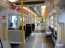
Since 26 September 2012 all services have been provided by eight-car S Stock trains[43] introduced in July 2010 to replace the 1960s A Stock.[44] Part of Bombardier's Movia family, they have air-conditioning, feasible because the sub-surface tunnels, unlike tube tunnels, are able to disperse the exhausted hot air.[45][46] They have regenerative brakes, returning around 20% of their energy to the network and thus reducing energy consumption.[47] With fewer seats than the older A Stock – 306 compared with 448 – they can accommodate 697 standing passengers, compared with 597 in A Stock,[note 1] and have dedicated space for wheelchairs.[48] They have a top speed of 62 miles per hour (100 km/h),[45] being the only London Underground stock to travel at that speed, doing so on the long-distance sections north of Finchley Road.
There are 58 S8 Stock trains in operation, as well as one eight-car S7 Stock also called 'S7+1' – which retains the all-longitudinal seating of the normal seven-car S7 Stock that is operated on London Underground's other sub-surface lines.
It is planned to increase the traction voltage from the present nominal 630 V to 750 V to give better performance and allow the trains to return more energy to the network through their regenerative brakes.[49]
Depot
The line is served by a depot at Neasden.[note 2] The Metropolitan Railway opened a carriage works at Neasden in 1882 and the following year the locomotive works were moved from Edgware Road.[50] In 1904–05 the depot was refitted to take the new electric multiple units[51] and accommodation enlarged in 1932–3.[52] After the amalgamation into the LTPB, the depot was rebuilt from 1936 to 1939. The depot was upgraded in 2010–11 to make it suitable for maintenance of S Stock trains.[53] Trains are also stabled overnight at Uxbridge, Watford, Rickmansworth and Wembley Park.[54]
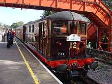
Steam on the Met
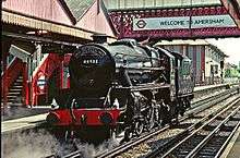
In 1989, to celebrate the 100th anniversary of the opening of the Metropolitan to Chesham, the first Steam on the Met event took place with London Underground running two weekends of steam specials between Chesham and Watford.[55] The event was a success and so in 1990 London Underground ran steam between Harrow and Amersham. In 1992, to celebrate 100 years of the Met at Amersham, the event was extended to five days at the end of May. From 1994, diesel locomotive 20227, owned by the Class 20 Locomotive Society, and electric locomotive Sarah Siddons provided air braking for the coaches. In 1995 trains ran between Amersham and Watford.[56]
Engines used included BR standard class 5 and BR standard class 4 and GWR Pannier tanks. There was other rolling stock on static display at Rickmansworth sidings. The steam trains ran between normal Metropolitan and main line services. Due to the imminent partial privatisation of LUL and the stock condition, the last steam excursion took place in 2000. In 2008, special trains ran on using Metropolitan Railway electric locomotive "Sarah Siddons" and diesel Class 20 locomotives.[57]
To celebrate the 150th anniversary of the opening of the Metropolitan, special services ran in January 2013 using a restored 1892 "Jubilee" carriage, 1898–1900 Ashbury and Cravens bogie carriages, Metropolitan Railway milk van No.3, Metropolitan Railway E Class steam locomotive No. 1 and electric locomotive "Sarah Siddons".[58] Further events are planned in 2013 for Locomotive No. 1, "Sarah Siddons" and the Jubilee carriage, including a Steam back on the Met scheduled for May.[59]
Future
Sub-surface railway upgrade
With the introduction of S8 Stock, the track, electrical supply, and signalling systems are being upgraded in a programme planned to increase peak-hour capacity on the line by 27 per cent by the end of 2018.[60][61][62] A single control room for the sub-surface railway opened in Hammersmith on 6 May 2018, and an automatic train control (ATC) system will replace signalling equipment installed from the 1940s.[60][63] Trackside signals with automatic train protection (ATP) will remain on the line north of Harrow-on-the-Hill, shared with Chiltern Railways DMUs.[60] It was planned that the new signalling system would be used first on the line north of Baker Street from the end of 2016,[60] but signalling contractor Bombardier was released from its contract by agreement in December 2013 and London Underground are looking for a replacement.[64]
Metropolitan line extension
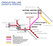
Also known as the Croxley Rail Link, the Metropolitan line extension was planned to reroute the Watford branch from the current terminus over the disused Croxley Green branch line to Watford Junction. Funding was agreed in December 2011[65] and the necessary permission was granted by the UK Government in July 2013.[66]
Construction work was expected to take place from June 2016 to January 2020.[36][67] However, the future of the project is now uncertain, due to a funding shortfall.[2]
List of stations
Open stations
In order from east to west.
| Station | Image | Opened[16] | Branch | Additional information | Position |
|---|---|---|---|---|---|
| Aldgate |  | 18 November 1876 | Circle | Terminus | 51°30′50″N 000°04′34″W |
| Liverpool Street | 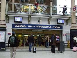 | 12 July 1875 | Circle | Originally Bishopsgate, renamed 1 November 1909 | 51°31′07″N 000°04′53″W |
| Moorgate |  | 23 December 1865 | Circle | Originally Moorgate Street, renamed 24 October 1924 | 51°31′07″N 000°05′19″W |
| Barbican | 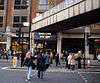 | 23 December 1865 | Circle | Originally Aldersgate Street, renamed Aldersgate 1910, Aldersgate and Barbican 1923, Barbican 1968 | 51°31′13″N 000°05′52″W |
| Farringdon | 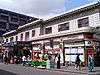 | 10 January 1863 | Circle | Resited 22 December 1865. Originally Farringdon Street, renamed Farringdon & High Holborn 1922, Farringon 1936 | 51°31′12″N 000°06′19″W |
| King's Cross St Pancras | 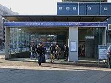 | 10 January 1863 | Circle | Station resited 1941. Originally King's Cross, renamed King's Cross & St Pancras 1925, King's Cross St Pancras 1933. | 51°31′49″N 000°07′27″W |
| Euston Square | 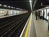 | 10 January 1863 | Circle | Originally Gower Street, renamed 1909 | 51°31′33″N 000°08′09″W |
| Great Portland Street | 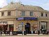 | 10 January 1863 | Circle | Originally Portland Road, renamed Great Portland Street 1917, Great Portland Street & Regent's Park 1923, Great Portland Street 1933 | 51°31′26″N 000°08′38″W |
| Baker Street | 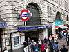 | 10 January 1863 | Main line | Metropolitan line platforms date from 1868 | 51°31′19″N 000°09′25″W |
| Finchley Road | 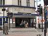 | 30 June 1879 | Main line | Finchley Road (South Hampstead) from 1885 to 1914 | 51°32′50″N 000°10′49″W |
| Wembley Park |  | 12 May 1894 | Main line | 51°33′49″N 000°16′46″W | |
| Preston Road | 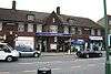 | 21 May 1908 | Main line | Resited 1931/2 | 51°34′20″N 000°17′43″W |
| Northwick Park | 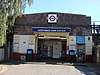 | 28 June 1923 | Main line | Originally Northwick Park & Kenton, renamed 1937 | 51°34′43″N 000°19′07″W |
| Harrow-on-the-Hill | 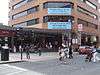 | 2 August 1880 | Main line | Originally Harrow, renamed 1894 | 51°34′46″N 000°20′13″W |
| West Harrow | 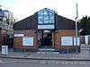 | 17 November 1913 | Uxbridge | 51°34′47″N 000°21′12″W | |
| Rayners Lane |  | 26 May 1906 | Uxbridge | 51°34′31″N 000°22′17″W | |
| Eastcote | 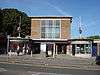 | 26 May 1906 | Uxbridge | 51°34′36″N 000°23′49″W | |
| Ruislip Manor | 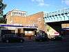 | 5 August 1912 | Uxbridge | 51°34′24″N 000°24′45″W | |
| Ruislip | 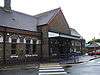 | 4 July 1904 | Uxbridge | 51°34′17″N 000°25′16″W | |
| Ickenham | 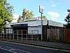 | 25 September 1905 | Uxbridge | 51°33′43″N 000°26′31″W | |
| Hillingdon | 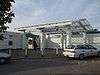 | 10 December 1923 | Uxbridge | Renamed Hillingdon (Swakeleys) 1934, suffix gradually dropped. Resited and rebuilt 1992 | 51°33′14″N 000°27′00″W |
| Uxbridge | 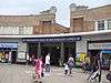 | 4 July 1904 | Uxbridge | Station resited from Belmont Road in 1938 Terminus | 51°32′45″N 000°28′42″W |
| North Harrow | 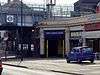 | 22 March 1915 | Main line | 51°35′06″N 000°21′45″W | |
| Pinner | 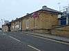 | 25 May 1885 | Main line | 51°35′34″N 000°22′50″W | |
| Northwood Hills | 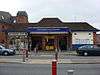 | 13 November 1933 | Main line | 51°36′02″N 000°24′33″W | |
| Northwood | 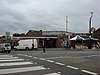 | 1 September 1887 | Main line | The last station within Greater London | 51°36′39″N 000°25′28″W |
| Moor Park | 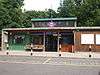 | 9 May 1910 | Main line | Originally Sandy Lodge, renamed Moor Park & Sandy Lodge 18 October 1923, Moor Park 25 September 1950 | 51°37′47″N 000°25′58″W |
| Croxley |  | 2 November 1925 | Watford | Originally Croxley Green, renamed 23 May 1949 | 51°38′51″N 000°26′29″W |
| Watford | 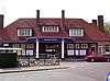 | 2 November 1925 | Watford | Terminus | 51°39′27″N 000°25′03″W |
| Rickmansworth | 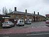 | 1 September 1887 | Main line | 51°38′25″N 000°28′24″W | |
| Chorleywood | 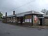 | 8 July 1889 | Main line | The last station within Hertfordshire. Originally Chorley Wood, renamed Chorley Wood & Chenies 1 November 1915, Chorley Wood 1934, Chorleywood 1964 | 51°39′15″N 000°31′06″W |
| Chalfont & Latimer | 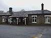 | 8 July 1889 | Main line | Originally Chalfont Road, renamed 1 November 1915 | 51°40′04″N 000°33′40″W |
| Chesham | 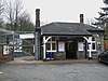 | 8 July 1889 | Chesham | Terminus | 51°42′19″N 000°36′41″W |
| Amersham |  | 1 September 1892 | Amersham | Renamed Amersham & Chesham Bois 12 March 1922, Amersham 1937 Terminus | 51°40′27″N 000°36′27″W |
Former stations
The Brill Tramway with stations Waddesdon Road, Westcott, Wotton, Church Siding, Wood Siding and Brill closed in 1935. In the following year the line was cut back to Aylesbury, with Waddesdon station and Granborough Road, Winslow Road stations on the line to Verney Junction closing.[16] Initially Verney Junction and Quainton Road remained open, with main line services provided by the LNER.
In 1939 the Stanmore branch and the stopping service between Finchley Road and Wembley Park were transferred to the Bakerloo line. On the St John's Wood section, Lord's and Marlborough Road stations were replaced by St. John's Wood, and Swiss Cottage replaced the Metropolitan line station.[14][16] The Bakerloo line service to Stanmore was transferred to the Jubilee line when that line opened in 1979.[15]
In 1961, when steam locomotives were replaced and the line was electrified to Amersham, the Underground service to Great Missenden, Wendover, Stoke Mandeville and Aylesbury was withdrawn.[16]
Goods-only branches
Between Moor Park and Croxley, a short branch ran south-east off the Watford branch, near its junction with the main line, to Croxley Tip, a rubbish dump beside the Grand Union Canal. This site began as a gravel loading point before becoming used by the railway to dump waste such as old ballast and waste from Neasden power station. This route, never used for passenger traffic, continued to be used by London Transport's small fleet of steam engines until 1971, when diesels replaced them. The branch closed some time after this, although a section of the spur line remained visible from a passing train.
A second short branch line, known as the Halton Railway, served RAF Halton near Wendover, across the Wendover Arm of the Grand Union Canal. The line was built during the First World War and closed in 1963.[68] The trackbed is now a footpath.[69]
Although not operated by Metropolitan passenger services, the line from South Harrow to Rayners Lane was built by the Metropolitan railway as the District Railway was in financial difficulties at the time. This included a short branch, part of which is still visible, on a viaduct to a gas works. Other minor freight connections along the line once included connections to the Midland main line at Finchley Road.
A single-track spur from a small yard between Ickenham and Ruislip stations connects to Ruislip Depot of the Central line. This line is used for engineering and empty stock transfers, although occasional plans suggest extending the Central line into Uxbridge by upgrading the connection. It was built in 1973.
References
Footnotes
- Based on 4 passengers per square metre.
- Position: 51°33′28″N 000°15′31″W
Notes
- "Performance: LU Performance Data Almanac". Transport for London. 2011–2012. Archived from the original on 14 February 2013. Retrieved 17 January 2013.
- Matters, Transport for London | Every Journey. "Metropolitan line extension". Transport for London. Archived from the original on 17 July 2017. Retrieved 4 September 2017.
- Green 1987, pp. 3–5.
- Edwards, Dennis; Pigram, Ron (1988). The Golden Years of the Metropolitan Railway and the Metro-land Dream. Bloomsbury. p. 32. ISBN 1-870630-11-4.
- Pipe, Victoria; Marshall, Geoff (2018). The Railway Adventures: Places, Trains, People and Stations. Tewkesbury: September Publishing. p. 82. ISBN 9781910463871.
- Bobrick, Benson (1981). Labyrinths of Iron. Newsweek books. p. 142.
- Green 1987, pp. 7–10.
- Green 1987, pp. 11–14.
- Green 1987, pp. 24–26.
- "A Trip on the Metropolitan Railway (1910)". Screen Online. British Film Institute. Retrieved 25 January 2016.
- Green 1987, pp. 43–45.
- Green 1987, pp. 46–48.
- Horne 2003, p. 69.
- Green 1987, p. 51.
- Green 1987, p. 63.
- Rose, Douglas (December 2007) [1980]. The London Underground: A Diagrammatic History (8th ed.). London: Capital Transport. ISBN 978-1-85414-315-0.
- Bruce 1983, pp. 72–74.
- Bruce 1983, pp. 78–81.
- Green 1987, p. 55.
- Bruce 1983, p. 110.
- Bruce 1983, p. 113.
- Croome, Desmond F.; Jackson, Alan Arthur (1993). Rails Through the Clay: A History of London's Tube Railways. Capital Transport. p. 468. ISBN 978-1-85414-151-4.
- "London Underground map 1968". The London Tube map archive. Retrieved 21 November 2012.
- "London Underground map 1970". The London Tube map archive. Retrieved 21 November 2012.
- "London Underground map 1985". The London Tube map archive. Retrieved 21 November 2012.
- "London Underground map 1990". The London Tube map archive. Retrieved 21 November 2012.
- "PPP Performance Report" (PDF). Transport for London. 2009–2010. pp. 7–8. Archived from the original (PDF) on 26 April 2012. Retrieved 7 March 2012.
- "Chesham trains to run direct into central London". tfl.gov.uk. Transport for London. 7 December 2010. Archived from the original on 17 April 2012. Retrieved 21 March 2018.
- "A Stock last day on the Metropolitan Line". Railways Today. 26 September 2012. Archived from the original on 19 January 2016. Retrieved 2 November 2012.
- "Last A stock rail tour". London Transport Museum. Retrieved 27 September 2012.
- "Key facts". Transport for London. Archived from the original on 29 May 2007. Retrieved 22 November 2012.
- Martin, Andrew (2012). Underground, Overground: A Passenger's History of the Tube. London: Profile Books. pp. 137–138. ISBN 978-1-84765-807-4. Retrieved 7 December 2012.
- "Metropolitan line facts". Transport for London. Retrieved 23 November 2012.
- "Detailed London Transport Map". cartometro.com. Retrieved 23 November 2012.
- Horne 2003, p. x.
- "Croxley Rail Link". Transport for London. Archived from the original on 25 March 2013. Retrieved 23 November 2012.
- "Amersham/Chesham tube guide" (PDF). Transport for London. Retrieved 9 December 2013.
- Kichenside, G.M.; Williams, Alan. British Railway Signalling. p. 72.
- "Facts & figures". tfl.gov.uk. Transport for London. Retrieved 14 July 2017.
- "Working timetable 340 - Metropolitan line" (PDF). Archived from the original (PDF) on 21 May 2017. Retrieved 5 May 2018.
- Detailed London transport map - Carto Metro
- Working timetable 35 - Circle and Hammersmith & City lines
- "Commissioner's Report" (PDF). Board Meeting Documents. paragraph 3.2: Transport for London. 20 September 2012. Retrieved 27 September 2012.CS1 maint: location (link)
- Waboso, David (December 2010). "Transforming the tube". Modern Railways. London. pp. 42–45.
- "Movia metro – London, United Kingdom". Bombardier. Retrieved 27 January 2011.
- "'S' stock making its mark". Modern Railways. London. December 2010. p. 46.
- "Transforming the Tube" (PDF). Transport for London. July 2008. Archived from the original (PDF) on 5 June 2011. Retrieved 28 May 2009.
-
- "Rolling Stock: A Stock". Transport for London. Retrieved 25 November 2012.
- "Rolling Stock: S Stock". Transport for London. Archived from the original on 29 December 2013. Retrieved 25 November 2012.
- "S stock". Transport for London. Archived from the original on 29 December 2013. Retrieved 10 January 2012. (Note: The table erroneously says "Length per car", instead of "Length per train".)
- Jackson 1986, pp. 82–82.
- Jackson 1986, p. 176.
- Jackson 1986, p. 281.
- "Works begin to build new maintenance facility at Neasden Depot". Transport for London. 28 September 2010. Retrieved 11 February 2011.
- "London Underground Key Facts". Transport for London. Archived from the original on 29 May 2007. Retrieved 21 May 2008.
- metroland.org.uk. "Steam on the Met".
- King, Geoffrey. "Steam on the Met".
- "Not quite Steam on the Met". peat.me.uk. 30 August 2008. Retrieved 24 November 2011.
- "Past Events – tube 150". London Transport Museum. Retrieved 4 February 2013.
- "Vehicles on the Move" (Press release). London Transport Museum. Retrieved 4 February 2013.
- Abbott, James (January 2013). "Sub-surface renewal". Modern Railways. pp. 38–41.
- "Our Upgrade Plan" (PDF). Transport for London. February 2011. Archived from the original (PDF) on 17 August 2012. Retrieved 7 December 2012.
- "Tube Upgrade Plan: Metropolitan line". Transport for London. Retrieved 18 June 2011.
- Stewart, Rob (January 2013). "Cityflo 650 to control the SSR". Modern Railways. pp. 42–43.
- "London Underground and Bombardier agree to re-let signalling contract" (Press release). Transport for London. 31 December 2013. Retrieved 2 January 2014.
- "Transport schemes given £854m in government funding". BBC News. 14 December 2011. Retrieved 14 December 2011.
- "Watford Metropolitan line Tube extension gets go-ahead". BBC News. 24 July 2013. Retrieved 24 July 2013.
- "Metropolitan line Extension". Archived from the original on 17 July 2017. Retrieved 19 November 2015.
- "Halton Railway". RAF Halton. MOD. Retrieved 6 September 2015.
- The Wendover Arm: Linear and Circular Walks (PDF). Aylesbury: Buckinghamshire County Council. Retrieved 6 September 2015.
Sources
- Bruce, J Graeme (1983). Steam to Silver. A history of London Transport Surface Rolling Stock. Capital Transport. ISBN 0-904711-45-5.CS1 maint: ref=harv (link)
- Green, Oliver (1987). The London Underground: An illustrated history. Ian Allan. ISBN 0-7110-1720-4.CS1 maint: ref=harv (link)
- Horne, Mike (2003). The Metropolitan Line. Capital Transport. ISBN 1-85414-275-5.CS1 maint: ref=harv (link)
- Jackson, Alan (1986). London's Metropolitan Railway. David & Charles. ISBN 0-7153-8839-8.CS1 maint: ref=harv (link)
Further reading
- Foxell, Clive (2010). The Metropolitan Line. History Press. ISBN 978-0-7524-5396-5.
External links
| Wikimedia Commons has media related to Metropolitan Line. |
- Metropolitan line facts
- Clive's Underground Line Guide
- Railways Around Amersham & The Metropolitan line
- Metropolitan line on Twitter

| Stations |
| ||||||||||||||||
|---|---|---|---|---|---|---|---|---|---|---|---|---|---|---|---|---|---|
| Rolling stock |
| ||||||||||||||||
| History |
| ||||||||||||||||
| Future proposals |
| ||||||||||||||||
| |||||||||||||||||
Transport in Buckinghamshire | |||||||||||||||
|---|---|---|---|---|---|---|---|---|---|---|---|---|---|---|---|
| Road |
| ||||||||||||||
| Rail |
| ||||||||||||||
| Air |
| ||||||||||||||
| Waterways |
| ||||||||||||||
| Footpaths |
| ||||||||||||||
| Cycle paths |
| ||||||||||||||
| Related articles |
| ||||||||||||||