Caracas
Caracas (/kəˈrækəs, -ˈrɑːk-/, Spanish: [kaˈɾakas]), officially Santiago de León de Caracas, abbreviated as CCS, is the capital and largest city of Venezuela, and the centre of the Metropolitan Region of Caracas (or Greater Caracas).[3] Caracas is located along the Guaire River in the northern part of the country, following the contours of the narrow Caracas Valley on the Venezuelan coastal mountain range (Cordillera de la Costa). Terrain suitable for building lies between 760 and 1,140 m (2,490 and 3,740 ft) above sea level, although there is some settlement above this range. The valley is close to the Caribbean Sea, separated from the coast by a steep 2,200-metre-high (7,200 ft) mountain range, Cerro El Ávila; to the south there are more hills and mountains. The Metropolitan Region of Caracas has an estimated population of almost 3 million inhabitants. It is the seventh largest metropolitan area in terms of population in Latin America.
Caracas | |
|---|---|
Capital City | |
| Santiago de León de Caracas | |
      | |
 Flag 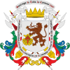 Coat of arms | |
| Nicknames: La Sultana del Ávila La Sucursal del Cielo La Ciudad de la Eterna Primavera | |
| Motto(s): Muy Noble y Leal Ciudad | |
.jpg) Caracas Location in Venezuela and South America 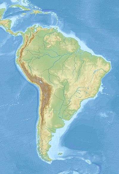 Caracas Caracas (South America) | |
| Coordinates: 10°28′50″N 66°54′13″W | |
| Country | Venezuela |
| State | Capital District |
| Founded | 25 July 1567 |
| Founded by | Diego de Losada |
| Government | |
| • Type | Mayor–council |
| • Body | Government of the Capital District |
| • Chief of Government | Darío Vivas |
| Area | |
| • Capital City | 433 km2 (167 sq mi) |
| • Metro | 4,715.1 km2 (1,820.5 sq mi) |
| Elevation | 900 m (3,000 ft) |
| Highest elevation | 1,400 m (4,600 ft) |
| Lowest elevation | 870 m (2,850 ft) |
| Population (2017)[1] | |
| • Capital City | 1,945,901 |
| • Density | 4,212.9/km2 (10,911/sq mi) |
| • Metro | 2,967,626 |
| • Metro density | 1,123.4/km2 (2,910/sq mi) |
| Demonyms | Caraquenian (Spanish: caraqueño (m), caraqueña (f)) |
| Time zone | UTC-04:00 (VET) |
| Postal codes[2] | 1000–1090, 1209 |
| Area code | 212 |
| ISO 3166 code | VE-A |
| Website | http://www.caracas.gob.ve |
| The area and population figures are the sum of the figures of the five municipalities (listed above) that make up the Distrito Metropolitano. | |
Strictly speaking, the centre of the city is still Catedral, located near Bolívar Square,[4] even though it is assumed that it is Plaza Venezuela, located in the Los Caobos neighbourhood.[3][5][6] Chacaíto area, Luis Brión Square and El Rosal neighborhood are also considered the geographic center of the Metropolitan Region of Caracas.[7][8]
Businesses in the city include service companies, banks, and malls. Caracas has a largely service-based economy, apart from some industrial activity in its metropolitan area.[9] The Caracas Stock Exchange and Petróleos de Venezuela (PDVSA) are headquartered in Caracas. PDVSA is the largest company in Venezuela. Caracas is also Venezuela's cultural capital, with many restaurants, theaters, museums, and shopping centers. Caracas has some of the tallest skyscrapers in Latin America,[10] such as the Parque Central Towers.[11]
Caracas has been considered one of the most important cultural, tourist, industrial and economic centres of Latin America. The Museum of Contemporary Art of Caracas is one of the most important in South America. The Museum of Fine Arts and the National Art Gallery of Caracas are also noteworthy.[12] The National Art Gallery was projected to be the largest museum in Latin America, according to its architect Carlos Gómez De Llarena.[13]
Caracas has one of the highest per capita murder rates in the world, with 111.19 homicides per 100,000 inhabitants.[14]
History
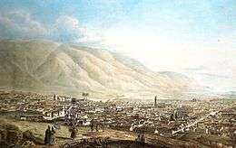
The city was founded in 1567,[15] when the valley of Caracas was populated by indigenous peoples. Francisco Fajardo, the son of a Spanish captain and a Guaiqueri cacica, who came from Margarita, began establishing settlements in the area of La Guaira and the Caracas valley between 1555 and 1560. Fajardo attempted to establish a plantation in the valley in 1562 after these unsuccessful coastal towns, but it did not last long: it was destroyed by natives of the region led by Terepaima and Guaicaipuro.[16][17] The eventual settlers of Caracas came from Coro, the German capital of their Klein-Venedig colony around the present-day coastal Colombia–Venezuela border; from the 1540s, the colony had been de facto controlled by Spaniards. Moving eastward from Coro, groups of Spanish settlers founded inland towns including Barquisimeto and Valencia before reaching the Caracas valley.[16] On 25 July 1567, Captain Diego de Losada laid the foundations of the city of Santiago de León de Caracas.[15]
In 1577, Caracas became the capital of the Spanish Empire's Venezuela Province under Governor Juan de Pimentel (1576–1583).
During the 17th century, the coast of Venezuela was frequently raided by pirates. With the coastal mountains as a barrier, Caracas was relatively immune to such attacks. However, in 1595, around 200 English privateers including George Sommers and Amyas Preston crossed the mountains through a little-used pass while the town's defenders were guarding the more often-used one. Encountering little resistance, the invaders sacked and set fire to the town after a failed ransom negotiation.[18][19]
As the cocoa cultivation and exports under the Compañía Guipuzcoana de Caracas grew in importance, the city expanded. In 1777, Caracas became the capital of the Captaincy General of Venezuela.
José María España and Manuel Gual led an attempted revolution aimed at independence, but the rebellion was put down on 13 July 1797. Caracas was ultimately the site of the signing of a Declaration of independence on 17 August 1811. In 1812, an earthquake destroyed Caracas. The war for independence continued until 24 June 1821, when Bolívar defeated royalists in the Battle of Carabobo.[20]
Caracas grew in economic importance during Venezuela's oil boom in the early 20th century. In 1941, Caracas was the site at which ratifications for the López de Mesa-Gil Borges Treaty were exchanged. Later, during the 1950s, Caracas began an intensive modernization program which continued throughout the 1960s and early 1970s. The Universidad Central de Venezuela, designed by modernist architect Carlos Raúl Villanueva and declared World Heritage by UNESCO, was built. New working- and middle-class residential districts sprouted in the valley, extending the urban area toward the east and southeast. Joining El Silencio, also designed by Villanueva, were several workers' housing districts, 23 de Enero and Simon Rodriguez. Middle-class developments include Bello Monte, Los Palos Grandes, Chuao, and El Cafetal. The dramatic change in the economic structure of the country, which went from being primarily agricultural to dependent on oil production, stimulated the fast development of Caracas, and made it a magnet for people in rural communities who migrated to the capital city in an unplanned fashion searching for greater economic opportunity. This migration created the rancho (slum) belt of the valley of Caracas.
Symbols

The flag of Caracas consists of a burgundy red field with the version of the Coat of Arms of the City (effective since the 1980s). The red field symbolises the blood spilt by Caraquenian people in favour of independence and the highest ideals of the Venezuelan Nation. Later, in the year 1994, presumably as a result of the change of municipal authorities, it was decided to increase the size of the Caracas coat of arms and move it to the centre of the field. This version of the flag is still in use today.
The coat of arms of the City of Caracas was adopted by the Libertador Municipality to identify itself. Later, the Metropolitan Mayor Office assumed the lion, the scallop and Saint James' Cross for the same purpose.
The anthem of the city is the Marcha a Caracas, written by the composer Tiero Pezzuti de Matteis with the lyrics by José Enrique Sarabia. The lyrics are said to be inspired by the heroism of the Caraquenian people, and the memory of the City of Red Roofs. Incidentally, the National Anthem of Venezuela, Gloria al Bravo Pueblo, includes the lines "...y si el despotismo levanta la voz, seguid el ejemplo que Caracas dio" ("...and if despotism raises its voice, follow the example that Caracas gave"), reflecting the fact that, in addition to generously providing many heroic fighters to the War of Independence, the junta established in Caracas (19 April 1810) served as inspiration for other regions to do the same—as did its declaration of independence a year later.
Local government
Under the constitution of Venezuela, municipal governments have two branches: the executive (governed by a mayor) and the legislative (managed by a municipal council).
Metropolitan District of Caracas
On 8 March 2000, the year after a new constitution was introduced in Venezuela, it was decreed in Gaceta Official N° 36,906 that the Metropolitan District of Caracas would be created and that some of the powers of the Libertador, Chacao, Baruta, Sucre, and El Hatillo municipalities would be delegated to the Alcaldía Mayor, physically located in the large Libertador municipality, in the center of the city.[23] The Metropolitan District of Caracas was suppressed on 20 December 2017 by the Constituent National Assembly of Venezuela.[24]
Economy

Businesses that are located here include service companies, banks, and malls, among others. It has a largely service-based economy, apart from some industrial activity in its metropolitan area.[9] The Caracas Stock Exchange and Petróleos de Venezuela (PDVSA) are headquartered here. The PDVSA is the largest company in Venezuela,[25] and negotiates all the international agreements for the distribution and export of petroleum.[26] When the company existed, the airline Viasa had its headquarters in the Torre Viasa.[27][28]
Several international companies and embassies are located in El Rosal and Las Mercedes, in the north of the Baruta municipality and the south of the Chacao municipality. Small and medium-size industry contributes to the Caracas economy. The city provides communication and transportation infrastructure between the metropolitan area and the rest of the country. Important industries in Caracas include chemicals, textiles, leather, food, iron and wood products. There are also rubber and cement factories.[29] Its GDP(Nominal) is US$70 billion and the GDP(PPP) per Capita is.USD 24,000.[30]
Cost of living

A 2009 United Nations survey reported that the cost of living in Caracas was 89% of that of the survey's baseline city, New York.[31] However, this statistic is based upon a fixed currency-exchange-rate of 2003 and might not be completely realistic, due to the elevated inflation rates of the last several years.[32] However, Caracas is now one of the cheapest cities for tourists, according to The Economist Intelligence Unit.[33]
Tourism
In 2013, the World Economic forum evaluated countries in terms of how successful they were in advertising campaigns to attract foreign visitors. Out of the 140 countries evaluated, Venezuela came last. Myriad factors contribute to the lack of tourism in Caracas. A major factor that has contributed to the lack of foreign visitors has been poor transport for tourists. Venezuela has limited railway systems and airlines. High crime rates and the negative attitude of the Venezuelan population towards tourism also contributed to the poor evaluation.
In an attempt to attract more foreign visitors, the Venezuelan Ministry of Tourism invested in multiple hotel infrastructures. The largest hotel investment has been in the Hotel Alba Caracas. The cost for the general maintenance of the north and south towers of the hotel is approximately 231.5 million Venezuelan bolivars.
Although the Venezuelan Ministry of Tourism has taken the initiative to recognize the importance of the tourism industry, the Venezuelan government has not placed the tourism industry as an economic priority. In 2013, the budget for the Ministry of Tourism was only 173.8 million bolivars, while the Ministry of the Youth received approximately 724.6 million bolivars.
The tourism industry in Venezuela contributes approximately 3.8 percent of the country GDP. Venezuela's current goal is to reach a GDP of 7.6 percent. The World Economic Forum predicts Venezuela's GDP to rise to 4.2 percent by 2022.[34]
Geography
Caracas is contained entirely within a valley of the Venezuelan central Range, and separated from the Caribbean coast by a roughly 15 kilometres (9 miles) expanse of El Ávila National Park. The valley is relatively small and quite irregular, the altitude with respect to sea level varies from between 870 and 1,043 meters (2,854 and 3,422 ft), with 900 meters (3,000 feet) in the historic zone. This, along with the rapid population growth, has profoundly influenced the urban development of the city. The most elevated point of the Capital District, wherein the city is located, is the Pico El Ávila, which rises to 2,159 meters (7,083 feet).
The main body of water in Caracas is the Guaire River, which flows across the city and empties into the Tuy River, which is also fed by the El Valle and San Pedro rivers, in addition to numerous streams which descend from El Ávila. The La Mariposa and Camatagua reservoirs provide water to the city. The city is occasionally subject to earthquakes – notably in 1641 and 1967.
 Day view of El Avila National Park from Parque del Este
 Galipán, town atop El Ávila
 View of the Rio Guaire canyon, main body of water that passes through Caracas
 View of the Avila gondola lift starting from Caracas to Hotel Humboldt station
Climate

Under the Köppen climate classification, Caracas has a mix of tropical savanna climate (Aw) with subtropical highland (Cwb) influences due to its altitude. Caracas is also intertropical, with precipitation that varies between 900 and 1,300 millimeters (35 and 51 inches) (annual), in the city proper, and up to 2,000 millimeters (79 inches) in some parts of the Mountain range. While Caracas is within the tropics, due to its altitude temperatures are generally not nearly as high as other tropical locations at sea level. The annual average temperature is approximately 23.8 °C (75 °F), with the average of the coldest month (January) 22.8 °C (73 °F) and the average of the warmest month (July) 25.0 °C (77 °F), which gives a small annual thermal amplitude of 2.2 °C (4.0 °F).
In the months of December and January abundant fog may appear, in addition to a sudden nightly drop in temperature, until reaching 8 °C (46 °F).[35] This peculiar weather is known by the natives of Caracas as the Pacheco. In addition, nightly temperatures at any time of the year are much (14 to 20 °C) lower than daytime highs and usually do not remain above 24 °C (75 °F), resulting in very pleasant evening temperatures. Hail storms appear in Caracas, although only on rare occasions. Electrical storms are much more frequent, especially between June and October, due to the city being in a closed valley and the orographic action of Cerro El Ávila.
| Month | Jan | Feb | Mar | Apr | May | Jun | Jul | Aug | Sep | Oct | Nov | Dec | Year |
|---|---|---|---|---|---|---|---|---|---|---|---|---|---|
| Record high °C (°F) | 31.9 (89.4) |
34.1 (93.4) |
35.3 (95.5) |
33.5 (92.3) |
34.4 (93.9) |
32.8 (91.0) |
33.6 (92.5) |
31.5 (88.7) |
32.2 (90.0) |
31.4 (88.5) |
31.2 (88.2) |
30.8 (87.4) |
35.3 (95.5) |
| Average high °C (°F) | 23.3 (73.9) |
23.6 (74.5) |
24.3 (75.7) |
25.0 (77.0) |
25.8 (78.4) |
26.0 (78.8) |
25.5 (77.9) |
25.8 (78.4) |
25.5 (77.9) |
25.2 (77.4) |
24.6 (76.3) |
23.8 (74.8) |
24.9 (76.8) |
| Daily mean °C (°F) | 19.6 (67.3) |
19.7 (67.5) |
20.2 (68.4) |
21.2 (70.2) |
22.0 (71.6) |
22.0 (71.6) |
21.7 (71.1) |
21.9 (71.4) |
21.9 (71.4) |
21.8 (71.2) |
21.3 (70.3) |
20.2 (68.4) |
21.1 (70.0) |
| Average low °C (°F) | 15.9 (60.6) |
15.8 (60.4) |
16.0 (60.8) |
17.5 (63.5) |
18.2 (64.8) |
18.1 (64.6) |
17.9 (64.2) |
18.1 (64.6) |
18.3 (64.9) |
18.4 (65.1) |
18.0 (64.4) |
16.5 (61.7) |
17.4 (63.3) |
| Record low °C (°F) | 7.1 (44.8) |
10.9 (51.6) |
11.4 (52.5) |
12.5 (54.5) |
13.1 (55.6) |
14.9 (58.8) |
14.1 (57.4) |
14.3 (57.7) |
15.5 (59.9) |
13.1 (55.6) |
11.9 (53.4) |
10.0 (50.0) |
7.1 (44.8) |
| Average rainfall mm (inches) | 15.3 (0.60) |
13.2 (0.52) |
11.4 (0.45) |
59.2 (2.33) |
81.7 (3.22) |
134.1 (5.28) |
118.4 (4.66) |
123.8 (4.87) |
115.4 (4.54) |
126.3 (4.97) |
72.6 (2.86) |
41.4 (1.63) |
912.8 (35.94) |
| Average rainy days (≥ 1.0 mm) | 6 | 4 | 3 | 7 | 13 | 19 | 19 | 18 | 15 | 15 | 13 | 10 | 142 |
| Average relative humidity (%) | 73.7 | 74.2 | 73.0 | 76.3 | 75.4 | 75.1 | 74.1 | 74.0 | 74.9 | 74.7 | 73.7 | 74.7 | 74.5 |
| Mean monthly sunshine hours | 229.4 | 217.5 | 235.6 | 183.0 | 182.9 | 183.0 | 210.8 | 217.0 | 213.0 | 210.8 | 210.0 | 213.9 | 2,506.9 |
| Source #1: Instituto Nacional de Meteorología e Hidrología (INAMEH)[36][37] | |||||||||||||
| Source #2: World Meteorological Organization (rainfall data),[38] Hong Kong Observatory (sun only),[39] NOAA(extremes)[40] | |||||||||||||
Demographics
According to the population census of 2011 the Caracas proper (Distrito Capital) is over 1.9 million inhabitants,[41] while that of the Metropolitan District of Caracas is estimated at 2.9 million as of 2011. The majority of the population is mixed-race, typically with varying degrees of European, African, Indigenous and occasional Asian ancestry. There is a noteworthy Afro-Venezuelan community formed by residents whose ancestors settled in Caracas after being liberated from slavery as a reward for aiding Bolívar in the Venezuelan War of Independence. Additionally, the city has a large number of both European Venezuelans & Asian Venezuelans who descend from the massive influx of various immigrants Venezuela received from all across Eurasia during the 20th century. The descendants of Spaniards, Portuguese, Italians, Chinese, Colombians, Germans, Syrians and Lebanese stand out.[41][42]
Crime

Venezuela and its capital, Caracas, are reported to both have among the highest per capita murder rates in the world. Caracas is the city with the highest homicide rate in the world outside of a warzone, with a 2016 rate of around 120 murders per 100,000 people.[43][44][45][46][47][48] Most murders and other violent crimes go unsolved, with estimates of the number of unresolved crimes as high as 98%.[49][50][51] The U.S. Department of State and British Foreign and Commonwealth Office have issued travel warnings for Venezuela (especially Caracas) due to high rates of crime.[52][53]
Landmarks
Paseo Los Próceres
The Paseo Los Próceres is a monument located near Fort Tiuna and the Military Academy of the Bolivarian Army. On the promenade there are statues of the heroes of the Independence of Venezuela, as well as symbolic sculptures.
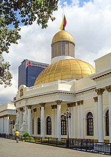
Federal Capitol
The Federal Capitol occupies an entire city block, and, with its golden domes and neoclassical pediments, can seem even bigger. The building was commissioned by Antonio Guzmán Blanco and was built between 1872–1877, and is most famous for its Salón Elíptico, an oval hall with a mural-covered dome and walls lined with portraits of the country's great and good. The nearby Palacio Municipal de Caracas dating from 1696 was renovated in the Neoclassical style in 1906 and now serves as the city hall and the Caracas Museum.[54]
East Park
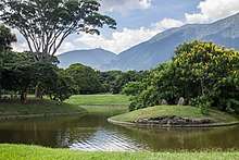
The Caracas East Park (Parque del Este, now officially Parque Generalísimo Francisco de Miranda) was designed by Brazilian architect Roberto Burle Marx. It is a green paradise in the middle of the city, and it contains a small zoo. A replica of the ship led by Francisco de Miranda, the Leander, is in the southern part of the park. Before there used to exist a replica of the Santa Maria ship, used by Christopher Columbus in his voyages to America.
Teresa Carreño Cultural Complex
The Teresa Carreño Cultural Complex (Complejo Cultural Teresa Carreño) is by far the most important theater of Caracas and Venezuela. The theater presents symphonic and popular concerts, operas, ballet, and dramatic works. It is the second largest theater in South America, after the Teatro Colón of Buenos Aires, Argentina.

Simón Bolívar's Birthplace Home
Skyscrapers may loom overhead, but there is more than a hint of original colonial flavor in this neatly proportioned reconstruction of the house where Simón Bolívar was born on 24 July 1783. The museum's exhibits include period weapons, banners and uniforms.
Much of the original colonial interior has been replaced by monumental paintings of battle scenes, but more personal relics can be seen in the nearby Bolivarian museum. The pride of the place goes to the coffin in which Bolívar's remains were brought from Colombia; his ashes now rest in the National Pantheon.
National Pantheon
Venezuela's most venerated building is five blocks north of Plaza Bolívar, on the northern edge of the old town. Formerly a church, the building was given its new purpose as the final resting place for eminent Venezuelans by Antonio Guzmán Blanco in 1874.
Parque Central Complex
At a short distance east of Plaza Bolívar is Parque Central, a concrete complex of five high-rise residential slabs of somewhat apocalyptic-appearing architecture, crowned by two 56-storey octagonal towers, one of them is under repair due to the fire which burnt the building on 17 October 2004.
Parque Central is Caracas' art and culture hub, with museums, cinemas and the Teresa Carreño Cultural Complex. The West Tower balcony, on the 52nd floor, gives a 360° bird's-eye view of Caracas.
Public squares
- Plaza Bolívar is the focus of the old town with the monument to El Libertador, Simón Bolívar, at its heart. Modern high-rise buildings have overpowered much of the colonial flavor of Caracas' founding neighbourhood.
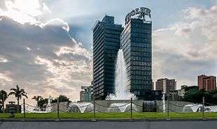
- Plaza Venezuela is the geographic center of Caracas. It is a large urban plaza at the entrance of the Central University of Venezuela. Kinetic artists have displayed their works there, including Carlos Cruz-Diez, Alejandro Otero and Jesus Soto. East of the Plaza is the Plaza Venezuela Fountain, a large computerized display of water, music and colored light refurbished in 2009 to include the latest available technology.[55]
- Plaza Caracas was constructed in 1983. It is in the Simón Bolívar Center.
- Plaza San Jacinto dates to 1603 and used to be the site of the city market
- Plaza Los Palos Grandes is a modern construction located at the municipality of Chacao. It has a display of water and a beautiful coffee shop. this plaza is the center of free yoga lessons for all the people that want to enjoy the city outdoors. It also has its own library.
El Hatillo

El Hatillo is a neighborhood which was previously a colonial town, that is located in the south-east of Caracas in the municipal area of the same name. This small area, which is one of Venezuela's few well-preserved typical colonial areas, gives an idea of what Caracas was like in centuries past.
Cerro El Ávila
Cerro El Ávila (Mountain El Ávila) (Indigenous name: Waraira Repano), is a mountain in the mid-North of Venezuela. It rises next to Caracas and separates the city from the Caribbean Sea; The area's highest elevation is Pico Naiguatá, at 2,765 metres (9,072 ft) above sea level. It is considered the lungs of Caracas due to the amount of vegetation on the mountain.
Las Mercedes
This zone contains restaurants with varied gastronomical specialties, along with pubs, bars, pools and art galleries.
Altamira neighborhood

Altamira is a neighborhood in the Chacao municipality of Caracas. It has its own Metro Station, many hotels, malls and restaurants, and is an important business and cultural centre. The Francisco de Miranda avenue (a major avenue in Caracas) and the Distibuidor Altamira (a congested highway exit) are both in Altamira.
Religious buildings

The Iglesia de San Francisco is of historical value. Bolívar's funeral was held here twelve years after his death. Here he was proclaimed Libertador in 1813 by the people of Caracas. The church has gilded baroque altarpieces, and retains much of its original colonial interior, despite being given a treatment in the 19th century under the auspices of Antonio Guzmán Blanco, which was intended to be modernizing. It contains some 17th-century masterpieces of art, carvings, sculptures and oil paintings. The Central University of Venezuela, established during the reign of Philip V, was lodged for centuries in the church cloisters next door, which today are the seat of the Language Academy, and the Academies of History, Physics, and Mathematics.
Caracas Cathedral is the seat of the Roman Catholic Archdiocese of Caracas. Basilica of St. Teresa is designated a National Historic Landmark.
The Mosque of Sheikh Ibrahim Al-Ibrahim is the second largest mosque in Latin America. For many years it was the biggest.[56]
The Union Israelita de Caracas is the biggest Synagogue for the Jewish Ashkenazi community in Caracas. Its mission is to host the religious services and preserve the memory of the Jewish heritage in Venezuela. Similarly, Los Caobos the biggest Synagogue for the Jewish Sephardic community in Caracas.
Education
| UNESCO World Heritage Site | |
|---|---|
| Location | Venezuela |
| Criteria | Cultural: i, iv |
| Reference | 986 |
| Inscription | 2000 (24th session) |


Central University of Venezuela
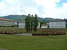
The Central University of Venezuela (Universidad Central de Venezuela in Spanish) is a public University. Founded in 1721, it is the oldest university in Venezuela.[57] The university campus was designed by architect Carlos Raúl Villanueva and it was declared World Heritage by UNESCO in 2000.[58]
Simón Bolívar University
The Simón Bolívar University (Universidad Simón Bolívar, in Spanish, or USB) is a public institution in Caracas that focuses on science and technology. Its motto is "La Universidad de la Excelencia" ("University of Excellence").
Other universities
- Academia Militar de Venezuela
- Escuela de Formación de Oficiales de las Fuerzas Armadas de Cooperación
- Universidad Católica Andrés Bello
- Universidad Nacional Experimental de la Gran Caracas
- Universidad Metropolitana
- Universidad Nacional Experimental de las Artes
- Universidad Monteávila
- Universidad Nueva Esparta
- Universidad Santa Maria
- Universidad Alejandro de Humboldt
- Universidad Nacional Experimental de las Fuerzas Armadas
- Universidad Nacional Experimental Simón Rodríguez
- Universidad Bolivariana de Venezuela
- Universidad José María Vargas
- Universidad Pedagógica Experimental Libertador
- Universidad Experimental Politécnica Antonio José de Sucre
International schools
- British School of Caracas
- Colegio Internacional de Caracas
- Escuela Campo Alegre
- International Christian School
- Tomchei Tmimim
- Lycée Français de Caracas - Colegio Francia
- Colegio Japonés de Caracas (カラカス日本人学校) - Sucre Municipality, Miranda - A nihonjin gakko[59]
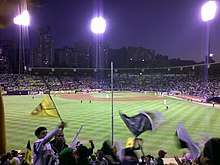
Sports
.jpg)
The city hosted the official 2013 Americas Basketball Championship.
There are professional association football, baseball and several other sports.
Professional teams include Caracas Fútbol Club, Deportivo Petare, Atlético Venezuela, Centro Italo Venezolano, Estrella Roja and Deportivo La Guaira. Deportivo Petare has reached the semi-finals of international tournaments, such as the Copa Libertadores, while the Caracas Fútbol Club has reached the quarterfinals.
Baseball teams Tiburones de La Guaira and Leones del Caracas play in the Estadio Universitario de la UCV, of the Central University of Venezuela, with a capacity of 26,000 spectators.
Another baseball team started in Caracas: the Navegantes del Magallanes. It was moved to Valencia, Carabobo in the 1970s.
Association football stadiums include:
- Estadio Olímpico de la UCV, with capacity of 30 000 spectators is seat of the Caracas Fútbol Club and Deportivo La Guaira.
- Brígido Iriarte Stadium, with a capacity of 12 000 spectators (old seat of the Deportivo Italia and Caracas Fútbol Club, and seat of the Atlético Venezuela). The Caracas Fútbol Club opened its own stadium in 2005, Campo Deportivo Cocodrilos.
- Cocodrilos de Caracas plays in the Venezuelan professional basketball league. They play their games in the Poliedro de Caracas in the neighbourhood of El Paraíso.
Caracas is the seat of the National Institute of Sports and of the Venezuelan Olympic Committee.
Caracas hosted the 1983 Pan American Games.
Teams
- Association Football: Caracas, Deportivo Petare, Atlético Venezuela, Centro Italo Venezolano, Estrella Roja, Deportivo La Guaira, Metropolitanos, Estudiantes de Caracas.
- Baseball: Tiburones de la Guaira, Leones del Caracas.
- Basketball: Cocodrilos de Caracas.
Culture

Caracas is Venezuela's cultural capital, with many restaurants, theaters, museums, and shopping centers. The city is home to many immigrants from Spain, Italy, Portugal, the Middle East, Germany, China, and Latin American countries.[60][61][62][63]
Notable people
Transportation
.jpg)
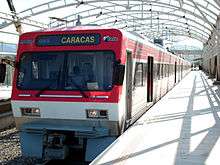
- The Caracas Metro has been in operation since 27 March 1983. With 4 lines, 47 stations and about 10 more to be constructed. It covers a great part of the city and also has an integrated ticket system that combines the route of the Metro with those offered by the Metrobús, a bus service of the Caracas Metro. In 2010, the first segment of a new ariel cable car system opened, Metrocable[64] which feeds into the larger metro system.
- Buses are the main means of mass transportation. There are two bus systems: the traditional system and the Metrobús. The traditional system runs a variety of bus types, operated by several companies on normal streets and avenues:
- Autobus; large buses
- Camioneta; medium size buses
- microbus or camionetica; vans or minivans
- IFE; train services to and from Tuy Valley cities of Charallave and Cúa
- Simón Bolívar International Airport, the biggest and most important in the country is located outside the city, roughly 32 kilometres (20 mi) from the downtown area.
- Caracas Aerial Tramway
- The Los Teques Metro is a suburban mass-transit system completed in 2006 that connects Caracas with the suburban city of Los Teques.
- In March 2009 four of the five Caracas districts launched Plan Vía Libre to reduce traffic (the pro-Chavez Jorge Rodríguez' Libertador District is currently not cooperating as the other districts are in the hands of the opposition[65]). On each weekday, cars with certain number plates are banned from entering key parts of the city centre; the numbers rotate so that any particular car is banned one day a week.[66]
- Generalisimo Francisco de Miranda airbase used by military aviation and govern aeroplane
International relations
Twin towns and Sister Cities
Caracas is twinned with:
Union of Ibero-American Capital Cities
Caracas is part of the Union of Ibero-American Capital Cities[71] from 12 October 1982 establishing brotherly relations with the following cities:
- Andorra la Vella, Andorra
- Asunción, Paraguay
- Bogotá, Colombia
- Buenos Aires, Argentina
- Caracas, Venezuela
- Guatemala City, Guatemala
- Havana, Cuba
- Quito, Ecuador
- La Paz, Bolivia
- Lima, Peru
- Lisbon, Portugal
- Madrid, Spain[72]
- Managua, Nicaragua
- Mexico City, Mexico
- Montevideo, Uruguay
- Panama City, Panama
- Rio de Janeiro, Brazil
- San Jose, Costa Rica
- San Juan, Puerto Rico, United States
- San Salvador, El Salvador
- Santiago, Chile
- Santo Domingo, Dominican Republic
- Tegucigalpa, Honduras
Districts
Caracas Divisions | ||
|---|---|---|
| Northwest |
| Flag of Caracas |
| Center |
| |
| Southwest |
| |
| Centereastern |
| |
| South |
| |
| Eastern |
| |
| Southeastern |
| |
See also
- 1641 Caracas earthquake
- 1967 Caracas earthquake
- Greater Caracas
- Large Cities Climate Leadership Group
- La Silsa
- List of metropolitan areas of Venezuela
- Venezuela International Book Fair
- Caracazo – a riot
- Venezuela 60-day state of emergency
Notes and references
- "Population projection for federal entities" (PDF). Archived from the original on 9 October 2012. Retrieved 30 April 2010.
- "Postal Codes in Caracas". Páginas Amarillas Cantv. Archived from the original on 12 April 2018. Retrieved 30 December 2015.
- "Caracas, Presente y Futuro: Ideas para Transformar una Ciudad". Alcaldía de Caracas. 1995.
- Martín Frechilla, Juan José (2004). Diálogos reconstruidos para una historia de la Caracas moderna. Caracas, Venezuela: CDCH UCV.
- "Plaza Venezuela (Caracas) - Ciberturista". Ciberturista (in Spanish). 20 January 2010. Archived from the original on 15 May 2018. Retrieved 14 May 2018.
- Rodríguez, Verónica; Valero, Carla. "Una rayuela que se borra y se vuelve a dibujar cada día. Semblanza de lugar sobre la transformación urbanística y cultural de Sabana Grande" (PDF). Tesis de grado. Archived from the original (PDF) on 10 September 2016. Retrieved 15 March 2018.
- Velásquez, Carmen (2004). "Espacio público y movilidad urbana. Sistemas Integrados de Transporte Masivo (SITM)" (PDF). Universitat de Barcelona. Archived from the original (PDF) on 15 May 2018.
- ""¡Bienvenidos al oeste!", así recibieron vecinos a marcha que salió de Chacaito - Efecto Cocuyo". Efecto Cocuyo (in Spanish). 22 April 2017. Archived from the original on 15 May 2018. Retrieved 14 May 2018.
- "Caracas". Caracas.eluniversal.com. Archived from the original on 3 September 2008. Retrieved 30 April 2010.
- "The Skyscraper Center". www.skyscrapercenter.com. Archived from the original on 3 May 2018. Retrieved 3 May 2018.
- "Caracas The Skyscraper Center". www.skyscrapercenter.com. Archived from the original on 2 May 2018. Retrieved 1 May 2018.
- Valentina Quintero. 1998. Venezuela. Corporación Venezolana de Turismo. Caracas. 118p.
- "Entrevista Carlos Gómez de Llarena, arquitecto, creador de la Galería de Arte Nacional". 24 March 2009. Archived from the original on 29 March 2019. Retrieved 4 May 2019.
- "The Most Dangerous Cities in the World".
- Chisholm, Hugh, ed. (1911). . Encyclopædia Britannica (11th ed.). Cambridge University Press.
- Ferry, Robert J. (1989). The colonial elite of early Caracas: formation & crisis, 1567-1767. Berkeley, Calif.: University of California Press. ISBN 0-585-28540-3. OCLC 45728929.
- Layrisse, Miguel; Wilbert, Johannes; Arends, Tulio (1958). "Frequency of blood group antigens in the descendants of Guayquerí Indians". American Journal of Physical Anthropology. 16 (3): 307–318. doi:10.1002/ajpa.1330160304. ISSN 0002-9483.
- John Lombardi, Venezuela, Oxford, England, 1982, p 72.
- "George Somers, Amyas Preston and the Burning of Caracas". The Bermudian. Archived from the original on 13 May 2016. Retrieved 17 May 2016.
- Maurice Wiesenthal, The History and Geography of a Valley, 1981.
- Eduardo Baez (2005). Cruelty and Utopia: Cities and Landscapes of Latin America. Princeton Architectural Press. p. 29. ISBN 1568984898.
- "Caracas (Venezuela). Planos de población. (1775)". Catalog of the Map Collection, Instituto Geográfico Nacional (Spain).
- Goldfrank, Benjamin (2011). Deepening Local Democracy in Latin America: Participation, Decentralization, and the Left. Penn State Press. p. 190. ISBN 978-0-271-07451-1.
- "ANC aprobó supresión y liquidación del Área Metropolitana de Caracas" (in Spanish). El Nacional. 20 December 2017. Retrieved 21 April 2018.
- "Sitio Web PDVSA". Pdvsa.com. Retrieved 26 June 2010.
- "Petróleos de Venezuela S.A." PDVSA. Retrieved 26 June 2010.
- "World Airline Directory." Flight International. 30 March 1985. 130." Retrieved on 17 June 2009.
- "World Airline Directory." Flight International. 26 March 1988. 125.
- "CIA – The World Factbook". Cia.gov. Retrieved 16 March 2012.
- "The Online Journal of McKinsey & Company". McKinsey Quarterly. Archived from the original on 14 July 2012. Retrieved 12 March 2013.
- "Archived copy" (PDF). Archived from the original (PDF) on 24 December 2009. Retrieved 2009-09-18.CS1 maint: archived copy as title (link)
- En_eco_art_venezuela With The H_13A884453 – 2007 – El Universal Archived 12 January 2014 at the Wayback Machine
- "Caracas entre las ciudades más baratas para turistas". El Venezolano de Orlando.
- MARTÍNEZ RODRÍGUEZ, M. (2013). Venezuela: un destino nada chévere. Debates IESA, 18(4), 73–75.
- "Weather Base – World Weather – Average Conditions – Caracas". BBC. Retrieved 28 July 2013.
- "Estadísticos Básicos Temperaturas y Humedades Relativas Máximas y Mínimas Medias" (PDF). INAMEH (in Spanish). Archived from the original (PDF) on 15 June 2013. Retrieved 31 July 2012.
- "Estadísticos Básicos Temperaturas y Humedades Relativas Medias" (PDF). INAMEH (in Spanish). Archived from the original (PDF) on 15 June 2013. Retrieved 31 July 2012.
- "World Weather Information Service – Caracas". World Meteorological Organization. Retrieved 16 October 2012.
- "Climatological Information for Caracas, Venezuela". Hong Kong Observatory. Archived from the original on 4 October 2014. Retrieved 16 October 2012.
- "Caracas-La-Carlota Climate Normals 1961–1990". National Oceanic and Atmospheric Administration. Retrieved 15 January 2013.
- "Archived copy" (PDF). Archived from the original (PDF) on 9 October 2012. Retrieved 2010-04-30.CS1 maint: archived copy as title (link)
- Censo Nacional Deciembre 2014
- "List of cities by murder rate". seguridadjusticiaypaz.org.mx. Retrieved 26 January 2016.
- "Most Dangerous Cities in the World". WorldAtlas.
- Tait, Robert. "Caracas, Venezuela named as the world's most violent city". The Telegraph. Retrieved 22 April 2017.
- Grillo, Ioan. "Venezuela's Murder Epidemic Rages on Amid State of Emergency". TIME. Retrieved 22 April 2017.
- Tegel, Simeon. "Venezuela's capital is world's most murderous city". USA Today. Retrieved 22 April 2017.
- "Caracas World's Most Violent City: Report". Insight Crime. Retrieved 22 April 2017.
- Woody, Christopher. "Venezuela admits homicides soared to 60 a day in 2016, making it one of the most violent countries in the world". Business Insider. Archived from the original on 23 April 2017. Retrieved 22 April 2017.
- "'98% Impunity Rate in Venezuela': Opposition". InSight crime. Archived from the original on 26 September 2017. Retrieved 22 April 2017.
- Mendoza, Samuel. "Impunity and insecurity go hand in hand in Venezuela". El Universal. Archived from the original on 23 April 2017. Retrieved 22 April 2017.
- "Venezuela Travel Warning". U.S. Department of State. Archived from the original on 16 June 2017. Retrieved 16 June 2017.
- "Venezuela travel advice". GOV.UK. Retrieved 6 November 2018.
- "Palacio Municipal de Caracas" Archived 12 November 2013 at the Wayback Machine, EcuRed. (in Spanish) Retrieved 20 May 2013.
- (in Spanish) VTV Noticias "Con gran explosión de luz, sonido y movimiento fue reinaugurada fuente de Plaza Venezuela". vtv.gov.ve. Archived from the original on 2 November 2009. Retrieved 13 December 2009.
- The New York Times/ Brooke, James (3 January 1993). "Caracas Getting Continent's Biggest Mosque". The New York Times. Retrieved 13 December 2009.
- Abner J. Colmenares, "Urban and Real Estate Development of the Central University of Venezuela's Rental Zone", in Wim Wiewel and David C. Perry, eds., Global Universities and Urban Development: Case Studies and Analysis (Armonk NY: M.E. Sharpe, 2008), 181. ISBN 9780765638922
- "Ciudad Universitaria de Caracas". UNESCO World Heritage Centre. Unesco. Archived from the original on 25 March 2019. Retrieved 25 March 2019.
- "学校案内." Colegio Japonés de Caracas. Retrieved on 7 July 2018. "所在地 Carretera Union Comunidad Juan Garcia El Otro Lado al Sur de Hatillo Distrito Sucre Edo.Miranda"
- Ingham, James (20 April 2007). "Americas | Airships to tackle Caracas crime". BBC News. Retrieved 7 July 2009.
- "Venezuela". Travel.state.gov. Archived from the original on 11 January 2014. Retrieved 7 July 2009.
- "Venezuela Warnings or Dangers – Travel Guide". VirtualTourist.com. Archived from the original on 3 May 2009. Retrieved 7 July 2009.
- Feinman, Sacha (27 November 2006). "Crime and class in Caracas. – By Sacha Feinman – Slate Magazine". Slate.com. Retrieved 7 July 2009.
- "Caracas Metro Cable". www.urbanrail.net.
- Gabriel, George. "Discourse and Division in Venezuela". venezuelanalysis.com. Retrieved 7 July 2009.
- (in Spanish) Noticias24, 1 March 2009, Mañana comienza el "Plan Vía Libre" para combatir las colas en Caracas Archived 20 June 2017 at the Wayback Machine
- "Caracas, Venezuela". Sister Cities International. Archived from the original on 10 February 2015. Retrieved 9 February 2015.
- Terra. "Hermanamiento de Melilla con Caracas".
- "Town Twinning Agreements". Municipalidad de Rosario – Buenos Aires 711. Retrieved 14 October 2014.
- Santa Cruz más. "Ciudades hermanadas con Santa Cruz de Tenerife". Archived from the original on 16 July 2011. Retrieved 21 October 2015.
- "Declaración de Hermanamiento múltiple y solidario de todas las Capitales de Iberoamérica (12-10-82)" (PDF). 12 October 1982. Archived from the original (PDF) on 10 May 2013. Retrieved 2015-03-12.
- "Madrid International". Ayuntamiento de Madrid. Archived from the original on 10 February 2015. Retrieved 22 July 2009.
Bibliography
External links
| Wikimedia Commons has media related to Caracas. |

Landmarks of Caracas | ||
|---|---|---|
| Museums |
|  Plaza O’Leary |
| Religion |
| |
| Culture and sport |
| |
| Government |
| |
| Other |
| |
| ||||||||||||||||||||||||||||||||||||||
| Authority control |
|
|---|