Yoro Department
Yoro is one of the 18 departments into which Honduras is divided. The department contains rich agricultural lands, concentrated mainly on the valley of the Aguan River and the Sula Valley, on opposite ends. The departmental capital is Yoro. The department covers a total surface area of 7,939 km² and, in 2005, had an estimated population of 503,886 people. It is famous for the Lluvia de Peces (rain of fishes), a tradition by which fish fall from the sky during very heavy rains.
Yoro Department Departamento de Yoro | |
|---|---|
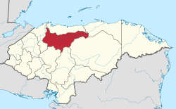 Location of Yoro in Honduras | |
| Coordinates: 15°08′N 87°06′W | |
| Country | |
| Municipalities | 11 |
| Villages | 253 |
| Founded | 28 June 1825[lower-alpha 1] |
| Capital city | Yoro |
| Government | |
| • Type | Departmental |
| • Gobernador | Juan Carlos Molina (2018-2022) (PNH) |
| Area | |
| • Total | 7,787 km2 (3,007 sq mi) |
| Population (2015) | |
| • Total | 587,375 |
| • Density | 75/km2 (200/sq mi) |
| Time zone | UTC-6 (CDT) |
| Postal code | 53101 |
| ISO 3166 code | HN-YO |
| HDI (2017) | 0.602[1] medium · 6th |
| Statistics derived from Consult INE online database: Population and Housing Census 2013[2] | |
Municipalities
Economy
The department, historically, is known for harvesting mahogany and cedar trees for exportation. The area also had a cattle industry.[3]
Football players from Yoro
A number of football players are from the department.
| Name | Club | City |
|---|---|---|
| Carlos Pavón | Real España | El Progreso |
| Milton Reyes | Motagua | Jocón |
| Sergio Mendoza | Motagua | Yoro |
| Johnny Leveron | Motagua | Yoro |
| Alfredo Mejía | Real España | El Negrito |
| Ever Alvarado | Real España | El Negrito |
| Juan C. Acevedo | Real España | El Progreso |
| Johnny Rivera | Real España | El Progreso |
| Leonardo Isaula | Necaxa | Yoro |
| Anthony Lozano | Alcoyano | Yoro |
| Wilfredo Bueso Valle | Platense F.C. | El Progreso |
Notes
- Yoro was one of the first 7 departments in which the national territory was divided in the first political division of Honduras in 1825.
References
- "Sub-national HDI - Area Database - Global Data Lab". hdi.globaldatalab.org. Retrieved 2018-09-13.
- "Consulta Base de datos INE en línea: Censo de Población y Vivienda 2013" [Consult INE online database: Population and Housing Census 2013]. Instituto Nacional de Estadística (INE) (in Spanish). El Instituto Nacional de Estadística (INE). 1 August 2018. Retrieved 2018-09-13.
- Baily, John (1850). Central America; Describing Each of the States of Guatemala, Honduras, Salvador, Nicaragua, and Costa Rica. London: Trelawney Saunders. p. 119.
This article is issued from Wikipedia. The text is licensed under Creative Commons - Attribution - Sharealike. Additional terms may apply for the media files.