Ocotepeque Department
Ocotepeque is one of the 18 departments of Honduras, Central America, located in the West and bordering both El Salvador and Guatemala. It was formed in 1906 from part of Copán department. The capital and main city is Ocotepeque.
Ocotepeque Department Departamento de Ocotepeque | |
|---|---|
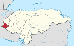 Location of Ocotepeque in Honduras | |
| Coordinates: 14°26′N 89°11′W | |
| Country | |
| Municipalities | 16 |
| Villages | 126 |
| Founded | 17 February 1906 |
| Capital city | Ocotepeque |
| Government | |
| • Type | Departmental |
| • Gobernador | César Osmín Arita Paz (2018-2022) (PNH) |
| Area | |
| • Total | 1,636 km2 (632 sq mi) |
| Population (2015) | |
| • Total | 151,516 |
| • Density | 93/km2 (240/sq mi) |
| Time zone | UTC-6 (CDT) |
| Postal code | 43101, 43201 |
| ISO 3166 code | HN-OC |
| HDI (2017) | 0.571[1] medium · 11th |
| Statistics derived from Consult INE online database: Population and Housing Census 2013[2] | |
The department covers a total surface area of 1,630 km² and, in 2015, had an estimated population of 151,516.
References
- "Sub-national HDI - Area Database - Global Data Lab". hdi.globaldatalab.org. Retrieved 2018-09-13.
- "Consulta Base de datos INE en línea: Censo de Población y Vivienda 2013" [Consult INE online database: Population and Housing Census 2013]. Instituto Nacional de Estadística (INE) (in Spanish). El Instituto Nacional de Estadística (INE). 1 August 2018. Retrieved 2018-09-13.
This article is issued from Wikipedia. The text is licensed under Creative Commons - Attribution - Sharealike. Additional terms may apply for the media files.