Cortés Department
Cortés is one of the 18 departments of Honduras. The department covers an area of 3,954 km² and, in 2015, had an estimated population of 1,612,762, making it the most populous in Honduras. The Merendón Mountains rise in western Cortés, but the department is mostly a tropical lowland, the Sula Valley, crossed by the Ulúa and Chamelecon rivers.
Cortés Department Departamento de Cortés | |
|---|---|
Department | |
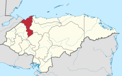 Location of Cortés in Honduras | |
| Coordinates: 15°30′10″N 88°0′49″W | |
| Country | |
| Municipalities | 12 |
| Villages | 284 |
| Founded | 4 July 1893 |
| Capital city | San Pedro Sula |
| Government | |
| • Type | Departmental |
| • Gobernador | Wila Chiang de Pinto (2018–2022) (PNH) |
| Area | |
| • Total | 3,911 km2 (1,510 sq mi) |
| Highest elevation | 2,242 m (7,356 ft) |
| Lowest elevation | 0 m (0 ft) |
| Population (2015) | |
| • Total | 1,621,762 |
| • Density | 410/km2 (1,100/sq mi) |
| • Ethnicities | Ladino, Garifuna |
| • Religions | Catholicism, Evangelicalism |
| Time zone | UTC-6 (CDT) |
| Postal code | San Pedro Sula: 21101, 21102, 21103, 21104, Puerto Cortés 21301 |
| ISO 3166 code | HN-CR |
| HDI (2017) | 0.658[1] medium · 2nd |
| Statistics derived from Consult INE online database: Population and Housing Census 2013[2] | |
It was created in 1893 from parts of the departments of Santa Bárbara and Yoro. The departmental capital is San Pedro Sula. Main cities also include Choloma, La Lima, Villanueva, and the sea ports of Puerto Cortés and Omoa. The Atlantic coast of the Department of Cortés is known for its many excellent beaches.
Cortés is the economic heartland of Honduras, as the Sula Valley is the country's main agricultural and industrial region. US banana companies arrived in the area in the late 19th century, and established vast plantations, as well as infrastructure to ship the fruit to the United States. San Pedro Sula attracted substantial numbers of European, Central American, and Palestinian and Lebanese immigrants. Industry flourishes in the department, and Cortés today hosts most of the country's assembly plants, known as maquilas.
Municipalities
- Choloma
- La Lima
- Omoa
- Pimienta
- Potrerillos
- Puerto Cortés
- San Antonio de Cortés
- San Francisco de Yojoa
- San Manuel
- San Pedro Sula
- Santa Cruz de Yojoa
- Villanueva
References
- "Sub-national HDI – Area Database – Global Data Lab". hdi.globaldatalab.org. Retrieved 13 September 2018.
- "Consulta Base de datos INE en línea: Censo de Población y Vivienda 2013" [Consult INE online database: Population and Housing Census 2013]. Instituto Nacional de Estadística (INE) (in Spanish). El Instituto Nacional de Estadística (INE). 1 August 2018. Retrieved 13 September 2018.