Santa Rita, Yoro
Santa Rita is a municipality in the Honduran department of Yoro. The Humuya River passes through it.[1][2]
Santa Rita | |
|---|---|
Municipality | |
 Santa Rita Location in Honduras | |
| Coordinates: 15°12′N 87°53′W | |
| Country | Honduras |
| Department | Yoro |
| Area | |
| • Municipality | 149 km2 (58 sq mi) |
| Population (2015) | |
| • Municipality | 28,576 |
| • Density | 190/km2 (500/sq mi) |
| • Urban | 12,869 |
| Time zone | UTC-6 (Central America) |
It had a population of 12 869 in 2004.[3]
In 1684, it was a hamlet called Benque La Laguneta. It later became the village of Santa Rita El Negrito. The place was established as a town in 1959 with part of the municipality of El Negrito.
References
- Efrain V. Molina. "Habilitan paso en el río Humuya de Santa Rita". Diario La Prensa. Retrieved 24 November 2015.
- Efrain Molina. "Multarán a los que contaminan el río Humuya". Diario La Prensa. Retrieved 24 November 2015.
- "santa rita, yoro, honduras". wolframalpha.com. Retrieved 24 November 2015.
Capital: Yoro | ||
| Municipalities | 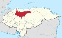 | |
This article is issued from Wikipedia. The text is licensed under Creative Commons - Attribution - Sharealike. Additional terms may apply for the media files.