Yaracuy
Yaracuy State (Spanish: Estado Yaracuy, IPA: [esˈtaðo ʝaɾaˈkuj]; Wayuu: Mma’ipakat Yaraküi)is one of the 23 states of Venezuela. It is bordered by Falcón in the north, in the west by Lara, in the south by Portuguesa and Cojedes and in the east by Cojedes and Carabobo.
Yaracuy | |
|---|---|
 Flag | |
| Anthem: Himno del Estado Yaracuy | |
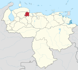 Location within Venezuela | |
| Coordinates: 10.31°N 68.71°W | |
| Country | Venezuela |
| Created | 1909 |
| Capital | San Felipe de Yaracuy |
| Government | |
| • Body | Legislative Council |
| • Governor | Julio León (2008–present) |
| • Assembly delegation | 5 |
| Area | |
| • Total | 7,100 km2 (2,700 sq mi) |
| Area rank | 19th |
| 0.77% of Venezuela | |
| Population (2011 census) | |
| • Total | 600,852 |
| • Rank | 18th |
| 2.16% of Venezuela | |
| Time zone | UTC-04:00 (VET) |
| ISO 3166 code | VE-U |
| Emblematic tree | Chaguaramo (Roystonea oleracea) |
| Website | www |
Its geography is mountainous: the Andes range ends there, and the Coastal Range begins. It is split by two mountainous systems, the Sierra de Aroa on the North and the Sierra de Nirgua. In between lies the agricultural land drained by the Yaracuy River. Most cities and towns are in this valley, including its capital San Felipe.
The economy of Yaracuy is mostly agricultural (sugar cane, corn, cattle raising). Some manufacturing can be found in Yaritagua area and Chivacoa, usually in agribusiness.
In recent years, Yaracuy had experienced some growth and social development under governor Eduardo Lapi (1995 - 2004). In 2004, thanks to the Chavez landslide, Lapi was narrowly unseated by Carlos E. Giménez, supported by Chavez political allies in the area. Since then, the economy has been in some turmoil as a considerable amount of land invasions by poor farmers in search of lands have created havoc within the agricultural system. In particular, the sugar cane production has plummeted. Carlos Giménez was followed as governor by Julio León in 2008, after he was removed from power due to allegations of corruption.[1]
Government and politics
Like other states, the structure of the government of Yaracuy is laid out in the Constitution, the highest law in the state.
The Governor of Yaracuy is in charge of the government and administration, serves for a four-year term and can be re-elected to an additional term only immediately and only once.
The state legislature is made up of a single body, the Legislative Council. It has the power to pass the state's Budget Law.
Like the other 23 federal entities of Venezuela, the State maintains its own police force, which is supported and complemented by the National Police and the Venezuelan National Guard.
Municipalities and municipal seats
Yaracuy is divided into fourteen municipalities:
| # | Municipality | Seat |
|---|---|---|
| 1 | Aristides Bastidas | San Pablo |
| 2 | Bolívar | Aroa |
| 3 | Bruzual | Chivacoa |
| 4 | Cocorote | Cocorote |
| 5 | Independencia | Independencia |
| 6 | Jose Antonio Paez | Sabana de Parra |
| 7 | La Trinidad | Boraure |
| 8 | Manuel Monge | Yumare |
| 9 | Nirgua | Nirgua |
| 10 | Peña | Yaritagua |
| 11 | San Felipe | San Felipe de Yaracuy |
| 12 | Sucre | Guama |
| 13 | Urachiche | Urachiche |
| 14 | Veroes | Farriar |
The state capital is San Felipe de Yaracuy. Other important towns are Aroa, Chivacoa, Cocorote, Marín, Nirgua, Sabana de Parra, Yaritagua, and Urachiche.
Yaracuy State covers a total surface area of 7,100 km2 (2,700 sq mi). Population: 597,700 inhabitants (2007 est).
Population
Race and ethnicity
According to the 2011 Census, the racial composition of the population was:[2]
| Racial composition | Population | % |
|---|---|---|
| Native American (Mestizo) | N/A | 58.4 |
| White | 229,542 | 35.5 |
| Black | 31,683 | 4.9 |
| Other race | N/A | 1.2 |
References
- http://www.radiomundial.com.ve/yvke/noticia.php?t=22487&imprimir=1
- "Resultado Básico del XIV Censo Nacional de Población y Vivienda 2011 (Mayo 2014)" (PDF). Ine.gov.ve. p. 29. Retrieved 8 September 2015.
See also
| Wikimedia Commons has media related to Yaracuy. |
| Capital District | ||
|---|---|---|
| States | ||
| Federal Dependencies |
| |
| Regions | ||
| Claimed | ||
| Authority control |
|
|---|