Vargas (state)
Vargas (Spanish: Estado La Guaira; Estado Vargas, IPA: [esˈtaðo ˈβaɾɣas]), officially La Guaira, is one of the 23 states of Venezuela. Named after Venezuela's first non-military president, José María Vargas, Vargas comprises a coastal region in the north of Venezuela, bordering Aragua to the west, Miranda to the east, the Caribbean Sea to the north and the Capital District to the south. It is home to both the country's largest seaport and airport. The state capital is La Guaira. The Litoral Varguense conurbation is the principal urban agglomeration in the state, which is part of the Greater Caracas Area.
Vargas state | |
|---|---|
 Flag | |
| Motto(s): Igualdad, Libertad, Prosperidad y Seguridad (English: Equality, Liberty, Prosperity and Security) | |
| Anthem: Carmañola Americana | |
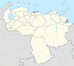 Location within Venezuela | |
| Coordinates: 10.572°N 66.88°W | |
| Country | Venezuela |
| Created | 1998 |
| Capital | La Guaira |
| Government | |
| • Body | Legislative Council |
| • Governor | Jorge García Carneiro (2017–2021) |
| • Assembly delegation | 4 |
| Area | |
| • Total | 1,172 km2 (453 sq mi) |
| Area rank | 22nd |
| 0.16% of Venezuela | |
| Population (2011 census est.) | |
| • Total | 352,920 |
| • Rank | 21st |
| 1.29% of Venezuela | |
| Time zone | UTC-04:00 (VET) |
| ISO 3166 code | VE-X |
| Emblematic tree | Uva de Playa (Coccoloba uvífera) |
| Website | www |
In 1999, the geographic center of La Guaira state suffered major floods and landslides, known as La Tragedia de Vargas (the Vargas tragedy), causing major losses of life and property, and resulting in forced population movements, including the virtual disappearance of some small towns. Thousands died, and many more fled the area to other states. The state owed its previous name to José María Vargas, although this was changed on June 13, 2019 to only La Guaira.
History

This region of Venezuela has undergone important changes over the years, and while the geographical borders have remained, the territorial delineation has varied. The area was previously one of the departments of the Venezuela's Federal District (the other being the Libertador department, now Libertador Municipality), and the governor of this region was chosen by the national government. The area later evolved into a municipality, but was still dependent on the governor of the Federal District. In the 1990s there were increased calls for Vargas to become a separate entity, distinct from Federal District. In 1998 the government of Rafael Caldera decreed Vargas as an independent municipality, separate from the Federal District, with the statute of Federal Territory. Shortly after it became the 23rd state of Venezuela.
In mid-December 1999, after several days of ever-increasing rains pouring over the Central Mountain Range and the piedmont within the span of 24 hours along the coastline for about 45 km (28 mi)., the state suffered from massive floods which resulted in severe losses of life and property. In its wake as of December 16, the surviving population witnessed the massive destruction of most of the state infrastructure, including the collapse of most roads, bridges, housings, public and private buildings, and of basic services as electricity and communications; in which thousands were killed or missing. Official estimates some 50,000 dead or missing, but the real figure may be much higher. In the following weeks nearly the entire state's population was displaced. Locals refer to the Dec. 1999 disaster as "La Tragedia de Vargas" (the Vargas' Tragedy). Such climatic phenomenon (of extraordinarily high rainfall levels) appears to be periodical, having a cycle of about 70 years, and probably has occurred hundreds, perhaps thousands of times since a distant past.
Government and politics
Like other states, the structure of the government of Vargas is laid out in the Constitution, the highest law in the state.
The Governor of Vargas is in charge of the government and administration, serves for a four-year term and can be re-elected to an additional term only immediately and only once.
The state legislature is made up of a single body, the Legislative Council. It has the power to pass the state's Budget Law.
Like the other 23 federal entities of Venezuela, the State maintains its own police force, which is supported and complemented by the National Police and the Venezuelan National Guard.
Geopolitical division


La Guaira state covers a total surface area of 1,497 km2 (578 sq mi).
Parishes
- Caraballeda
- Carayaca
- Carlos Soublette (Maiquetía)
- Caruao (La Sabana)
- Catia La Mar
- El Junco
- La Guaira
- Macuto
- Maiquetía
- Naiguatá
- Raul Leoni (Catia La Mar)
Population
Sites of interest

Simón Bolívar International Airport
Beaches
|
|
|
|
|
See also
| Wikimedia Commons has media related to Vargas (state). |
- Venezuela
- States of Venezuela
- 1999 Vargas mudslide catastrophe
- Dancing devils of Corpus Christi
References
- "Resultado Básico del XIV Censo Nacional de Población y Vivienda 2011 (Mayo 2014)" (PDF). Ine.gov.ve. p. 29. Retrieved 8 September 2015.
External links
- History
- Geography
- Geopolitical division
- Law and government— State government
- Law and government— Municipal government
- Economy
- Sites of interest
- Folklore
- Historical seats
| Capital District | ||
|---|---|---|
| States | ||
| Federal Dependencies |
| |
| Regions | ||
| Claimed | ||