Wolford, North Dakota
Wolford is a city in Pierce County, North Dakota, United States. The population was 36 at the 2010 census.[5] Wolford was founded in 1905.
Wolford, North Dakota | |
|---|---|
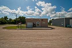 Post office in Wolford | |
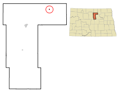 Location of Wolford, North Dakota | |
| Coordinates: 48°29′53″N 99°42′20″W | |
| Country | United States |
| State | North Dakota |
| County | Pierce |
| Area | |
| • Total | 0.16 sq mi (0.41 km2) |
| • Land | 0.16 sq mi (0.41 km2) |
| • Water | 0 sq mi (0 km2) |
| Elevation | 1,624 ft (495 m) |
| Population | |
| • Total | 36 |
| • Estimate (2018)[3] | 34 |
| • Density | 230/sq mi (88/km2) |
| Time zone | UTC-6 (Central (CST)) |
| • Summer (DST) | UTC-5 (CDT) |
| ZIP code | 58385 |
| Area code(s) | 701 |
| FIPS code | 38-87180 |
| GNIS feature ID | 1032872[4] |
Geography
Wolford is located at 48°29′53″N 99°42′20″W (48.497937, -99.705528).[6]
According to the United States Census Bureau, the city has a total area of 0.16 square miles (0.41 km2), all of it land.[1]
Demographics
| Historical population | |||
|---|---|---|---|
| Census | Pop. | %± | |
| 1940 | 206 | — | |
| 1950 | 140 | −32.0% | |
| 1960 | 136 | −2.9% | |
| 1970 | 81 | −40.4% | |
| 1980 | 76 | −6.2% | |
| 1990 | 56 | −26.3% | |
| 2000 | 50 | −10.7% | |
| 2010 | 36 | −28.0% | |
| Est. 2018 | 34 | [3] | −5.6% |
| U.S. Decennial Census[7] 2018 Estimate[8] | |||
2010 census
As of the census[2] of 2010, there were 36 people, 17 households, and 10 families residing in the city. The population density was 225.0 inhabitants per square mile (86.9/km2). There were 27 housing units at an average density of 168.8 per square mile (65.2/km2). The racial makeup of the city was 100.0% White.
There were 17 households of which 23.5% had children under the age of 18 living with them, 58.8% were married couples living together, and 41.2% were non-families. 41.2% of all households were made up of individuals and 17.7% had someone living alone who was 65 years of age or older. The average household size was 2.12 and the average family size was 2.90.
The median age in the city was 51.5 years. 25% of residents were under the age of 18; 0.0% were between the ages of 18 and 24; 19.4% were from 25 to 44; 36.2% were from 45 to 64; and 19.4% were 65 years of age or older. The gender makeup of the city was 47.2% male and 52.8% female.
2000 census
As of the census of 2000, there were 50 people, 21 households, and 14 families residing in the city. The population density was 312.8 people per square mile (120.7/km²). There were 30 housing units at an average density of 187.7 per square mile (72.4/km²). The racial makeup of the city was 100.00% White.
There were 21 households out of which 28.6% had children under the age of 18 living with them, 61.9% were married couples living together, 4.8% had a female householder with no husband present, and 33.3% were non-families. 33.3% of all households were made up of individuals and 4.8% had someone living alone who was 65 years of age or older. The average household size was 2.38 and the average family size was 3.07.
In the city, the population was spread out with 26.0% under the age of 18, 2.0% from 18 to 24, 32.0% from 25 to 44, 30.0% from 45 to 64, and 10.0% who were 65 years of age or older. The median age was 38 years. For every 10 females there were 10.8 males. For every 10 females age 18 and over, there were 11.7 males.
The median income for a household in the city was $37,500, and the median income for a family was $38,750. Males had a median income of $21,250 versus $13,750 for females. The per capita income for the city was $18,662. None of the population and none of the families were below the poverty line.
References
- "US Gazetteer files 2010". United States Census Bureau. Retrieved June 14, 2012.
- "U.S. Census website". United States Census Bureau. Retrieved June 14, 2012.
- "Population and Housing Unit Estimates". Retrieved September 30, 2019.
- "US Board on Geographic Names". United States Geological Survey. October 25, 2007. Retrieved January 31, 2008.
- "2010 Census Redistricting Data (Public Law 94-171) Summary File". American FactFinder. United States Census Bureau. Retrieved May 2, 2011.
- "US Gazetteer files: 2010, 2000, and 1990". United States Census Bureau. February 12, 2011. Retrieved April 23, 2011.
- United States Census Bureau. "Census of Population and Housing". Retrieved September 7, 2013.
- "Population Estimates". United States Census Bureau. Retrieved September 30, 2019.
| Wikimedia Commons has media related to Wolford, North Dakota. |
Municipalities and communities of Pierce County, North Dakota, United States | ||
|---|---|---|
| Cities | 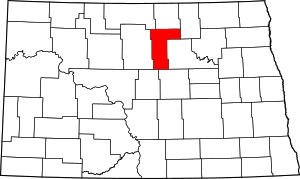 Map of North Dakota highlighting Pierce County | |
| Townships |
| |
| CDPs | ||
| Unorganized territories |
| |
| Unincorporated communities |
| |
| Authority control |
|
|---|